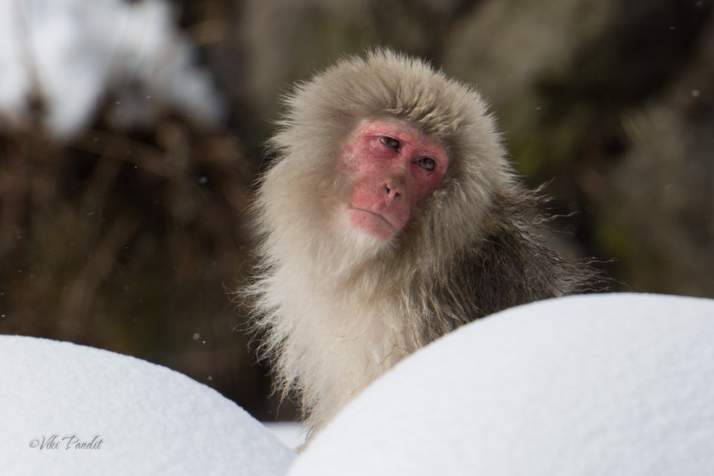
Snow Monkeys of Jigokudani
Snow Monkeys of Jigokudani
Some of my awe-inspiring experiences as I wander the beautiful Earth
Snow Monkeys of Jigokudani

We go on a tour of Gassho Zukuri Villages of Shirakawa-go and Ainokura.
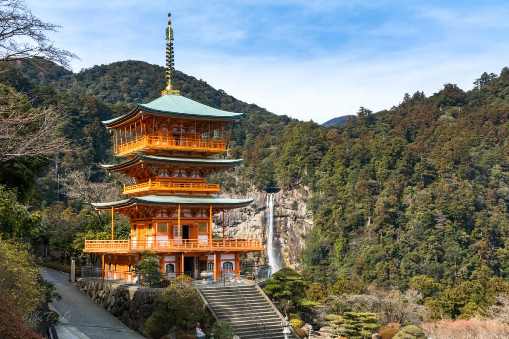
I hike to the incredible cliff-diving Nachi Waterfall to witness its wild beauty. The Sanjūdō Pagoda in front of the falls creates one of the most beautiful scenes in Japan. The tall waterfall boasts the longest drop in Japan. One can drink the flowing spring water, supposed to have healing abilities, from the falls at the Shrine directly below.
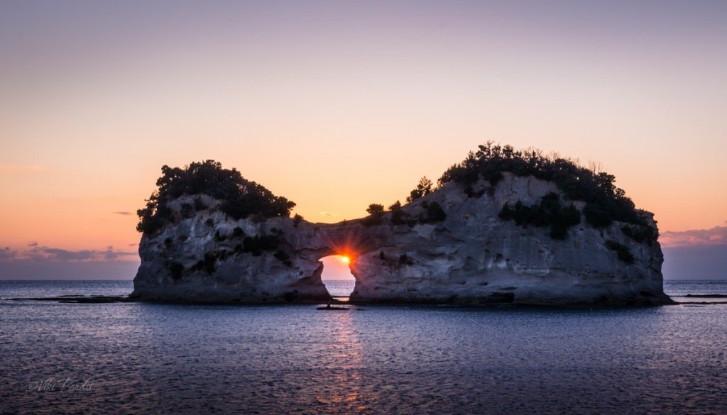
Engetsu Island is a sandstone rock in the midst of the sea, popular for its remarkable sunset view. The almost perfect circle in the center of the island is enchanting to see as the sun passes from inside the circular arch.

I go for a walk on the soft white sands of Shirahama Beach in Wakayama. The enchanting beach with its sparkling see thru waters make this place a paradise for beach lovers.
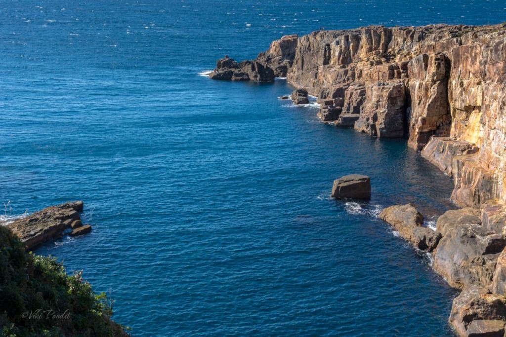
I go for a walk on the enthralling cliffs of Sandanbeki, stretching out into the Pacific Ocean. The 50 meters high towering cliffs dating back to the Tertiary period, still stand tall after centuries of erosion. Sitting on the inter-layered limestone rocks, it is scary watching the ocean’s current unleashing wave after wave, crashing up against the cliff. Located in Kii Peninsula, Wakayama, it has the dubious record as one of the most notorious spot on earth for suicides.
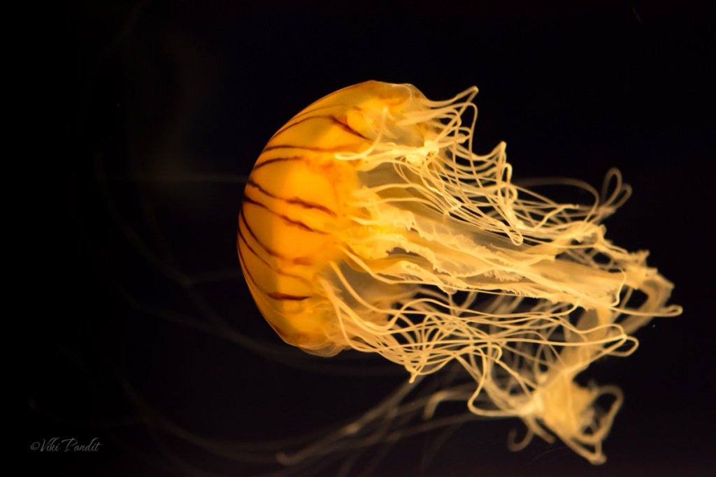
I head to Osaka Aquarium Kaiyukan for a special encounter with the incredible sea creatures. The aquarium is home to some 580 species from the Pacific Rim and nearby areas. The colorful sea creatures swimming around soothe the soul. The delightful jellyfish leave me awestruck.
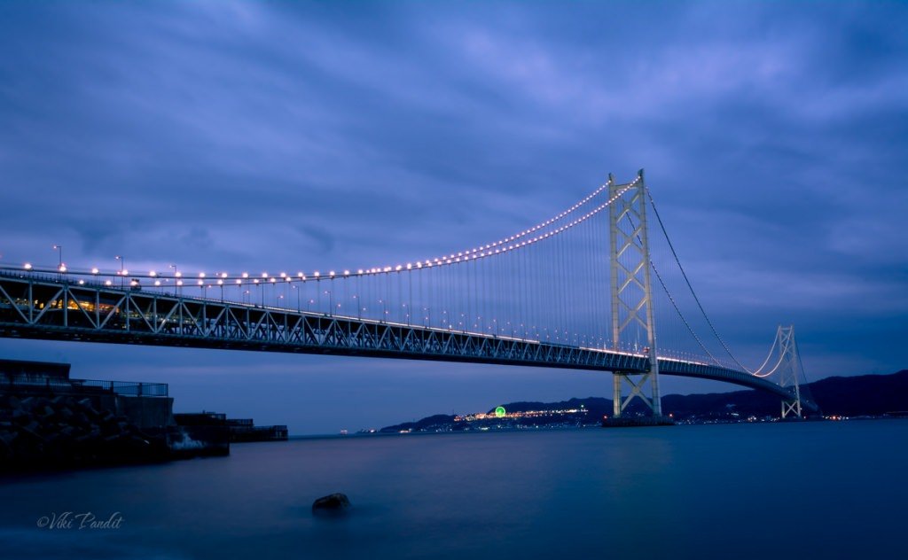
The Akashi Kaikyō Bridge is world’s longest suspension bridge, which links the city of Kobe on the Japanese mainland of Honshu to Iwaya on Awaji Island.

Today I went on a hike to Uguisunotaki Falls, into the deep end of the Kasugayama Forest, surrounded by tall Pines, where even the Sun doesn’t dare to peep through.
Loading more posts...