Journals

Aomori Bay

Aomori is mainly known for producing apples. But it was not always so…

The first apple saplings were imported in Japan around the year 1871. In the spring of 1875, the Department of Industry Promotion from the Home Ministry sent three apple saplings to Aomori prefecture. The apples that were grown on the grounds of the Aomori Prefectural Office were the beginnings of Aomori’s apples.

Since then Aomori apples have come a long way. Today most of the shops in the city will inevitably offer numerous kinds of apple-based culinary delights. Today however I am going to talk about one of the most photogenic spots in Aomori – the Aomori Bay.

When I was here a couple of years back, I was floored by the most incredible sunsets I have ever seen. Since then Aomori enjoys a special place in my heart. What I love the most the about it is that is just perfect for romantic walks by the sea. You can roam around the Sin-machi Dori, enjoy traditional artifacts at the WaRasse Museum or if you are lucky enough, you might also experience a most beautiful sunset like I did.

At the end of the day, you can just go up the ASPAM building, which is the tallest building in Aomori and enjoy the beautiful city at night while sipping on a warm cup of coffee. In this journal I will talk about a day I spent wandering around the beautiful bay and the incredible spots surrounding it.

Aomori Bay at Dawn

I woke up at dawn, packed my camera gear and left for the bay. I was staying at APA Aomori. The APA Hotel is located at a walk-able distance from the Aomori bay. I have stayed at this hotel before and really liked it. Its perfectly placed, equidistant from the Aomori Bay, Wa Rasse Museum and the Aomori Station.

It was still dark as I made my way towards the Bay. I reached the ASPAM building in few minutes. The Aoiumi Park in front of the ASPAM building was desolate and not a soul was around. As I set up my tripod, the morning glow was just beginning to spread over the city,

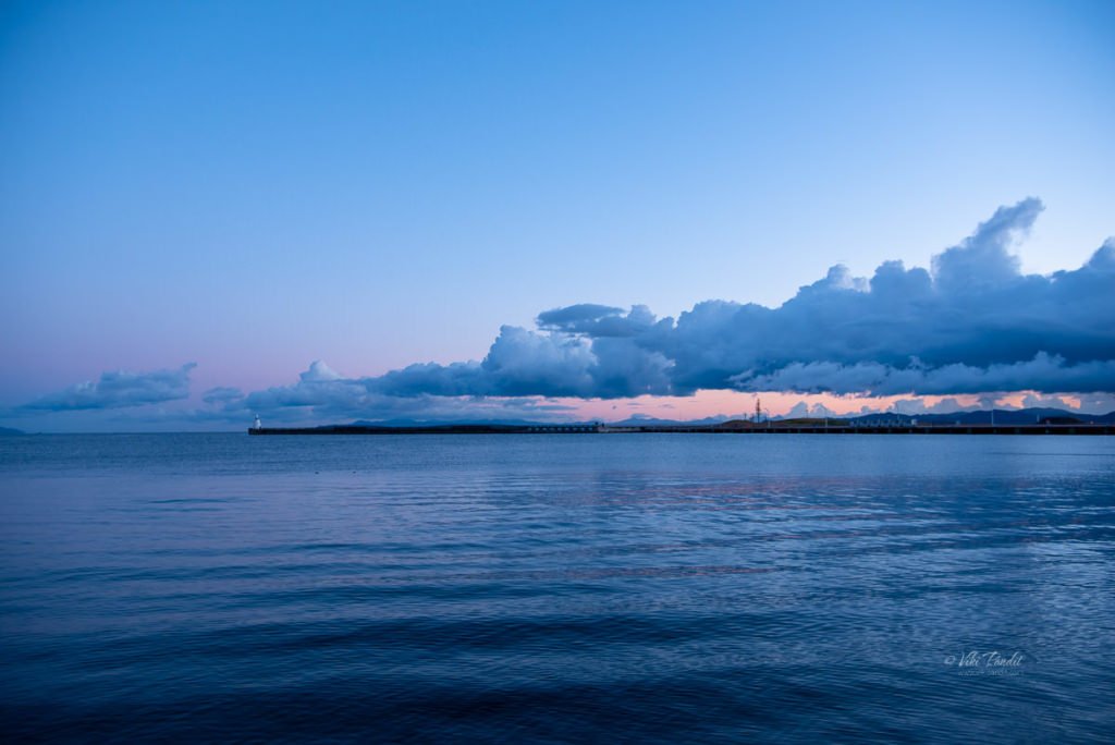
Far away towards the east, the Sun was starting to rise. As the Sun was just about to show itself, a long mass of cloud moved in from the south-eastern side and blocked the view. With every passing minute it floated more and more towards the sunrise and that was it. Even though I couldn’t capture the sunrise, the scene was still amazing to look at.

I slowly made my way along the central pier, towards the West Lighthouse. I have some amazing memories of the place from a few years back. Unfortunately the entrance to the lighthouse was locked. I am not really sure at what times they open it or its been closed for a while.

By that time the clouds had totally engulfed the sky, shattering all hopes of catching the rising sun.

However, it was not a total loss as as towards the west the sky was painted in a plethora of vivid colors in the sky. Far on the right you can see the yellow colored ship – Hakkoda-Maru. The ship which used to connect Aomori to Hakodate, was the longest Seikan ferry in operation and is now on exhibition as a memorial ferry.

I spent a few minutes near the bay enjoying the peaceful moment, before morning joggers gradually started showing up. Even though it was a cloudy day, the bay still looked incredible.

Aomori Bay in Daytime

After the peaceful morning at the Bay, I went back to the Hotel to catch up on some breakfast. After a light meal, I walked towards the Aomori Station. This time Mani was with me. It was pleasant surprise to see wild apples growing on the trees on the side-walk.

The day was dull but the queue of lovely Gingko trees near the station brought about a feeling of happiness. The broad, fan-shaped ginkgo leaves turn a brilliant yellow and can be stunning to watch during this time of the year.

We were on our way to the Seir-yu ji Temple in the suburbs of Aomori. If you want something closer you can always enjoy the amazing Nebuta Floats at the Aomori WaRasse Museum.

The Nebuta Museum WA-RASSE is a facility that introduces the history and charms of the Aomori Nebuta Festival. At the museum you can experience every aspect of the festival. On display are life-sized floats that participated in the festival in August, and Nebuta Faces that show the individuality of their respective creators

Just beside the WaRasse Museum you can find the Hakkoda Maru. The now retired ship used to ferry passengers between Aomori and Hakodate from 1964 to 1988 and is now a permanently moored floating museum.

If you take a small detour along the shore, you will pass under the lovely Aomori Bay Bridge. With the Sinmachi Dori nearby, you can find some nice restaurants in the most chirpy area of Aomori.

After lunch I would recommend a leisurely walk at Aoiumi Park along the bay. The park is decorated with some Momiji as well as Gingko trees.

Aomori Bay at Sunset

Because of its strategic location of the city, you get some really beautiful sunsets at Aomori. Click here to see my pictures of one of the most beautiful sunsets at Aomori.

For us it was not meant to be. The clouds had gathered up strongly but if you want to see what a glorious sunset looks like at Aomori bay, click the button below to read my story on the most memorable sunset I have ever been witness to.

Aomori Bay at Night

Finally, If you are willing to slug it out through the evening, the ASPAM building is the place to be. It is the perfect place to crown a lovely evening. Admire the unusual pyramid building that houses the Aomori Prefecture Tourist Center, ASPAM. Its platform on the twelfth floor offers a beautiful panoramic view of the Aomori bay and the city. I specially love the way you can capture the iconic Bay Bridge along with Aomori’s skyline.

It was still raining incessantly so we stayed at the coffee shop for a little longer. For photo enthusiasts. using a tripod is allowed inside. I would recommend using a lens skirt to take photos from inside the tower, so the reflections wont damage the photos.

Once the rain relented, we walked down to the Aomori Bay Bridge which looked so beautiful from the top of the ASPAM building. You don’t have to go all the way to where the flyover touches base. The bridge can be accessed from the pier by stairs. Just before you alight onto the main bridge you can see some beautiful designed street lamps. This shot was taken handheld using my Samsung S9+ device. It does surprise me more often that not.

We walked a bit further along the cable-stayed bridge overlooking the bay.
It’s the second longest bridge in Aomori Prefecture after the Hachinohe Ōhashi Bridge.

On the other side the ASPAM building was looking incredible lit up in changing colors.

So, there it is. I was certainly tired from the long day. But I was excited to post the pictures I shot. Even though the day was dull with cloud hanging over at all times, the pictures did come out interestingly well.

Aomori Bay is a nice and relaxing place to hang out. It is a major tourism attraction with many popular sights of historical, cultural, and local festivals. Even though it was my second visit to the city, I still haven’t had enough of it. Thanks for reading. I look forward to your questions or comments. Please leave me a star rating if you liked the post or continue to read the story of my visit to Showa Daibutsu in the suburbs of Aomori.

Nebuta Museum WA RASSE

This is my second visit to Nebuta Museum WA-RASSE. It is a facility that introduces the history and charms of the Aomori Nebuta Festival. Every year the best floats from the Nebuta Festival – which runs between 2-7 of August, are exhibited at the facility for the next 12 months. So, in a way no two visits to the Nebuta House will ever be the same.

I have written an in-depth article on the nuances of the Nebuta festival and how the museum facilitates the unique tradition in the Aomori prefecture. You can more about it here.

For this article I will be focusing more on the beautiful architecture of the unique building.

Architecture style of Nebuta Museum WA-RASSE

Nebuta House (Nebuta-no-ie Warasse) is a museum and center for creative culture in the Northern Japanese city of Aomori inspired by the craftsmanship and spirit of the Nebuta Matsuri. The festival, one of Japan’s largest, is a form of storytelling during which heroes, demons and animals from history and myth come to life as large-scale paper lanterns illuminated from within.

The first ideas of a cultural facility was initiated by Stephanie Forsythe and Todd MacAllen, who had previously worked closely with the city of Aomori to address the it’s evolving needs. In 2002, they had helped build the Aomori Lantern Houses and Community Center. The aim of that project was to create a lively, culture oriented space with the intent of revitalizing the city scape.

The partners identified the cultural importance of the Nebuta festival as one of the biggest draws of the prefecture. After selecting a new site for the awarded project – located adjacent to the JR Aomori train station, they proposed a building dedicated to preserving and enriching the festival’s heritage.

Their proposal was received with initial hesitation. The celebration itself was such a large, living part of the city that a museum didn’t seem essential. But after continued insistence from Forsythe and MacAllen, the local government realised that despite the festivals scale, there were hardly any lasting artifacts or methods of educating tourists about the festival.

In 2011, with assistance of the Kajima – Fujimoto – Kurahashi Construction JV, construction was completed on the unique, sculptural building – resting along the waterfront of Aomori City.

On first appearance the museum exterior looks like giant steel ribbons, parted like curtains to welcome visitors. These ribbons of steel enamel-coated in deep red, envelop the structure, creating a shifting pattern of light and shadow that separates exterior, everyday life from the otherworldly realm within. The design is said to have been inspired by the paper lanterns. The architects copied the movements of strips of paper caught in the breeze to generate the twists of each ribbon on the museum’s exterior.

For each steel ribbon, the bottom was set to a unique and specific angle, with thought to how sunlight would permeate the ribbons as it moved throughout the day, while the top part of each ribbon remained parallel to the building. These twists create openings that let in light and lead into a sheltered passageway between the ribbons and the glazed inner facade.

Dring fall the yellow Ginkgo trees look fabulous against the red nebuta museum

In all, the building is encased in 820 steel ribbons, 12 m tall, encircling the glass-and-steel structure inside. The exposed round steel columns are as slender as possible, giving the structure a feeling of physical lightness. The floor to ceiling window mullions are black, galvanized solid steel and fastened to the steel structure of slender columns to contribute structural support to the steel ribbon screen of the façade.

Enough with the boring stuff! Lets now enter the museum.

Exhibits from Nebuta Matsuri 2018

Aomori Nebuta House is a museum that houses and honours heroes and demons that are handcrafted into luminous floats for the Nebuta festival. Each year the five best Nebuta are selected for their creative artistry and craftsmanship and displayed at the Nebuta Wa-Rasse museum.

The interior is black, like a black box theatre. The abstraction of materiality, detail and colouring of the building allow visitors an intimate focus on the exhibits. The ground floor of the complex features a restaurant and a well stocked museum shop selling all sorts of local souvenirs and food. To witness the nebuta floats, take the stairs to the next floor.

Nebuta Tunnel

The tour starts with the Nebuta Tunnel. Along the red corridor lined with photos and images from the Nebuta Matsuri’s 300 year history, you can learn how the techniques and styles used in creating the floats has changed over the years.

Just beyond the Nebuta Tunnel, lanterns in the shape of red goldfish, another symbol of the festival, hang along the corridor where the recorded sounds of taiko drums, flutes, and voices play. These luminous Nebuta appear suspended in the darkness of the corridor, their vibrant colours reflected in the rippled, water-like floor. This is a subtle analogy to the last day of the festival when most of the Nebuta are set out to float on the sea.

One the walls along this corridor. the museum exhibits dioramas, drawings, photographs and artifacts that grant a deeper understanding of the unique culture and its evolution over time.

Aomori Nebuta Exhibit Hall

The Nebuta are creatures of light, and their home was designed as a realm of darkness. As you wind your way beyond the galleries and educational displays, you will find yourself in a dimly lit hall where you will be confronted by the Nebuta themselves.

There are no barriers, you can go as close as you want up to the paper structures with their expressive facial features and delicate detailing. In the darkened main hall of the museum these were five floats from this years festival.

I walked around the floats, taking pictures and admiring the craftsmanship that went into their construction. The floats reminds me of the “Durga Festival” we have back in my home town of Kolkata. Every year the deity is created using mud in numerous life-sized styles only to be submerged in to the Ganges after the festival ends.

A platform lies in one corner of the Hall, used for occasional performances by “Haneto” dancers. I have not been lucky enough be around during one of their dances. I would love to see them demonstrate the unique Nebuta Matsuri dance with taiko drums and flutes.

If you want to check out the nebuta floats from 2016, click here.

Conclusion

Nebuta is a living part of Aomori, and it continues to grow as an art form as individual artists bring their own style and innovations to the tradition. The Nebuta Warasse museum attempts to capture this spirit of the festival and gives visitors a teaser of its lively atmosphere, history and traditions.

The creation of the building dedicated to Nebuta allows people like me to visit Aomori at other times of year and yet experience the skillful craft of the artists that are the backbone of such an immersive festival.

Thanks for reading. Please leave me a comment if you liked the post or follow my story as I continue to explore the lovely Aomori waterfront.

How to access Nebuta Warasse Museum

The Nebuta Warasse is about a five minute walk north of JR Aomori Station.

Admission price of tickets

Adults: ¥600

On what days is the museum closed?

31st December-1st January (whole facility is closed)
9th-10th August (The museum is closed for the changing of the floats on display. The shop and restaurant are open for business as usual.)

Fall leaves at Yamadera Temple

This journal is mostly about my Fall experience in Yamadera (山寺), a scenic temple located in the mountains northeast of Yamagata City.
When autumn deepens and the leaves begin to change color in the the fall months, hunting for autumn foliage has become a popular pastime in Japan. Watching my friends post the mesmerizing beauty of Autumn forced me to also schedule my tour to Japan during this time of the year.

Mind you, this need to visit far off places to appreciate the beauty of autumn has been a custom since ancient time as depicted in “The Tale of the Genji.” Even in the eighth century we have scenes that talk about how people used to search for beautiful autumn colors in the Heian Period. Yamadera is one such place to experience the vivid colors of Autumn as the surrounding slopes are enveloped in red & yellow foliage as far as the eyes can see.

This was my second visit to the lovely mountain temple. I have written in detail about the various structures inside the temple grounds when I went on a hike to Yamadera a couple of years before.

Colors begin turning in late September around Yamagata and usually peak in mid October. The weather had been lovely in the recent past as we traveled from Kansai towards the Tohoku region. Unfortunately the weather deteriorated rapidly as we reached moved north of Fukushima, .

On the day of our Yamadera visit, we woke up to see early morning showers. I was a bit perturbed by the thought of hiking up Yamadera in wet conditions, but the weather cleared up quickly.

After a hearty breakfast, we walked down to Yamagata Station. The roads were still wet but the skies were beautiful blue.

There are regular trains to Yamadera and it takes less than 20 minutes to reach. We had some time in our hands, so we went around the back of the station to find some lovely Momiji trees.

We caught the 9:45 am local going to Sendai on the JR Sanzen line. The ride from Yamagata to Yamadera is covered by the JR Pass. The Fall experience started early on the train on the train itself, as it chugged alongside some lovely mountains.

We reached Yamadera at around 10 am. The weather had again turned cloudy, but the fall foliage around the Yamadera mountains kept my excitement alive.

After wandering around the base of the mountain for some time, we made our way across the Tachiya River towards Yamadera.

A brief history of Yamadera

It was during the early Heian Period (794-1185) when Emperor Seiwa sent Monk Ennin to the Tohoku Region. The monk, who is better known in Japan by his posthumous name, Jikaku Daishi is credited with founding Yamadera, in the current Yamagata prefecture. In those times this area used to be part of the Dewa province.

Even though in the Japanese Feudal Period (1450-1600) the temples were destroyed by the wars and temporary fell into decline, during the next Edo Period (1615-1868), Yamadera recieved a lot of recognitions by the shogun (military government) and regained its prosperity.

Konpon Chu-do

The first temple we visited was the Konpon Chu-do (Hall). The Konpon Chu-do is the Main Hall of the temple and its oldest structure. Made of beech wood, this building is said to be the oldest in the complex.

The eternal flame of Konpon Chu-do

According to my research prior to visiting the temple, the Konpon Chu-do hall holds an eternal flame that Jigaku Daishi brought from Enryaku-ji. This flame has been burning for more than 1100 years. It will appear silly and let me tell you it was not for lack of effort but I could not to figure out where this flame is placed.

According to legend, the monk Dengyo Daishi (767 – 822), the founder of both the Tendai sect and Enryaku-ji temple in Kyoto brought this flame from a pilgrimage to China in 804 / 805 A.D. to Japan. Interestingly, the original flame at Enryaku-ji was extinguished when Oda Nobunaga destroyed the Enryaku-ji complex in 1571. When Enryaku-ji was rebuilt, the flame was brought back to Kyoto from Yamadera.

Statue of Nadebotoke at Konpon Chu-do

In front of Kunpon Chu-do Hall, there is Nadebotoke, a statue representing Buddha. Nadebotoke refers to a Pindola, the highest order of Buddhist acolyte who has attained satori. It is said that if you touch this idol in the same place that you have an injury, and then touch the place where you are injured. Some of the Chinese tourists in front of us just wouldn’t leave. They kept touching the statue like forever. Eventually when they left, we offered prayers at the holy shrine here before beginning our ascent towards the higher reaches.

A few paces to the left, you can find the Sammon Gate. Here you can buy the admission tickets to the temple grounds. They cost ¥ 300 per head for adults. It was a Tuesday and there were very few visitors. We gradually made our way up the stairs towards the summit.

Midway on the trail, you can see some beautifully weathered rock faces on the side of the mountain. There are many other interesting structures on the way but I have discussed about them in my previous journal.

At the end of the stairs, you’ll find Niomon Gate. It was built in 19th century and it’s actually one of the newest building in Yamadera complex.

Nokyodo & Kaisando

As we passed the Niomon Gate, we found ourselves in front of a rocky outcropping on which lies the most-photographed wooden structure of Yamadera: the small Sutra Repository Tower known as Nokyodo.

Just beside the Nokyodo you can find the Kaisando or the Founder’s Hall. Kasaido Hall is dedicated to the founder of the temples, Jikaku Daishi (monk Ennin) while the Nokyodo Hall was used as a room where sutra were copied.

Godaido

The stairs going up on the right take you to Godaido Hall, an observatory deck, built in the early 1700. This hall is placed in such a way it provides glorious views on the valley.

Yamadera during Autumn

The maple tree is the indisputable king of autumn colors. As a matter of fact, the word “autumn colors” 紅葉 (pronounced: koyo) is written with the same kanji characters as the word “maple tree” (pronounced: momiji). Koyo refers to the phenomenon of changing autumn colors, mainly when it occurs to the leaves of deciduous broad-leaf trees before the leaves fall to the ground.

At some point in time, the word momiji became synonymous with the maple tree (kaede) and now people just use it to refer to the maple trees.

Maple trees are native to Japan and can be seen in their wild form in forests. I used my 80-400mm to get a few close-up shots of the mountain tops.

More closeup shots of Fall trees around Yamadera.

After capturing several shots of the mountain range, we climbed down the stairs back to the Kaisando. From here a narrow path leads up the mountain. Along the path are two Momiji trees perfectly placed to capture the most beautiful structure of Yamadera.

Even though the red leaves are more popular, I love the yellow Momiji leaves. Even in the dull weather, they were shining with joy. The species of maple generally determines the color the leaves will change to – red, yellow or brown. Although the word koyo literally means “red leaves, ” it is used to refer to all the colors of autumn leaves. The word oyo refers to yellow leaves, and the word katsuyo refers to brown leaves specifically.

Maple leaves are sometimes eaten as tempura. Fresh leaves are salted or sugared and then fried in tempura batter, for a delicious treat.

Took some photos with the Momiji Trees

Okunoin Hall

During the Kamakura Period (1185-1382), Yamadera became the center of the Tohoku’s Buddhist culture. During those times over 300 monks along with thousands of devouts lived in the upper and lower part of the mountain.

A small path goes to Okunoin hall, where Daibutsuden is located. Inside, a Buddha Amida statue is in place, and visitors can admire it from outside the building. Photography is prohibited in this area.

Okunoin hall

View of the mountains from the top

On the left, you can find a small building almost hidden from view.

Walking down Yamadera

The artificial lights had started to take effect along the mountain side.

In the failing light we made our way to the base of the mountain where the Risshaku-ji sat in the dusk.

Lights were turned on while we waited at the Yamadera Station fror our train.

Thanks for reading. Photographs can never tell the emotions I felt standing on the cliffs edge at Godaido as I witnessed the beautiful fall trees of Yamadera. But I hope they can inspire some of you to reach out and witness what I have. If you have the chance to tour Yamagata, do not miss this unique experience.

I look forward to your reviews and questions. If you are looking to explore more of the Tohoku region, follow my story as I move further north to the beautiful city of Aomori.

Can I carry my luggage to the Temple?

Yes, Coin lockers are available at Yamadera Station where you can store your belongings for the time you are here.

What are the visiting hours?

April to November: 9.30am to 4pm
December to March: 10am to 3pm
Closed on Wednesdays

Is there an Official website?

Yes, please follow this link: http://www.yamaderakankou.com/

What is the best time to view fall foliage in Yamadera?

From the end of October to the beginning of November

Photowalk to Vijaya Vittala Temple

While in Hampi, it is discourteous not to visit the Vijay Vittala Temple. This was my third visit to the UNESCO world heritage temple grounds and I was not sure what to capture. I have gone over the temple grounds pillar by pillar with my camera.

Anyways I left for the Temple early at dawn. This time I drove from Bangalore, so I had my car available to me at all times during the visit. It makes life a hell lot convenient having your own ride in a place like Hampi which spreads over acres of land.

I had booked my lodgings at Clark’s Inn, which is a pretty good deal considering the other available options. The small hotel also provided free parking facilities.

Now there are two routes to Vijay Vittala Temple from the nearby town. You can either park your car near the allotted parking space near Virupaksha Temple and take a 15 minute walk along the Tungabhadra. This is the scenic route and you will pass many other points of interest along the way. The other route is a bit desolate but takes you right to the parking space of Vittala Temple from where buggy rides are available up to the temple.

The Sun had just risen as I set on the road. The heavy clouds though made the skies quite murky. The first structure I came across was the Talarigatta Gate. This gate is the entrance to the lost city of Hampi. It stands alone, with no surrounding structures. During its heyday, there would be queues to get into the city.

After parking my Brezza, I made my way towards the Temple on foot. From the temple it takes about 10 minutes on foot to reach the temple grounds. Buggy rides are available from the Parking lot, but not this early in the morning. On either side of the mud road, you can find various other small temples and other structures in ruins.

To the North, West and east of the Vijaya Vitthala temple were rows of galleries of which only few survive now. The most impressive of these galleries were the ones facing the main gopura of the temple. The eastern Bazaar of the Chariot Street is about 40m wide and a kilometer long. The galleries served as ships, residential quarters, rest houses and camping centers for pilgrims.

The ticket counter had not opened yet, so I loitered round the complex taking some shots of the surrounding areas. The most prominently visible location is the Anjanadri Hill, across the Tungabhadra, just behind the Vittala Temple.

The marked white route goes all the way to the top where a temple lies dedicated to monkey god Hanuman. For some reason or the other, I have always somehow not been able to go to this hill.

The landscape outside the Vittala Temple is very shabby and not at all maintained. You can see rubbish and thorny bushes everywhere. This section used to be a market.

The corridors on either side of the wide road used to sell items relating to prayers at the temple. I moved towards the Shivalayam at the end of the road.

The Gopuram of the Shivalaya looked to have been abandoned midway through construction.

Inside the structure you can still see some boulders lying around that were meant to be sculpted to be a part of this temple dedicated to Shiva.

After exporing the Shivalaya, I walked back towards the Vittala Temple. The admission booth had still not opened, so I walked towards the back on the compound. On the Nothern side lies one of the smaller gates to the temple. These gates remain locked at all times.

Towards the back of the compound you can find two abandoned structures. The nearest one is an open air pavilion, which may have been left uncompleted.

The other structure is quite popular but again not very properly maintained is the King’s Balance.

From the King’s balance, I made my back towards the entrance. On the way I spotted another small temple known as the Nammalvar Temple. I am not very familiar with its main deity.

Just opposite to the Nammalvar Temple, lies the South Gate of Vittala Temple. Just like the North Gate, this gate too remains closed at all times.

Once I reached the front gate, I was glad to see the admission booth was finally opened. Tickets costs ₹30 for Indian citizens and ₹500 for foreign nationals. I do not understand why foreigners have to pay such an enormous amount, it is the Indians who do more damage to these heritage structures than foreigners, and so they should be dissuaded with higher fees to enter these magnificent works of art.

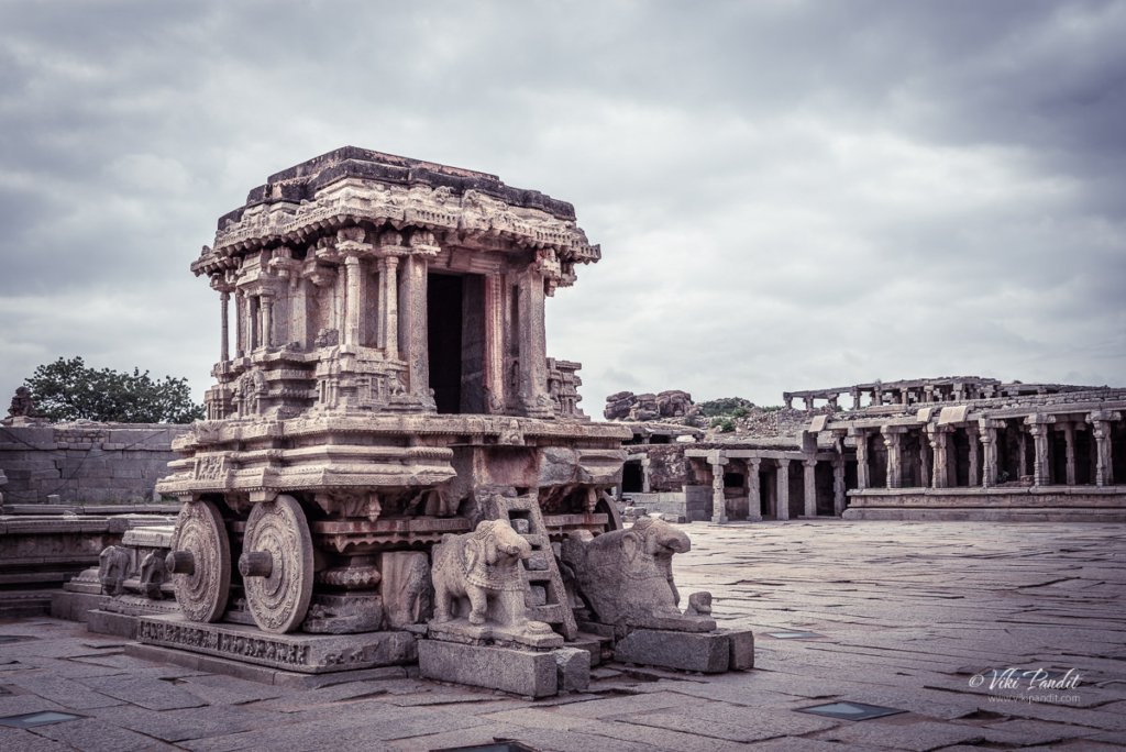
Once inside the temple grounds, I focused first on the Stone Chariot that welcomes the visitors inside the complex.

On all of my earlier visits, I have never been able to capture this beauty without hoards of selfie-takers getting in the way. The stupid thing about selfies is what does it matter if they take the photo in front of the chariot or anywhere else, their face covers 70% of the image anyways.

I took some other side snaps of the Stone Chariot. If you are a photo enthusiast, do take my advice and go in the mornings when there are almost no visitors to disturb your peace.

The Maha Mandap lies in the center of the Temple grounds. Visitors are prohibited from entering as they kept banging the pillars to hear the musical notes eminating from them. I have written in detail about the Maha Mandap in an earlier journal.

To the left of the Maha Mandap lies a flowering tree which is said to be very very old.

To the right of the Maha Mandap lies one of the two Kalyan Mandaps. These mandaps were generally reserved for marriages.

Incidentally I had also missed capturing the beautiful pillars of this mandap, so I went over each of the pillars capturing the beautiful sculptures one by one.

The outer pillars of the Kalyan Mandap have Yali scupltures.

This pillar clearly depicts Hindu God Vishnu in the avatar of Krishna playing his flute.

Below is another pillar with a carving of Hanuman

This one appears to be Lord Rama hunting the deer during his exile.

I am not really sure about this. The others above depict avatars of Vishnu. This could be the woman avatar that Vishnu took to steal away the Amrit from the Asuras.

After capturing the pillars of the Kalyan Mandap. I loitered around the premises. This is a shot of the South Gate again, but this time from the inside.

On the other side, there is a small corridor fallen into ruins.

People were now staring to come in steadily. Mani took a shot of me with the Stone Chariot.

After catching a last shot of the Stone Chariot, we were on our way back to the city.

While driving back to the hotel, I stopped at the fortified gateway known as the ‘Talarighat Gate,’ a ruined three storeyed gateway set into fortified walls. The two upper, arched sections have carved surface detail and a parapet. Two assistants are posed near the entrance and another seated in an archway above.

Identified by an inscription as the ‘hunter’s gate’, this gateway is found on the northeast road leading to Talarighat and the Vitthala temple complex. The gateway has a merloned parapet and pointed arches with rosettes in the spandrels. The walls in the foreground suggest a barbican enclosure (which no longer exists), forcing a number of turns in the approach to the gateway.

Thanks for reading.

Monuments on Hemkuta Hill

India is a country, rich in cultural heritage with hundreds of ancient archaeological sites – each with its own mythical stories. The monuments on Hemakuta Hill in Hampi is one such cluster of ancient temples, archways and pavilions with local folklore spread over centuries.

Hampi’s claim to fame began when it became the capital of the Vijayanagara empire. However these temples on the Hemakuta Hill are among the oldest cluster of shrines in Hampi, preceding even the Vijayanagara reign.

The hill is located on the southern side of the Virupaksha temple, identified quite easily by the slopes dotted with a number of abandoned monuments. When the revered Virupaksha temple was still in its infancy, this hill used to be occupied by Shaivas, devotees of Shiva, who would come from far away parts of South India to pay respects.

You can access the hill via two opposite routes. The first path is just beside the Virupaksha temple’s main entrance. From there, if you are facing Virupaksha, take the left alley up the hill. I chose this route since it was closer to the parking lot.

Otherwise if you already near the Balkrishna Temple, you can take the series of steps up the hill, through the twin storied archway located near the Sasivekalu Ganesha shrine.

History of the monuments on Hemkuta Hill

There are more than 30 structures on the Hemakuta hill that belong to both, pre-Vijayanagara as well as Vijayanagara periods. Celebrated in history, rooted in myths and now a tumbled mass of magnificent residues of an empire, Hampi is probably the most renowned medieval Hindu metropolis in the history of the Deccan plateau. As the capital city of the Vijayanagara Empire, from the 14th to 16th century, it was unparalleled in wealth as well in culture in its time.

The monuments spread across the face of the hill are centuries old and represent a historical era of art and culture. The hill also contains as many boulders as temples.

These boulders date back to more than 3 billion years and are believed to be the earliest solidified rock on the planet. From where I stood, the hill appears to be a canvas of stones.

Mythology associated with Hemakuta Hill

Most of the Hemakuta monuments are dedicated to Lord Shiva. According to local folklore, Pampa, a local girl, performed intense penance on Hemakuta Hill, aspiring to marry Lord Shiva. The Stala Purana and the Pampa Mahatme both support this myth. Seeing her intense devotion, Shiva eventually consented to marry her. People say it rained gold on the hill thereafter. Since then this hill came to be known as Hemakuta which loosely translates into the “hill of gold”.

With time, Hemakuta Hill came to be deeply associated with Lord Shiva and many temples were built on the hill to worship this fascinating deity of the Hindu Trinity.

Architecture of Monuments on Hemakuta Hill

The architecture of the temples on the Hemakuta Hill is quite different from the typical Vijayanagara style of architecture found in many other temples in Hampi. The Hemakuta group of temples have a distinct style of their own.

The first marked difference you will see is the lack of carvings on the pillars. If you have been to Vitthala or any other temple commissioned by the Vijayanagar kings, you cannot miss the intricate Yali carvings and decorations on the columns that support the roof. None of the monuments on Hemkuta carry this trademark style.

The early 14th century temples on Hemakuta hill built during the rule of Harihara Raya I, incorporates the distinctive stepped Kadamba style.

These are the largest and most elaborately decorated temples, situated on the northern side of the hill and face the Virupaksha temple compound. Below is a view from the inside of the temple looking towards the Virupaksha Temple compound.

On the top of the hill lies the Mula Virupaksha Temple, considered by historians to be the original Shiva temple, before the grand Virupaksha temple was built at the base of the hill. Though not as grand as the one built by the Vijayanagara rulers, the Mula Virupaksha Temple represents a style of architecture that was popular before the Vijayanagara style came into being.

There are several other monuments in this area that are built in the pre-Vijayanagara style of architecture.

In the ancient times the whole hill was fortified with stone walls and one could enter the area only using the two gates at each end. Once you each the top of the hill you will find it is almost flat providing the perfect base for temples. There is also a natural pond formation making it perfect for the temple.

Near the Mula Virupaksha temple lies a granite rock with the carvings of the characters from Ramayana. Ramayana plays an important part in the mythological aspect of Hampi. You can read more about it in my journal on Kishkindha.

Afternoons at Hemkuta Hill

The gentle morning light grew into a bright day. The skies turned a vivid blue. In all my visits to the ancient city, I have never seen it more blue before.

The age old boulders were lit up in the golden Sun and looking for attention.

As I hiked down from the other side, I passed by the one of the prominent monuments, that of Sasivekalu Ganesha at the foot of Hemkuta Hill.

It was late in the afternoon. The Sun was harsh, so I left for the hotel.

Evenings at Hemkuta

After a fulfilling lunch at Clark’s Inn, I was back at the hill in the evening. This time I used the entry from Sasivekalu Ganesha side of the hill. Dusk had begun to kick in.

Among the Hemakuta monuments, most are in total ruins. Once home to half a million people, Hampi was ransacked in 1565 by the armies of the Bahamani sultanates. For hundreds of years, the City of Victory lay abandoned until it was rediscovered by the British in the 19th century.

The hike is pretty easy in a few minutes and I was up at the top of the hill.

Some of the temples that had escaped destruction during the Mughal invasions have suffered damage from the wear and tear of weather. I truly appreciate the efforts of The Archaeological Survey of India in its continued efforts to renovate these temples and bring back their lost glory.

The beauty of the ancient temples and the relative calm of the place make it an amazing place to spend some peaceful moments on the hilltop.

We waited at the summit for the sun to set. Hemakuta Hill is one among the best places in Hampi to see the sunset but not as tedious to reach the top when compared to Matanga Hill nearby, which is considered as the best location to watch sunset in Hampi. It was touching 6 pm. The security guard made us promise that we would leave in 10 minutes and went his way.

Today the sprawling beauty, a world heritage site of ancient monuments scattered across a landscape of enormous granite boulders, pulls in hundreds of visitors every year from around the world. After relishing the beautiful sunset we were on our way back to the hotel.

VISITOR INFORMATION

The Hemkuta hill area remains open throughout the day and night. But guards will probably heckle to leave at 6 pm.

No tickets are required to access the site.

Thanks for reading. Please leave me a comment if you liked the post or follow these connected stories of my visit to the mythical monkey kingdom of Kishkindha from the epic tale of Ramayana or take a virtual walk with me to the iconic Vitthala Temple.

Shades of Virupaksha Temple

This was my third visit to Hampi, but the first time that I drove myself to the historical city. Hampi sits on the banks of the Tungabhadra river in the ruins of the ancient city of Vijayanagar, capital of the once flourishing Vijayanagara empire.

The road to Hampi is pretty straightforward. I took the NH48 from Bangalore and then slid into NH50 near Chitradurga. The NH50 is under major repairs but its still faster than any alternative routes.

On the way we passed the Tungabhadra reservoir. The national highway leads directly to the town of Hospet, from where we drove into Kamlapur, where our hotel was located.

Clark’s Inn

We were staying at Clark’s Inn for the duration of our stay in Hampi. Even though we had an amazing time at the Hyatt Hampi in 2014, I reserved this hotel mainly because I wanted to stay closer to the UNESCO site. Staying at Clark’s Inn reduced my travel time to reach the ancient monuments from 40 minutes to just over 10 mins.

Clark’s Inn is a decent place to put up for a few days. The food is nice and the staff hospitable. They also have a small swimming pool. But the parking is a bit of a concern since it lies in the basement and the lane leading to it is quite narrow. On the bright side, they do however have valet services to help out visitors.

History of Virupaksha Temple

Like I mentioned before, I have been to Hampi multiple times but this time I came with the sole purpose of capturing the iconic Virupaksha temple (храм вирупакша) at different times of the day.

While discussing the monuments at Hampi, the first thing that comes to mind is the contribution of the Vijaynagara Empire. However the Virupaksha – Pampa sanctuary existed well before the Vijayanagara capital was located here.

Virupaksha Temple has been a most prominent center of pilgrimage at Hampi for centuries with earliest records dating from 689 CE when it was known as Pampa Tirtha after the local river God Pampa. The temple is fully intact among the surrounding ruins and is the only active temple in all of Hampi. The temple is dedicated to Lord Shiva, known here as Virupaksha.

The shrine dedicated to Shiva was established on the banks of the Pampa (Tungabhadra) river sometime in the 7th century, thus making it older than a thousand years. It is debatable whether the initial temple was actually the structure that is still on top of the Hemkuta Hill known as Mula Virupaksha Temple. By logic it should, since temples are generally created on the top of hills. By the mid 7th century the temple had already become a revered Saiva pilgrimage with the Saivas taking up settlement on the Hemkuta hill just beside the temple.

In those times Hampi was known by the name Pampakshetra. It is not clear when but the growing popularity of the temple might have resulted in the creating of the larger Virupaksha Temple near the banks pf the river Pampa (Tungabhadra).

The mythology surrounding Virupaksha Temple

The Tungabhadra river of today was in ancient times known as the river Pampa. The Skanda Purana mentions Pampakshetra as saktipitha, describing it as the abode of the goddess Pampa otherwise referred to as Parvati. According to local myth, Pampa, the daughter of Brahma, mortified herself here to gain the hand of the Lord Shiva. Multiple references to Pampakshetra can be found in records between the 7th to 14th century, overlooking the banks of the Tungabhadra, which currently include Hampi and Anegundi. Several inscriptions can also be found at the temple itself dating back to the 9th and 10th centuries. 

Time passed and what started as a small shrine grew into a large complex under the Vijayanagara rulers. Domingos Paes (1520–22 AD) whose records provide valuable inputs into life during the Vijaynagara reign mentions that inspite of the numerous temples in the vicinity, Virupaksha temple was the one which the people held most veneration for.

The Vijayanagara rulers, in the middle of the 14th century, initiated the blossoming of native art and culture in the region. Though most of the temple buildings are attributed to the Vijayanagara period, there is ample evidence indicating to additions that were made to the temple in the late Chalukyan and Hoysala periods. When they were defeated by Deccan Sultunate in the 16th century, most of the wonderful decorative structures and creations were systematically destroyed. However they were not able to destroy the religious sect of Virupaksha-Pampa. Even after the anhilation of the city in 1565, worship of Shiva persisted throughout the years and continues even today.

Breaking dawn at Virupaksha Temple

On my first day in Hampi, I woke up at break of dawn and drove down to the temple. By the time I reached the parking lot near the temple the sky was already glowing in blue and the stars were beginning to fade away. The parking was mostly deserted.

One of the best spots to catch the sunrise is from the Hemkuta Hill. Its an easy hike up towards the western side of the hill. By the time I took my position on the Hemkuta hill, the Sun was ready to cast its blessings on Hampi and I was ready with my tripod to capture its glory.

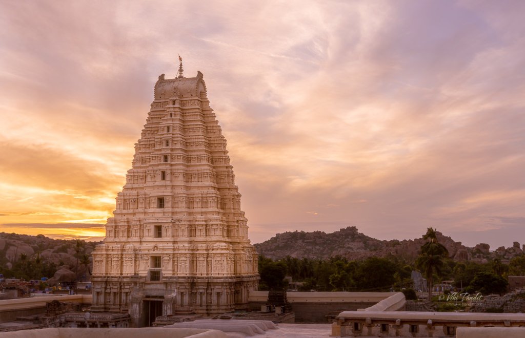
I set up my composition on the main gopura, which is the most ornate structure of the temple. The main gopura or temple tower is called the hiriyagopura or the chief tower. It has a brick superstructure and a stone base. Supervised by Devaraya’s minister Proluganti Tippa, the nine-tiered eastern gateway is the largest of the gopuras raised by the Vijayanagara kings.

Light changes pretty fast in these moments and within minutes the gopura was flooded with light from the Sun.

Daytime at Virupaksha Temple

By afternoon the sky had changed to a brilliant blue. The devotees were streaming in. Being a weekday, it was comparatively less than the crowds on weekends.

At present, the main temple consists of a sanctum, three ante chambers, a pillared hall and an open pillared hall. It is decorated with delicately carved pillars. The smaller eastern gateway leads to the inner court with its numerous smaller shrines. The hall of the main temple is believed to have built under the patronage of Saluvamantri, a minister of Sangama Mallikarjuna (1447–1465 AD).

Another gopuram towards north known as the Kanakagiri gopura, leads to a small enclosure with subsidiary shrines and eventually to the river Tungabhadra.

Krishnadevaraya, the most famous kings of the Vijayanagara Empire was a major patron of this temple. The most ornate of all structures in the temple, the central pillared hall is believed to be his addition to this temple. So is the gateway tower giving access to the inner courtyard of the temple.

It is recorded that Krishnadevaraya commissioned the open air hall in 1510 AD to mark his accession. Inscriptions on a stone plaque installed next to the pillared hall explain his contribution to the temple.

Nights at Virupaksha Temple

Sun is strong in Hampi. Evenings brought relief to my parched body. It also brought with it a magical glow to the surroundings. The sky went all red for a moment. The guard wouldn’t allow me to set up my tripod so I took this handheld.

After this we walked out of the fenced area where I set up my tripod to capture the one below. By that time the sun had already set but it left behind a beautiful blue sky.

After catching the temple at sunset, I made my way towards the wide street in front of Virupaksha, situated between the eastern gate of Virupaksha and the northwestern foot of the Matanga hill. Domingos Paes describes it as – a very beautiful street with beautiful houses with balconies and arcades, sheltering pilgrims that come to it, and with houses for the upper classes. He also mentions that the king too had a palatial residence in the same street.

Festivals at Virupaksha

In the month of February the annual chariot festival is celebrated here. Nicolo Conti, the first European visitor to Vijayanagara (1420–1421 AD), refers to two chariots which carried idols through the city. Richly adorned women or courtesans accompanied the procession stinging hymns in praise of the lord. Poet Ahobala, the author of Vasantotsava Champu, also refers to the two chariots: one taken out by the Brahmins and the other by the merchants or shudras.

Interestingly, the Virupaksha chariot festival has been continued ever since it was introduced in the fourteenth century and neither the fall of the empire nor the destruction of the capital in 1565 AD seems to have affected its popularity or practice. To date, the largest gathering at Hampi is witnessed during the chariot festival of Virupaksha held every year in March/April as per the local calendar.

Renovations

There have been major renovations which included painting the towers of the north and east gopura. When I was here a few years back the gopura were in white but I see a beige paint now. It is also heartening to see that ASI has stayed away from applying plasters to stone carvings like they did at Kailashanthar temple in Kanchipuram, which actually makes them look ugly.

I leave you with the last image of the day: Virupaksha captured from the steps of Matanga Hill at night.

Thanks for reading. Please leave me a comment if you liked the post or follow my story as I revisit the monuments on Hemkuta Hill.

Blue waters of Pangong Tso

The journey to Pangong Tso starts from Nubra Valley. We had a lovely day among the sand dunes of Nubra.

Drive from Nubra to Pangong Lake

The drive from Nubra to Pangong takes you through a wide varied landscape. The Shyok river stays with us for most part of the ride.

Once the river leaves us and goes on its own way near Durbuk, the road too becomes quite bad. In fact, at certain points, it was almost impossible to make out where the road was.

After a few hours we reached the Changthang Cold Desert Wildlife Sanctuary. This is the only place where you can see some vegetation. I caought some Pashmina goats grazing happily in the meadows

This little guy almost head butted me… he was probably taking care of the herd.

You can also find some horses lazying around in the cool breeze.

The roads near the santuary are well maintaned. The landscape also changes to a more pleasant view.

And then we see the first views of the Pangong Lake.

Pangong Viewpoint

We were staying in Spangmik village, but we first hit the popular viewing point, so we stopped there for a few minutes. It was around 2 pm and it was perfect to capture the beautiful lake in the brilliant light.

We moved around the edge of the huge lake taking shots of the crystal clear waters of the lake.

You can find Yaks available for rides if you want one.

You can see the changing colors of the water in the lake. It is greening towards the edges and more blue as you move your eyes towards the center.

After capturing some really amazing photos of the lake we moved on towards Spangmik village.

On the way we took more pictures of the mesmerizing lake.

Just before reaching the village, we passed an area with wide open space in front of the lake. Tsering, our chauffeur informed us that he will be taking us there in the evening, which is another wonderful place to enjoy the breathtaking scenery.

By 3 pm we had reached our lodgings at Spangmik.

It was May and still the mountains tops were covered in Snow.

After refreshing ourselves, we were ready for the second round. As promised Tsering took us to this lovely viewpoint from where you could capture the lake in its full beauty.

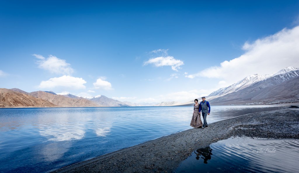
Mani modeled for me as I captured some amazing potraits. It was only 4 pm but the breeze had picked up and it was lethally cold. I was somewhat safe in my blazer, but Mani was having a tough time in the cold.

I quickly captured a shot of us before the cold really started to hurt.

With the Sun behind the mountains, the lake had turned into a deep blue color.

Shivering from cold, we hurried back to our tents. The tents lie at the edge of the banks. After a warm tea, we walked around in the evening.

The strong chilly breeze drove us inside the comfort of the tent. The night was extremely cold and even though I want to capture the stars over Pangong Tso, my body was too cold to come out.

In hind-sight, I should have stayed back for a day, but with a tight schedule, we had to move back to Leh the next day.

Next Morning…

The light is extremely bright in the mornings, so carry your eye shades.

We passed the lovey viewpoint we stopped at the day before for a few minute, but the light was too strong to capture good photos.

By 10 pm we are back on the road to Leh.

Dunes of Nubra

Nestled amidst the majestic peaks of the Himalayas in the northernmost region of India, Nubra Valley is a surreal and enchanting destination that captivates a photographer’s heart. Situated at an altitude of around 10,000 feet above sea level, this high-altitude cold desert boasts a landscape characterized by sweeping sand dunes and rugged terrains.

The valley lies between the two well-known Himalayan mountain ranges of the Karakoram (on the North), and the Ladakh (on the South). From Leh, we drove to Nubra across the Khardungla pass. The drive to the valley, spans around five hours, through one of the the world’s highest motorable roads.

Each twist and turn on the drive offers a new perspective of the desert’s beauty. At some points, the roads are treacherous but the awe-inspiring mountain vistas makes one ignore all the bumps on the road.

After the captivating drive through the mountains, we stopped at a dhaba near Khardung. The meal comprised steamed rice and dal along with some vegetables. Eateries are separated by long intervals so make sure you carry some biscuits or other beverages for the trip.

Just before we entered the valley, we came across some locals offering services for Quad biking. I have not driven one yet but a ride through this vast expanse of the desert must be an exhilarating adventure for those interested. The powerful hum of the quad bike engine echoed against the sandy dunes as we drove past them. The freedom to traverse the open desert, with its golden hues stretching as far as the eye can see, is an unmatched experience.

Diskit Monastery

Just before reaching Hunder, we took a small detour to Diskit Monastery, also known as Deskit Gompa. The monastery stands as the oldest and largest Buddhist monastery in the enchanting Nubra Valley. Constructed in the 14th century by Changzem Tserab Zangpo, a devoted disciple of Tsong Khapa, the founder of the Gelugpa (Yellow Hat) sect of Tibetan Buddhism, it serves as a sub-gompa to the Thikse gompa in Leh. Poised on the precipitous cliffs, the monastery exemplifies the Tibetan box structure, crafted from a blend of stones, mud, and wood.

Within its sacred walls, ancient scriptures, sculptures, murals, frescoes, brocades, and thangkas are housed, each narrating a tale of spiritual heritage. The Mahakali temple, statues of Tibetan deities, the Sakyamuni Temple, and the prayer hall add an air of mystery to this sacred sanctuary.

Near the historic Diskit monastery, the renowned 106-foot-tall statue of Maitreya Buddha stands as an iconic presence. Inaugurated by His Holiness the Dalai Lama in 2010, the enigmatic statue serves as a profound symbol of global peace and a vision for a future free from warfare.

Positioned on a hilltop, it offers a mesmerizing 360-degree panoramic vista. The bird’s-eye view unveils the picturesque Diskit Village in Nubra Valley, leaving us in awe of the vastness and tranquility of nature.

A quick 20-minute drive from Diskit Village transports us to the extraordinary realm of Hunder. Situated about 10 kilometers from Diskit, Hunder unveils a fascinating juxtaposition of snow-capped mountains and sand dunes, making it the sole location in India where these contrasting landscapes coexist in a single frame.

We were staying at the Hunder Sarai. The camps are surrounded by barren cold mountains and just about a 10-minute drive to the dunes. Hunder does have a mobile tower, but the network connectivity is not good. In between the gardens, outside slows a stream of crystal clear water. After a quick change of clothes, we directly drove to the dunes.

On the way, we noticed some camels making their way towards the dunes as well. The double-humped Bactrian camels are a distinctive feature of Hunder. It is said that Hunder used to be a crucial stop on the ancient Old Silk Route and these camels were brought in from Central Asia. In fact, it was still a trade route between Yarkand (present-day Xinjiang, China) and Leh, the capital of Ladakh, till the closing of borders in 1949 CE.

A camel safari atop these furry, double-humped creatures, navigating the silver or white sand dunes, becomes a once-in-a-lifetime adventure. The panoramic view of colossal mountains against the intensely blue sky, alongside the pristine white dunes will be etched in your memory for life.

The desert’s extremes are felt with the scorching sun in open areas and a sudden chill in the shade, necessitating layered clothing, sunscreen, and of course sunglasses. I would recommend staying in tents as the nights though chilly, promise a spellbinding display of the starry sky over the village.

Despite its arid and challenging conditions, Nubra’s cold desert boasts a unique ecosystem adapted to the harsh environment. Nomadic communities, such as the Changpas, have traditionally herded livestock in this challenging landscape, showcasing the resilience of life in the cold desert.

The Nubra region is the northernmost of Ladakh and in fact of all of India. It is fed by two main rivers: the Shyok and the Siachen. Both originate from the Siachen glacier but are on either side of the western Karakoram Range.

The climate of the regions is extremely harsh with scanty rainfall along with less moisture contained in the air. The minimum temperature in winter drops to -30 °C, and the maximum temperature is around 25 °C in the summer. In Nubra valley, the source and supply of water from glaciers is the only option for irrigation purposes, and portable water which is flowing through the two main rivers such as Nubraand Shayok, originates from the Siachen glacier and Remo glacier, respectively.

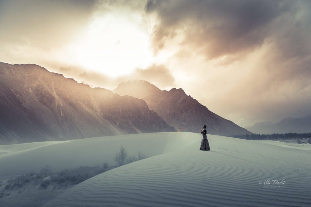
As the day passes, the winds pick up and create a kind of sandstorm. The sand dunes of Nubra are situated at the confluence of the Nubra and Shyok Rivers, creating a surreal desert landscape surrounded by majestic mountains. The dunes, predominantly composed of fine-grained sand, are sculpted by the relentless forces of wind, carrying sand particles from the riverbeds and depositing them in the valley. This continuous process shapes the dunes into undulating patterns, creating an ever-changing canvas of nature’s artistry.

The evening was cloudy and the sand kept blowing into our eyes. The weather is not friendly here and it gets pretty cold once the Sun hides behind the clouds. With every hour, the strong breeze keeps blowing the fine sand, reshaping them into new shapes. Even though the sand was harsh, we did get some wonderful photos. The wind whistles past, carrying the essence of the arid wilderness, while the rhythmic dance of the dunes creates a visually captivating spectacle.

Time passed quickly and soon the Sun was setting behind the mountains. The Nubra region is well known for its role as a gateway between the Indian subcontinent and Central Asia in modern times.

The voyage to Diskit Village in Nubra Valley is an exceptional experience, both literally and metaphorically placing me on top of the world. Traversing through Khardung La, the pass that once held the distinction of being the world’s highest motorable road at 18,380 feet, I found myself amidst unparalleled beauty. Presently, Umling La claims the title as the world’s highest motorable road, reaching an elevation of 19,300 feet in Ladakh.

The clear and unpolluted skies of Nubra Valley offer breathtaking views of the night sky, making it an ideal location for stargazing amid the tranquil desert setting.

Ladakh stands as one of the most stunning yet environmentally delicate regions in our country, emphasizing the need for tourists to be mindful of their impact on the area. The Ladakh region boasts breathtaking beauty with its cold desert landscape, yet it remains sparsely populated. It welcomes tourists from April to September, primarily during the summer months. While the improved infrastructure has brought economic benefits to the locals, the surge in tourism has raised concerns among environmental experts. Many argue that unregulated tourism poses a potential threat to the ecologically sensitive region.

Next, we move on to Pangong Tso, renowned for its stunning natural beauty. Surrounded by towering snow-capped peaks, the lake’s crystal-clear blue waters create a mesmerizing and picturesque landscape that is said to be a photographer’s dream. Thank you for taking the time to read my blog! Your interest and engagement mean the world to me. If you have any thoughts, comments, or questions, I’d love to hear from you.

Tourist Information

An Inner Line Permit (ILP), which can be acquired at the District Commissioner’s office in Leh, is required for tourists, Indians, and foreigners alike. People are required to check in en route and must provide photocopies of the permits to be deposited at each checkpoint.

Altitude sickness is a serious health concern for people not previously used to high altitudes. Prophylactic altitude-sickness medication such as Diamox may be necessary for some as there are no emergency medical facilities to treat altitude sickness along the route.

The road is closed from approximately October to May due to snow and is often subject to long delays due to traffic congestion on narrow one-lane sections, washouts, landslides and road accidents.

Road to Khardungla Pass

Ladakh is the highest altitude plateau in India. It is situated in the state of Jammu and Kashmir, bound by two of the world’s highest mountain ranges, the Karakoram in the north and the Himalayas in the south.

Khardung La is a mountain pass in Ladakh that serves as the gateway to the Shyok and Nubra valleys from the city of Leh. Though we write it as Khardung La, the local pronunciation is more like “Khardong La” or “Khardzong La.” The word La means pass while Kharzong means castle. I am not sure how the combination of these words were used to name this mountain pass.

Ride to Khardungla Pass

We were staying at the Shaolin Guest House in Leh. Leh is the largest settlement in Ladakh. It is a town of modest bazaars and winding streets, hemmed by rugged hills. A few of the main attractions are the Shanti Stupa, Namgyal Tsemo Gompa and Leh Palace. These places lie quite close to each other and can be visited in a single day.

We were leaving for Nubra Valley. Tsering, who was our designated chauffeur for the trip was at the gate exactly on time to pick us up for the long ride to Nubra Valley via Khardung La. The 150-km journey from Leh to the Nubra Valley includes some of the most diverse and exhilarating topography in the world, and its high point (both literally and metaphorically) is the Khardung La.

As we drove into the mountains, the air began to feel chilly. Due to the high altitude of Ladakh, the climate is very cold and the air is very thin, which in turn makes the heat of the sun extremely harsh. I don’t think I ever saw Tsering without a thick layer of sunscreen on his cheeks.

The geographical location of Ladakh ranges from 2,750 m high at Kargil to 7,672 m high at Saser Kangri in the Karakoram Range. The average height of the plateau is around 3,000m, and the numerous motor-able high altitude passes, such as Khardung La, Changa La, and Thaglang La allow for the region to be connected albeit during the summer months.

The motorway was built in 1976. It was opened to public vehicles much later in 1988. But the history of this road is much more ancient. Traders of the Silk Route, which developed in the pre-Christian era used the pass to travel between Leh and Kashgar in Xinjiang province of China. The 2000 meter climb to the pass provides thrilling panoramic views of the Zanskar Range beyond the Indus Valley and towards the Karakoram.

Khardung La is about 40 km by road from Leh. There are two bases on either side of Khardung La – North Pullu and South Pullu. The first 24 km, as far as the South Pullu check point, are paved. From there to the North Pullu checkpoint about 15 km beyond the pass the roadway is primarily loose rock and dirt.

Khardung La Viewpoint

The journey unfolded along perilous yet picturesque routes, with glacial snow flanking the roads and majestic, snow-covered mountains reaching towards the enchanting blue sky. The sheer ecstasy I felt during the drive is a sentiment shared by travelers globally who dream of navigating Ladakh’s roads by car or motorcycle. Gratitude extends to the Border Roads Organisation (BRO) and the Indian Army for their unwavering dedication to maintaining these roads, turning the dreams of many, including ours, into reality.

The elevation of Khardung La is claimed to be 5,359 m (17,582 ft). Earlier it was miscalculated to be around 18380 ft, which has now been corrected using measures from various other GPS surveys including SRTM data and ASTER GDEM data.

Maintained by the Border Roads Organization (BRO), the road is open to tourists all year round, but even now in the summer months, we could see icicles hanging along the sides from the rock faces. We stayed at the viewpoint for about 20 minutes and towards the end of the stay I could feel the dizzyness coming over me. We left soon afterwards. In fact a signboard nearby discourages tourists from staying beyond half an hour at this place.

A few minutes after the viewpoint, the roadsides were completely covered in snow. It was biting cold outside. In olden times the Ladhakis used to refer to India as Gyagar (gar or kar: white, ‘where people wear white clothes’). Here ‘white’ signifies the difficulties of living. For them life appeared more grim on the Tibetan plateau while they had always heard of warm and pleasant life in the Indian plains. Experiencing this level of snow in summer I can totally understand their hardship living in these cold mountains.

Towards Nubra Valley

From North Pullu into the Nubra Valley, the road was very well maintained.

As we descended we witnessed the first views of the Shyok river emerging from the eastern side of the Karakoram and flowing north– south before it takes a westerly course to join the Nubra river. In contrasting terms Nubra Valley means a valley of flowers while the Shyok river that flows into it means the ‘River of death’

An hour’s drive downhill from Khardung La leads to the first stop in Nubra called Khardung, a small village in a sandy flatland. We took our lunch at the village. Nearby some wild asses were busy munching on the rare green grass. This was our first view of any greens since leaving Leh.

Soon after, at Tirit, the road bifurcates: one takes you to the valley of the Shyok river which has the towns of Diskit and Hunder, with a magnificent high-altitude desert between them; and the other to the green valley of the Nubra river, towards Sumur and Panamik.

As we got closer to Hunder, the weather changed drastically and we were surrounded by sand from the cold desert. The skies had turned ominously gray, but we moved on excited and looking forward to our next stop: Sand dunes of Nubra.

Tourist Information

An Inner Line Permit (ILP), which can be acquired at the District Commissioner’s office in Leh, is required for tourists, Indians, and foreigners alike. People are required to check in en route and must provide photocopies of the permits to be deposited at each checkpoint.

Altitude sickness is a serious health concern for people not previously used to high altitudes. Prophylactic altitude-sickness medication such as Diamox may be necessary for some as there are no emergency medical facilities to treat altitude sickness along the route.

The road is closed from approximately October to May due to snow and is often subject to long delays due to traffic congestion on narrow one-lane sections, washouts, landslides and road accidents.