Journals

The forgotten tombs of Chattardi

On our autumn break, we were heading to the Rann of Kutch. The Great Rann of Kutch is a salt marsh located in the Thar Desert in the Kutch District of Gujarat. Kutch derives its name from its resemblance to a tortoise which is pronounced as “Kachabo” in the local Gujarati dialect. Kutch used to be a desert sporadically populated with small tribes. The first known mention of Kutch occurs around 300 BC. when a holy man, lost in the forests of the north-western Kutch, cleared the wildlands using celestial fire so that he could find his way home. It is said – from those ashes sprang crops of grass so rich that large numbers of pastoral tribes from neighboring areas moved in making it their new home.

Bangalore to Bhuj

There are many convenient ways to get to Bhuj but to save time I choose to take the flight from Bangalore with a break of a few hours at the Mumbai airport. This choice, however, was largely forced because my waitlist queue on the inbound train to Bhuj never moved a place in over a month.

As we landed in Bhuj, the flight intercom alerted us to abstain from taking photos of the airfield, on account of it being near the army base. The International border is not very far away and we don’t really have cordial relations with the Pakistanis.

Bhuj is the principal town of Kutch in Gujarat. The Kingdom of Kutch was founded around 1147 CE by Lakho Jadani of the Samma tribe who had arrived from Sindh. The walled city is built around a lake dominated by a fortified hill. As we stepped out of the Jet Airways plane, an army fighter took off from a nearby field. No wonder, the military doesn’t want tourists posting pictures of this area.

We had reservations at the Click Hotel in Bhuj. Taxis, few in numbers were asking for an astronomical amount of Rs. 500 for a three-kilometer ride to the hotel. With a little bargaining, I was able to convince an auto driver to drop us off at the hotel for Rs 200.

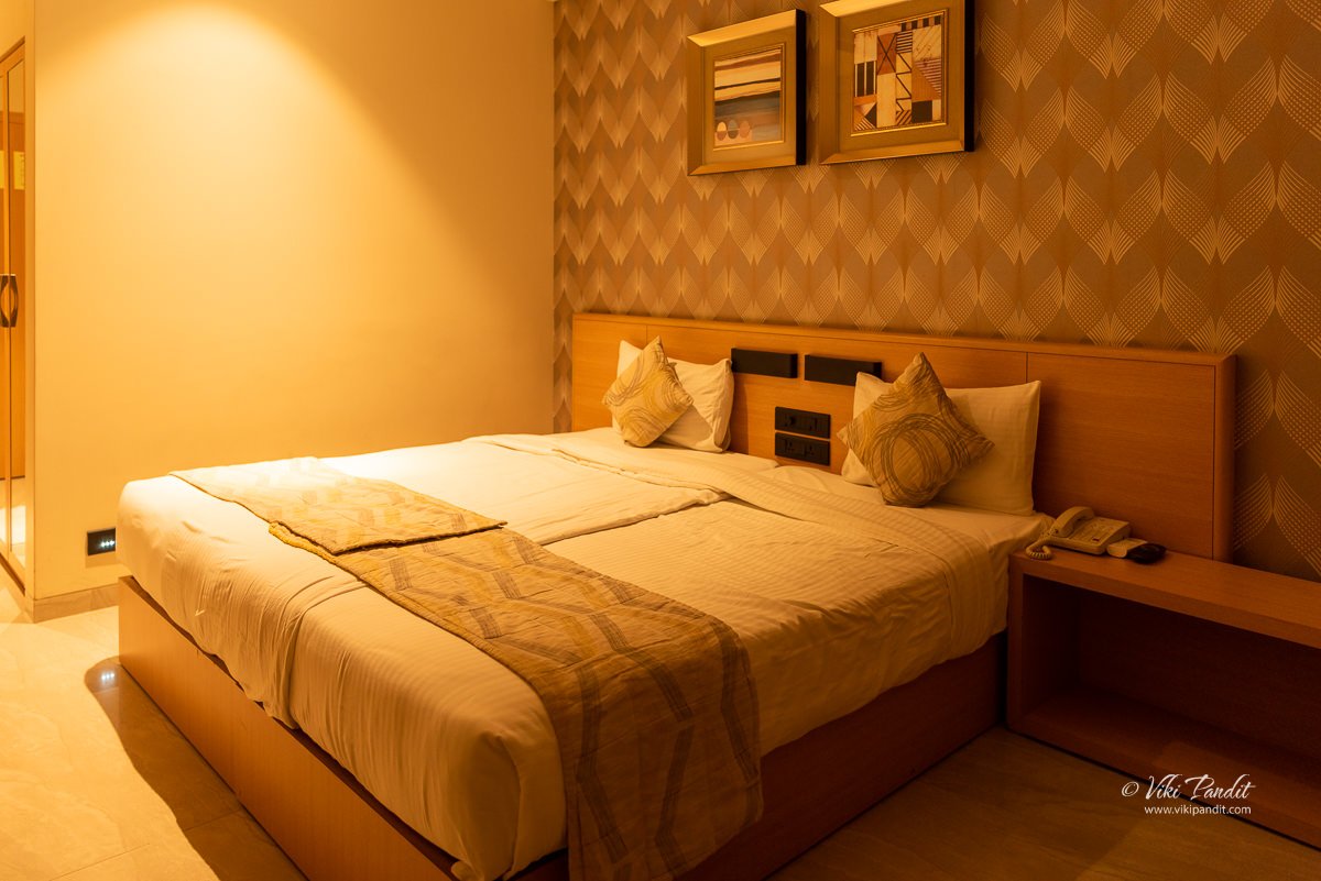
Click Hotel is one of the most lavish hotels in the city. It also helps immensely that they are located right next to the Bhuj railway station. The room and facilities at the hotel were beyond expectation. I would really recommend this hotel just on the basis of its amazing location.

After a shower, we dropped into the hotel restaurant on the ground floor. In Gujarat, come prepared to eat vegetarian. After lunch, we hopped into an auto-rickshaw also known as the Tuktuk, towards the local market. We were searching for some ethnic costumes to wear on our days at the Rann festival.

The Waniyawad market is about 15 minutes away from the hotel and it didn’t take us long to find a decent store that sells local handicraft items.

After obtaining a lovely Ghagra/ choli with lovely mirror work for my wife and a Kurta in Rabari embroidery for yours truly, we hired another auto-rickshaw to take us to the ruins of Royal Chhatardis of Bhuj. The “Chhatris” complex is a popular cenotaphs complex in the outskirts of Bhuj, not more than a 15 minutes ride from the town center. It preserves the tombstones belonging to the Jadeja rulers of Kutch.

The ruins of Chattardi of Bhuj

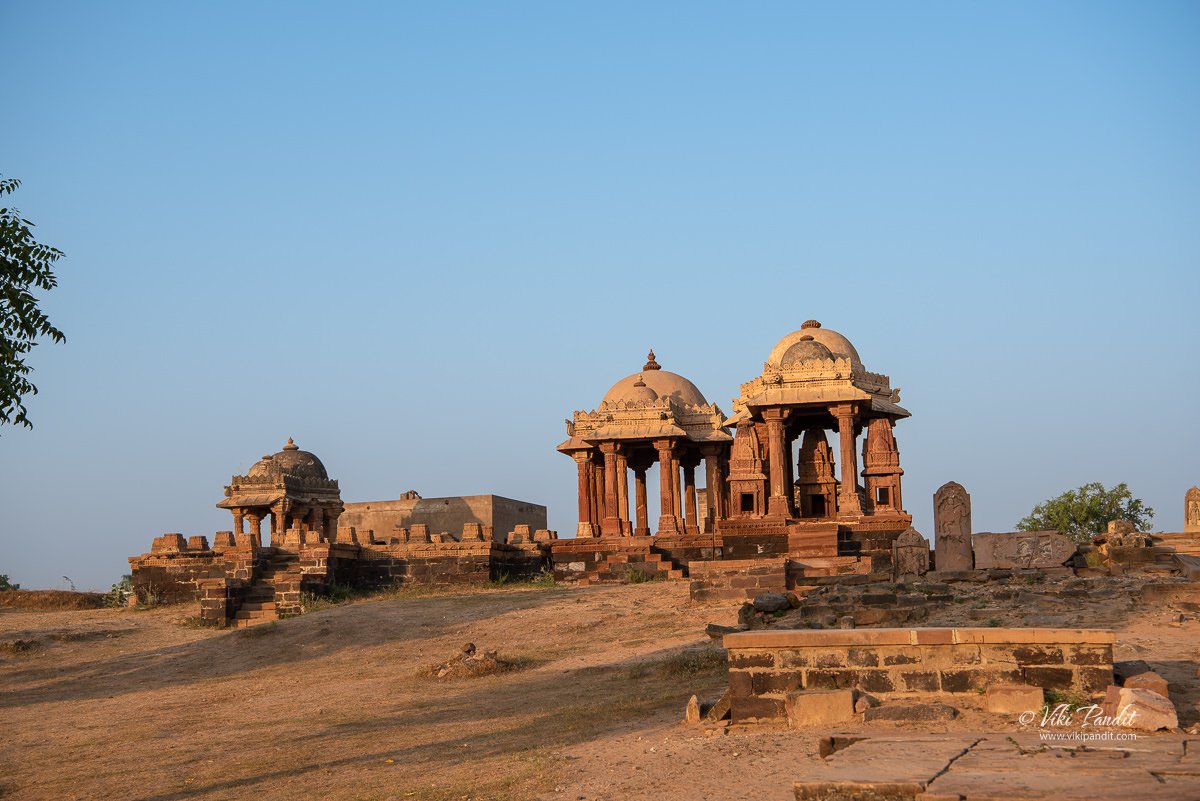
The sun was already saying its goodbyes by the time we reached the Chattri ruins. As the tuktuk dropped us off, you can tell there is no massive gate announcing an important heritage site. The entrance is so narrow that one can easily miss it. The “Chhatris” complex in Bhuj was constructed sometime in the 18th century to glorify the cenotaphs of the Rao’s of Kutch.

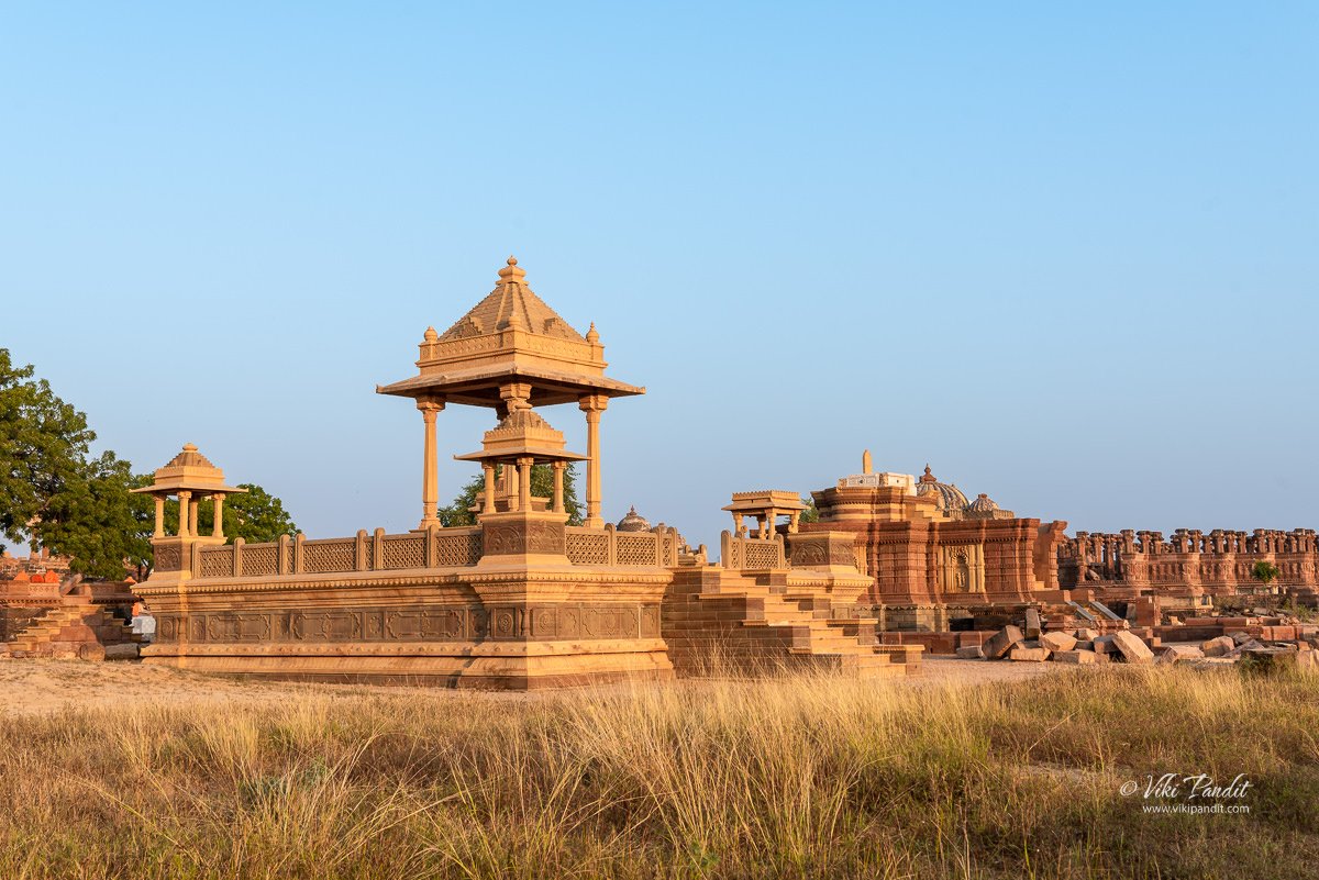
Most of the buildings have almost disappeared into rubble piles as a result of the earthquake of 2001. Still, the remaining pieces of history were enchanting enough for me. A few local visitors were sitting on the broken pedestals, enjoying the beautiful sunset. It was getting dark fast, so I decided to come down the next day at sunrise.

Reaching Chattardis of Bhuj

Even though I was exhausted from the two flights of the day before, I was also bubbling with excitement, to visit the final resting place of the kings of Kutch. I woke up at 5 am when the stars were still illuminating the sky. Bhuj being one the westernmost towns, the sun rises quite late in these parts at around 6.30 am.

It was still dark as I went around the back of the hotel towards the auto-rickshaws parked near the railway station. The Chattardi complex is located at a distance of about 5 km from Bhuj Railway Station, situated to the southwest of Hamirsar Lake. By the time the auto driver dropped me off in front of Chattardi complex, a soft glow of dawn had already appeared over the horizon.

History of Chattardis of Bhuj

I still had a half-an-hour lead over the sunrise. The revolving gate at the entrance was unmanned and I quickly made my way towards the damaged ruins. The Chhatris in Bhuj were commissioned sometime in the 18th century by Jadeja ruler Rao Lakhpatji.

Kutch was ruled by the Jadeja Rajput dynasty of the Samma tribe from its formation in 1147. The rulers had migrated from Sindh into Kutch in the late 12th century. The Jadejas in all probability could have been one of the Sindh tribes who, in the tenth century, were converted to the tenets of the Karmatians. When the leading branch of the Sammas adopted the orthodox form of Islam, the Jadejas kept to their Hindu faith. Some historians point to 1185 when Jam Jadaji became king of Sama Nagar, Sindh. He had no sons. So he adopted two sons of his Younger brother Veraji; Lakhaji and Lakhiyarji. So The names of Lakhaji and Lakhiyarji were changed to Lakhaji ‘Jadeja’, which means son of Jadaji. Thereafter all descendants were named ‘Jadeja’, which means sons of Jadaji.

Interestingly, the genealogy of the Jadejas is still maintained today by the respective Jadeja branches and every single person in their clan can trace their ancestry through to Rato Rayadhan.

The pure Jadeja rule started sometime near 1365 CE. Though considered a new name, they rose into prominence after the conversion to Islam of the Samma rule, that immediately precedes them.

The name Jadeja means “Belonging to Jada” in the Sindhi and Kutchi language, and is pronounced as “Jaa day jaa”.

The construction of cenotaphs or chhatris by the Royal families of erstwhile kingdoms in Gujarat and nearby regions had been in vogue for many centuries. These umbrella-shaped dome structures, built in memory of royals can also be found all over the nearby regions of Rajasthan and also in some parts of Madhya Pradesh which were connected to the Rajput lineage. Kutch was ruled by the Jadeja Rajput dynasty until 1948 when it acceded to the newly formed Republic of India.

The cenotaph complex was deserted at this early hour and I went about taking shots of these collapsed masterpieces. There are no official markings and it is impossible to assign any of these to a particular ruler.

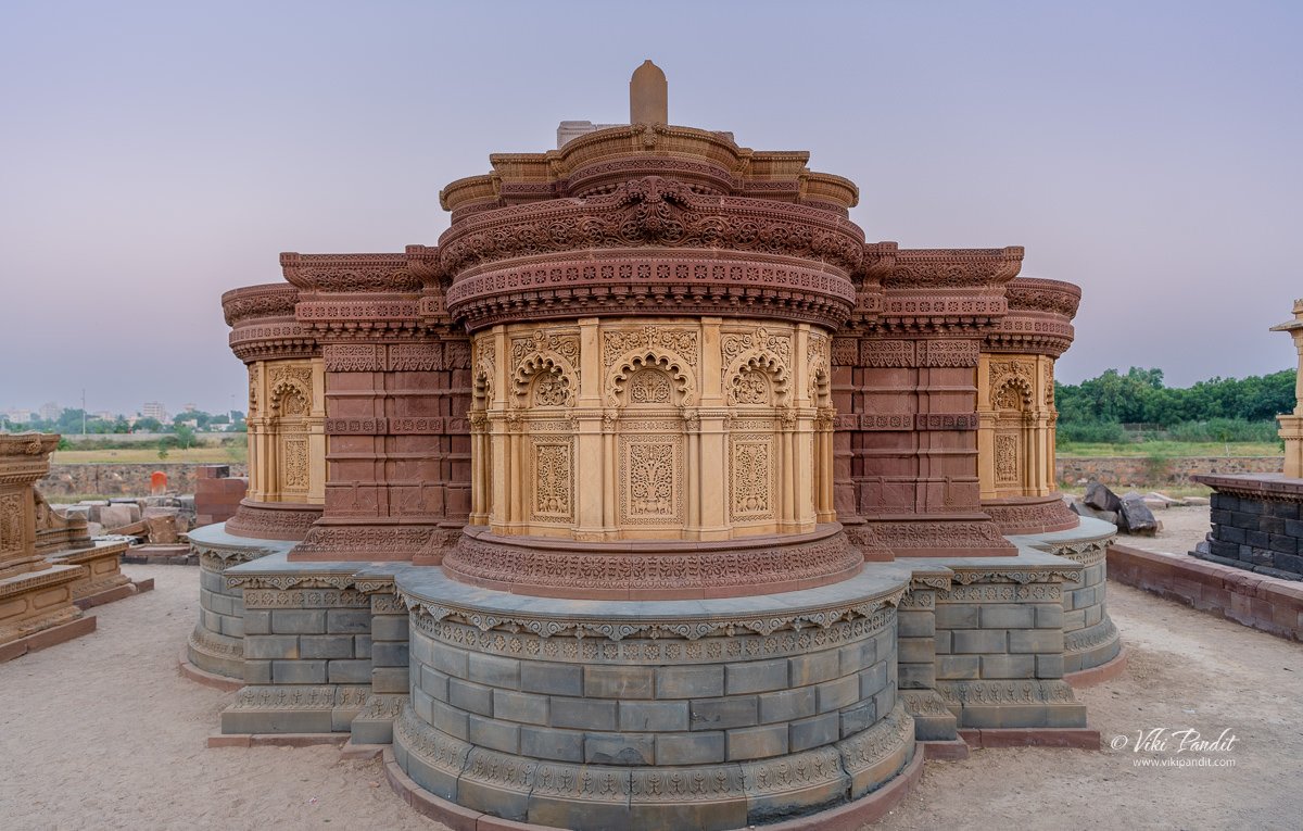
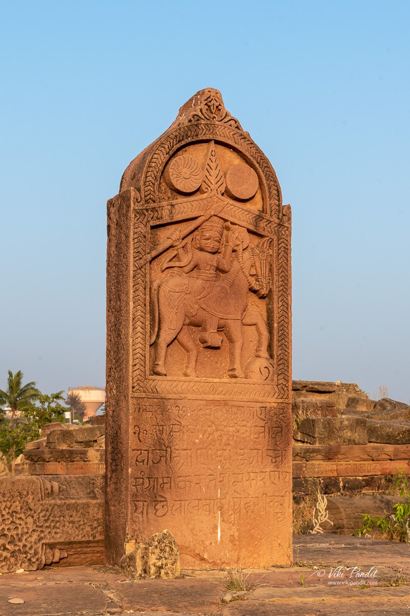
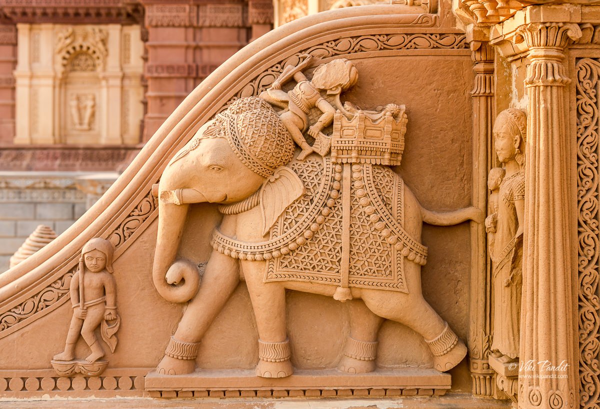
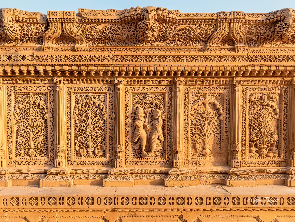
Inside the complex, there are many different types of Chhatris. I really loved the detailing on this tombstone. It is the most detailed surviving structure. Floral designs are the most common patterns found on these tombstones. Apart from floral patterns, hexagons, octagons, and stripe patterns can also be seen across the walls of the structure.

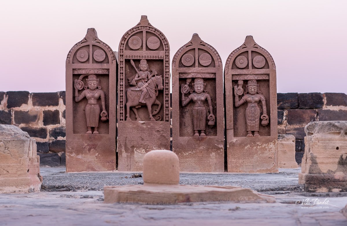
This was in all probability another tombstone of a Rajput king, but it is impossible to say who is depicted on the tablet. Over the years these ancient Chattris – the tombstones of fallen heroes, and stones erected in memory of their heroism and chivalry became their recognition. The person on the horse is supposed to depict the king surrounded by his wives.

Further up, I found another similar tablet. It was much simpler compared to the other ones. This one didn’t have the depiction of the king’s wives surrounding it.

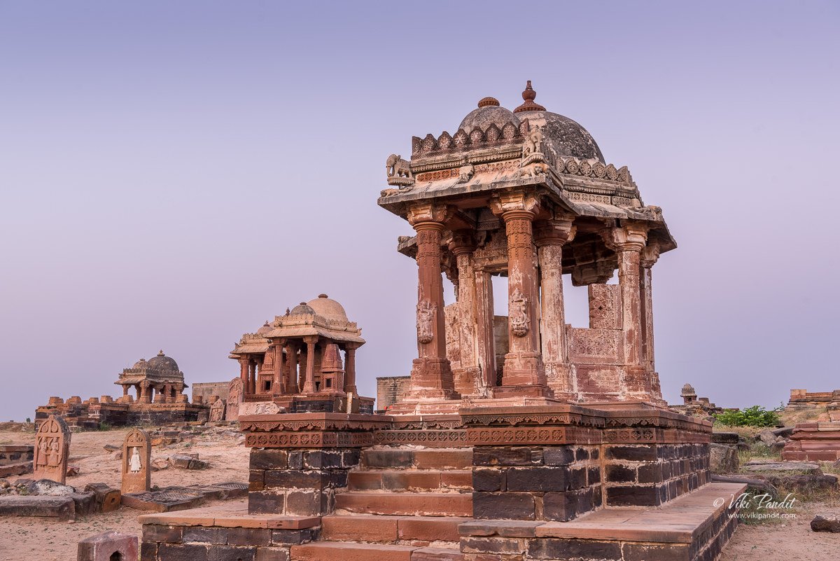
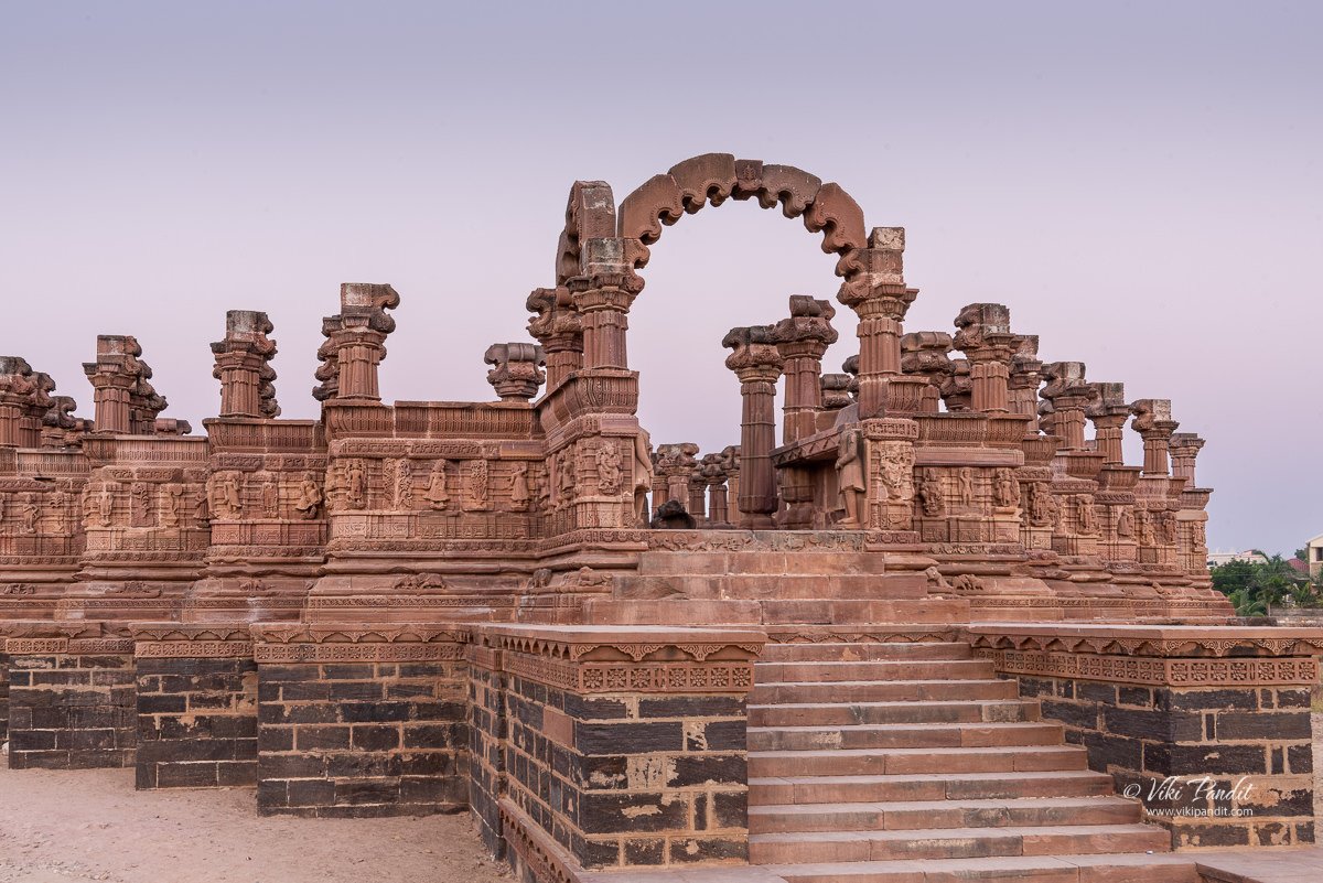
As I moved from one cenotaph to another I found myself in front of the largest and the finest tombstone, that of Rao Lakha built in 1770 CE. This cenotaph is particularly famous as it was shown in a Hindu movie. The movie was released years back and at that point in time the heritage structure still had its roof.

The story of Rao Lakhpatji

Maharao Lakhpatji, born in 1717, was probably the most influential of all the rulers of Kutch. Also known as Lakhaji, he was the Rao of Cutch, who ruled the princely state of Cutch (Kutch) as a regent from 1741 to 1752. He later succeeded his father Deshalji I in 1752 and ruled until his own death in 1760.

Rao Lakhpatji was a pivotal figure in the development of Kutch and his reign which started in 1741 saw the arts of Kutch introduced to the rest of India.

Please be careful while exploring these structures as you can see the main gate is just about hanging somehow.

Unlike Maharashtra, which is almost entirely covered by the basaltic lava flows of the Deccan Trap, the Bhuj landscape comprises sandstone and shale. Built of these red sandstones, the Chhatri of Rao Lakhpatji is situated on the northern side of the Chattardi complex. The main Chhatri used to be supported by decorative pillars, a fine specimen of Kutch architecture. Once you enter Rao Lakhpatji’s cenotaph you will be amazed by the semi-damaged beautiful sculptures of the deities and people in local costumes.

Designed by Ram Singh Malam, an architect and craftsman from the 18th century Kutch region, the cenotaph is polygonal in shape with balconies. There used to be a blue dome with jeweled work strongly influenced by Turkish architecture. His technique of enamel work is now known as ‘Kutch work’. The depictions in stone of Rao Lakhpatji chhatri suggest that 15 of his wives gave up their lives at his funeral pyre.

Ram Singh Malam is celebrated as a maritime folk hero and songs written on him are still sung in coastal regions of Gujarat.

Constructed in 1770, this cenotaph had many individual balconies. The structure used to be covered with a roof with intricate carvings but currently they lie scattered around the tombstone. In the center of all these lavish constructions sits the tablet of the king himself with 15 of his consorts. The tablets used to sit under the central dome, where it is also said, lies the ashes of Rao Lakha.

Raujputana history is rich in historical romance and chivalry. During my research, I read there are other tombstones dedicated to Rao Rayadhan, Rao Desai, and Rao Pragmal, but without any proper guide, it is hard to tell which one is which.

After taking a few shots in the early twilight, I waited for the Sun to show up, reading up on a bit of history behind the most influential ruler of Kutch – Rao Lakhpatji.

Sunrise at Chatteri

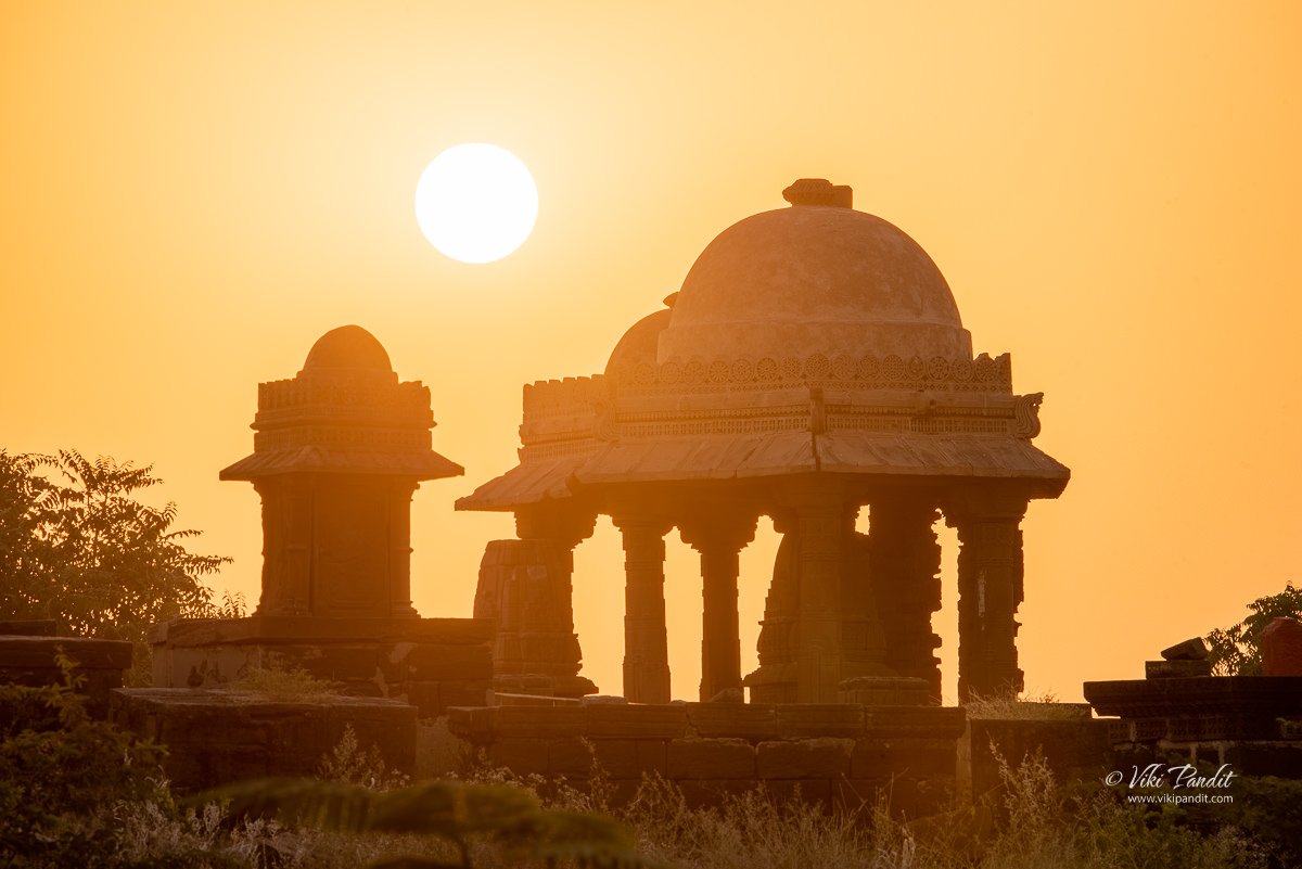
The sun took its time showing itself. The sky was already bright all around by the time I saw it peeking from behind the forests. I took my tripod to the opposite side of the sunrise so I could catch the silhouettes of the tombstones in an artistic way.

I was soon basking in the golden rays of the winter Sun. The square pavilion below was a standout among all other dome-shaped tombstones

In some articles, I have read that the Chattri with a blue dome with jeweled work strongly influenced by Turkish architecture is also dedicated to Rao Lakhpatji. Mind you, with some exceptions, Chhatris are basically tombstones that do not contain the mortal remains of that person and they were built as a tribute to their greatness.

The Chattris of different clans display variations of the umbrella form, in a way conveying its extra-ordinariness. The earlier cenotaphs memorialized their ancestors with Chhatris that took forms appropriated from temples built in the region. During the times of the Raos of Kutch, diplomatic relations with the Mughals imparted their own unique flavor to this structure.

By this time, a couple of local residents had made their way to the complex for their morning exercises. The golden light was perfect to capture the details of these tombstones so I went back around the structures that were comparatively less damaged to capture closely the details in these walls.

A distant view of these structures is very pleasing and yet a closer examination of the designs and intricate carvings engraved on the tombstones reveals a wealth of data about the social history of the region. Some walls bear floral patterns while others bear figurative depictions of equestrians and weaponry such as shields and spears.

On the southern side of the compound, there is, what seems like an active temple where people still come to say their prayers. The Jadejas, themselves were followers of Hinduism and worshiped Ashapura Mata, who is the kuldevi of the Jadeja clan and also the State deity. The main temple of the goddess is located at Mata no Madh.

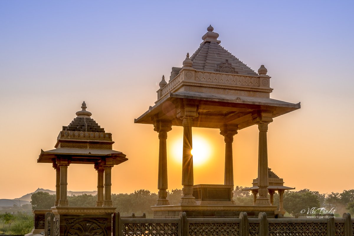
Just in front of the temple, the square pavilion was lit up beautifully in the soft golden rays of the Sun. This tombstone is the only square-shaped tombstone on the premises and appears to be tilted towards the chaukhandi type of architecture, much more prevalent in Sindh, now in Pakistan. Well, let us just say not everyone loves circular domes.

Restoration of Chattardi

It was 8 am already and I had to go back to the hotel to get ready for my ride to the Rann Utsav. The structures have been severely damaged by the Bhuj earthquake of 2001 and some are currently being renovated though at a very slow pace.

The Kutch region is underlain by a Mesozoic rift system. Faults within such rift systems are known to have the potential to generate large earthquakes. Earthquakes have visited this district of Kutch repeatedly over the centuries. The last great earthquake of 2001 has taken a huge toll on the enigmatic buildings from the 18th century. The area is so rich with cultural heritage, and the earthquake was particularly cruel to many of these architectural relics that embody that heritage. 

Walking through the boulders I found stone tablets depicting royalty as well gods and goddesses, some of them exquisitely carved. With no security around the compound, I wonder how difficult it would be for someone to just pick up one of these extremely valuable decorative slabs, either to sell in the gray markets or simply in order to decorate their own drawing rooms. I greatly appreciate the restoration work already done, but the concerned authorities must arrest this decay and destruction of these valuable pieces of our heritage and restore them to their original splendor.

Best time to visit Bhuj

Thanks for reading. Please leave me a comment if you liked the post or follow my story as I visit the White Rann.

What is the best time to visit Bhuj?

The best time to visit Bhuj is between November and February. These are the only times when the harsh sun isn’t beating down on the desert district.

What are the admission timings for Chattris in Bhuj?

It is open 24×7. I didn’t see any guards and morning joggers use the place freely.

What are the admission fees for Chattris of Bhuj?

admission is free
The Stone Sculptures of Veerabhadra Temple

The forecast for the weekend had been bleak. With frequent rains and cloudy days, I was a bit circumspect if we would eventually be able to go down to the Veerabhadra Temple in Lepakshi. Fortunately for us, it turned out to be a lovely sunny day.

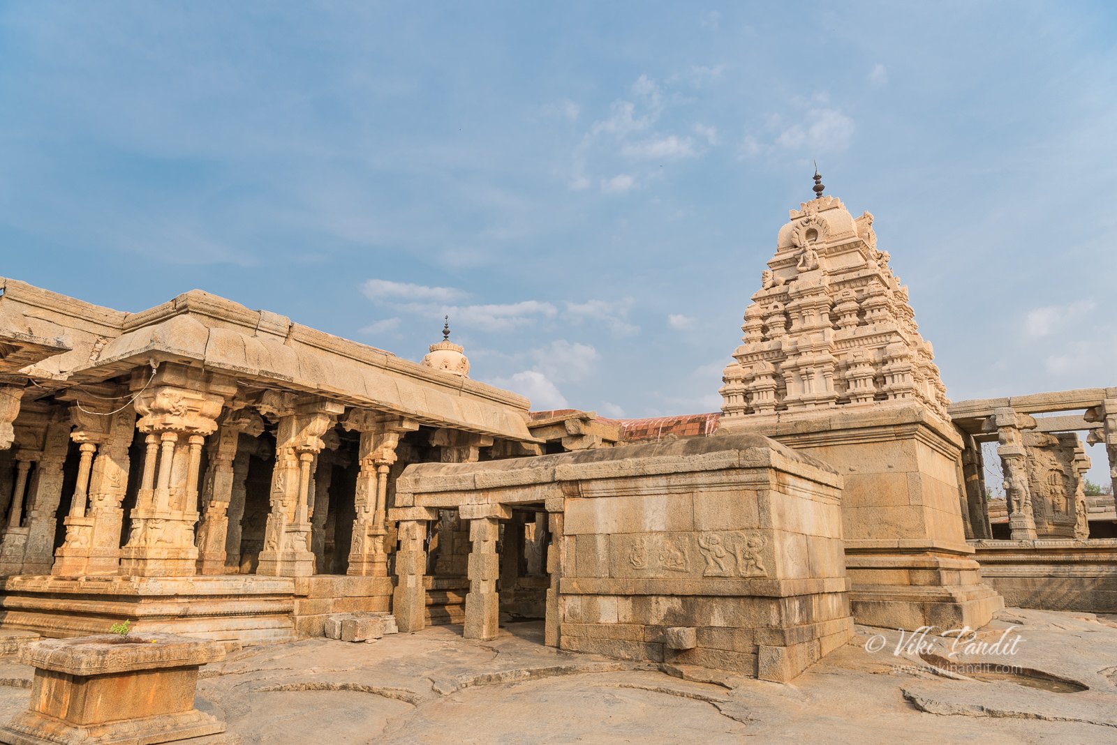
The Veerabhadra Temple lies not far from Bangalore in the Indian state of Andhra Pradesh. It is popular around these parts for its outstanding sculptures and ceiling paintings which represent the climax of the Vijayanagar Art towards the middle of the 16th century. Built in 1530 CE, the architectural features of the temple follow the Vijayanagar style to the detail, with numerous carvings and paintings at almost every exposed surface of the temple.

How to reach Veerabhadra Temple

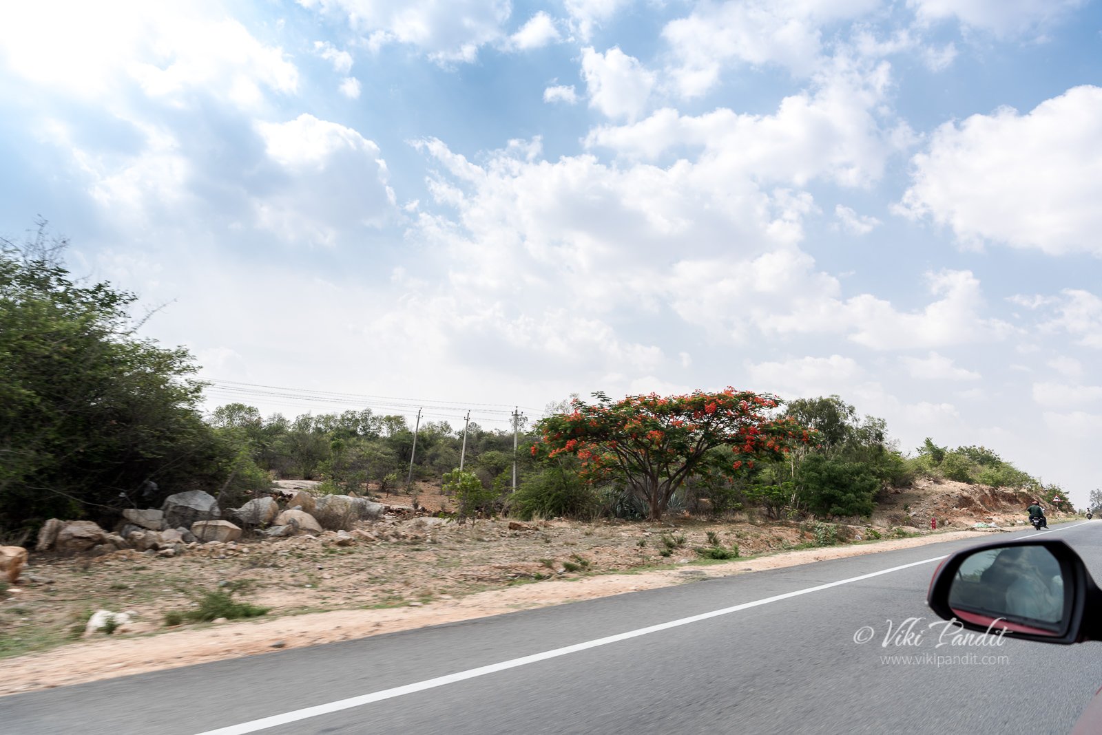
We started from Bangalore at about 1 pm. The journey was uneventful as we passed by some fine stretches of flowering Gulmohar trees along the NH7.

After about an hour and a half of driving along the national highway, we reached a toll booth at the borders of Karnataka. Immediately after the toll booth, we took a hard left into a branching road towards Lepakshi. The road is adorned with a huge gate and a big Nandi statue sitting in the center. From here Lepakshi is just about 12 km away.

Once we left the highway, the road narrowed down to a 2-lane driveway, but it was still well maintained. I thank the Andhra Pradesh government, who have done a great job for the many foreign and local tourists, who have no other way to reach this historical site.

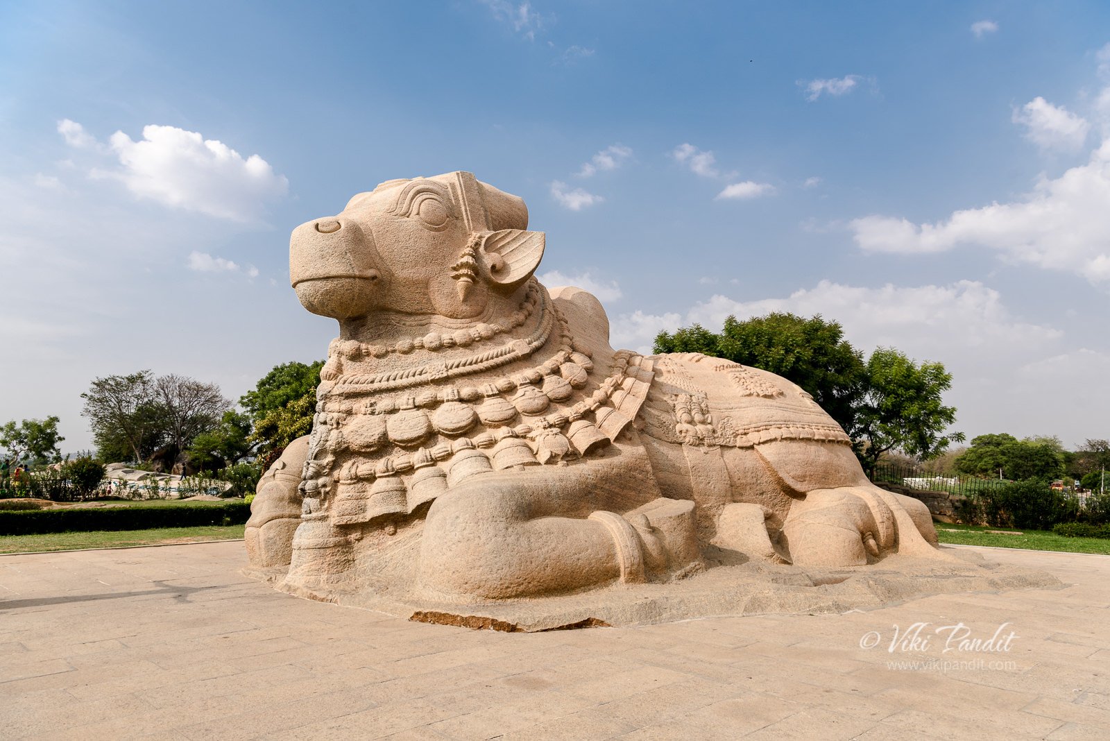
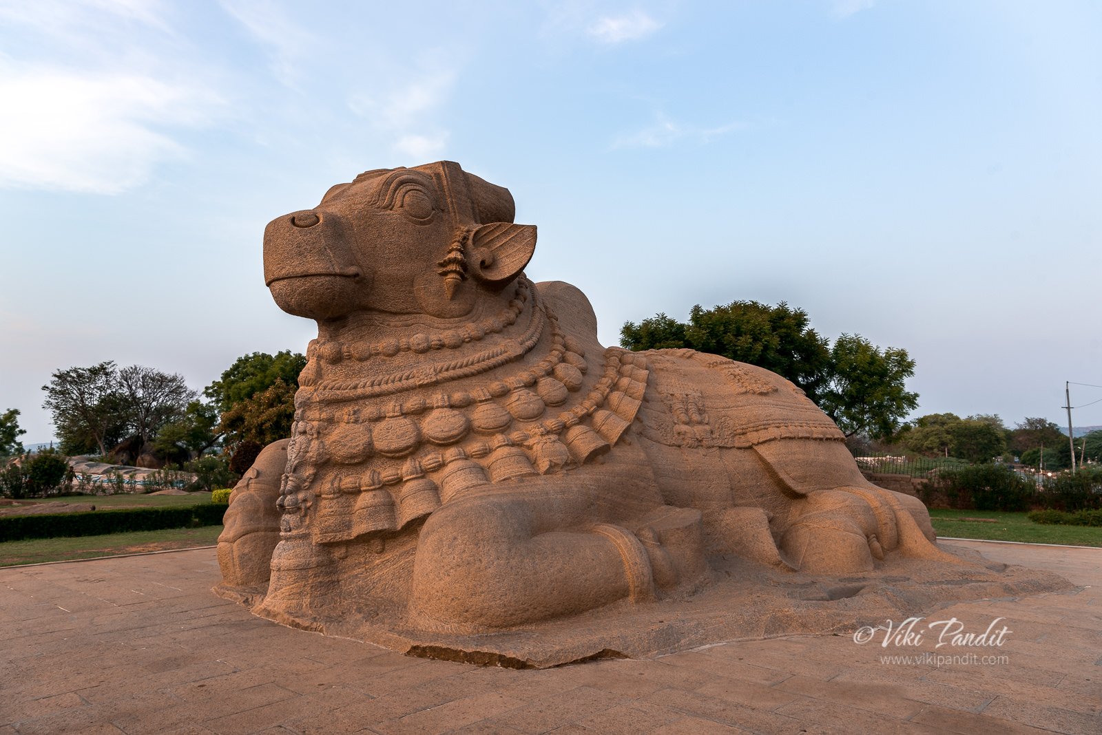
After about another 20 minutes, we found ourselves in front of the first attraction of the day – the colossal monolithic Nandi, carved from a single block of granite, said to be one of the largest of its type in the world.

Nandi of Lepakshi

Since I have relocated to Bangalore, this imposing sculpture of Nandi has been beseeching me to visit. Today, I found solace as I stood in front of the monumental Shiva’s mount from the Vijayanagar era. Seated peacefully in a lovely manicured garden the statue faces the precincts of the Veerabhadra Temple. The statue is about 5 meters in height and 9 meters in length. Its neck is bedecked with finely carved garlands and bells.

One of the first question that comes to one’s mind who understands Hindu mythology is “where is the shivalinga?” It is also quite odd that this large Nandi bull is situated almost 200 meters away from the temple. Generally, every Nandi statue I have seen is always accompanied by a shivalinga before it.

As we snapped away capturing different angles of the nandi, the caretaker walked in towards us. He carried a large wooden stick in his hand. He told us that the temple and the Nandi sculpture used to be part of the same temple grounds and during ancient times there used to be a clear view of the temple from here, however illegal encroachments have separated the Shiva’s mount with its master. 

After taking a few pictures of the grand Nandi, we came out of the small garden, planning to head towards the Veerabhadra Temple. Before entering the temple, we stopped for lunch at the Andhra State tourism board run restaurant, just beside the Nandi sculpture. After a sumptuous vegetarian thali meal and some rest, we gradually made our way towards the temple.

Veerabhadra Temple of Lepakshi

The Veerabhadra Temple has been built on the southern side of Lepakshi town on a low altitude granite hillock. The locals say this hillock was in the shape of a tortoise, and hence known as Kurmasailam – which translates to tortoise hill in Telugu. It is hard to see much of the hillock now because of the numerous shops and houses built around the temple.

You can avail parking near the entrance to the temple. There is a fixed car parking charge of Rs. 40 for an unlimited number of hours.

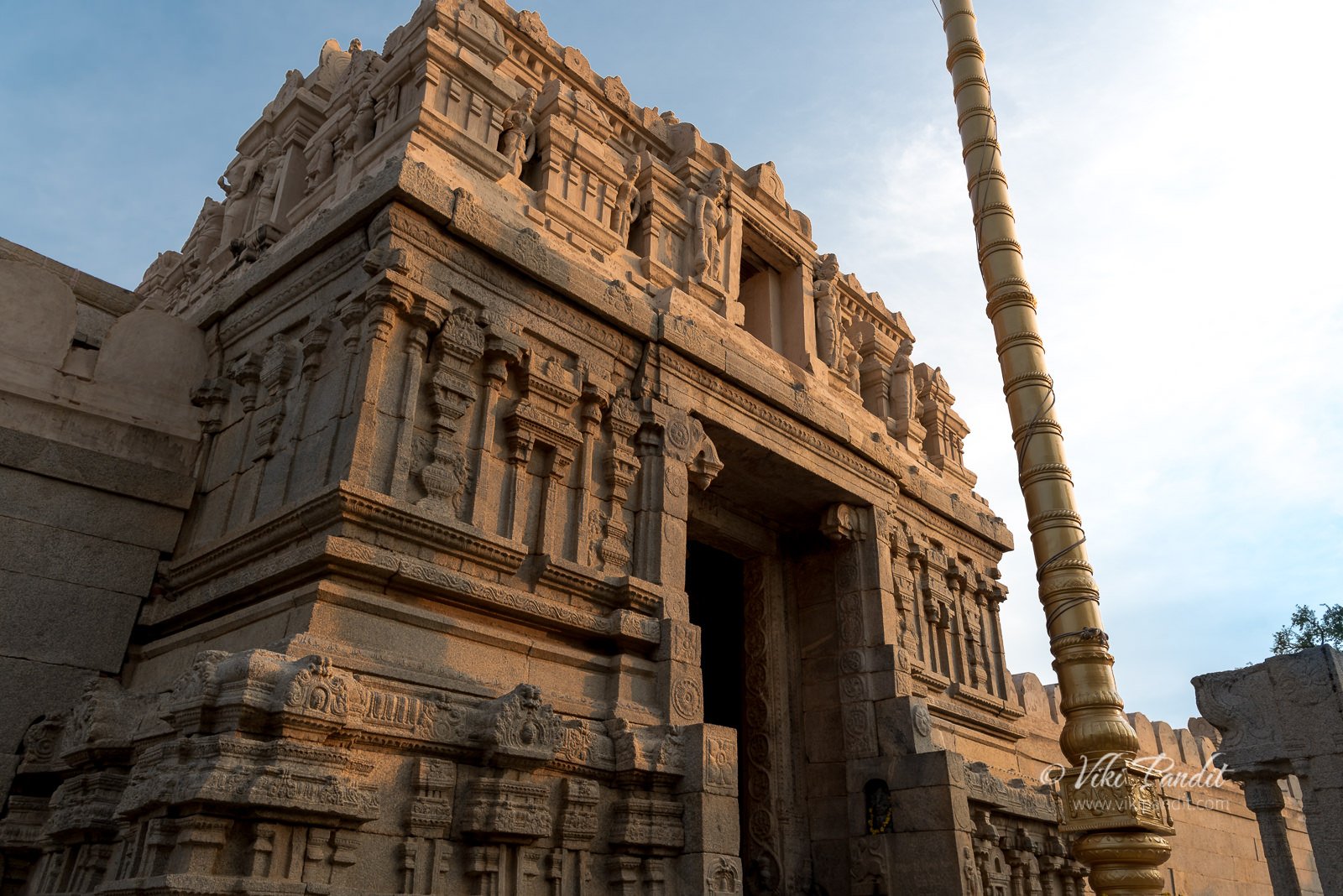
One has to remove their shoes before entering the temple. Beside the entrance, on the left there is a makeshift shoe rack. Patrolling this area is a middle-aged lady holding a long wooden stick in her had, primarily I think to drive the naughty monkeys away from the area. The temple does not seem that special from outside, but once you climb the fleet of steps and enter, you will begin appreciating the thorough artwork of the sculptors of that time. Not even at Hampi, in the historical temples at the core of the Vijayanagar empire, can one find carvings of this stature.

History of Veerabhadra Temple

In 1346 CE, Harihara constructed a fort at Penukonda, a town in Anantapur district of the Andhra Pradesh. It was one of the important provincial centers and occupied a strategic position in the Vijayanagara period. He made Lepakshi his second capital marking the start of the Vijayanagara rule over the town. During the rule of this dynasty, Lepakshi was benefited from a multitude of construction activities, centered around this temple.

Construction of the Veerabhadra Temple was started in around 1530 AD by two brothers, Virupanna Nayaka and Viranna, who were Governors of Penukonda, under the Vijayanagar Empire during the reign of King Achyutaraya, the successor of King Krishnadevaraya.  Virupanna was the son of Nandilakkisetti of Penukonda and rose to a position where he made himself prominent and indispensable. Inscriptions of the time of Acyutarāya inscribed on the walls of the temple give particulars about the neighbourhood, the temple and the devoted brothers.

The temple was dedicated to Veerabhadra Swamy, the family God for Tuluva dynasty. In the south Veerabhadra is known as the angry form of Hindu God Shiva. One interesting aspect of this temple is that it is North facing. Hindu temples are typically East facing, while there are some West and South facing temples too, North facing temples are rare in comparison. 

Even today, no one stays in the temple after sunset as the locals believe that Veerabhadra Swamy will be coming for rounds at night

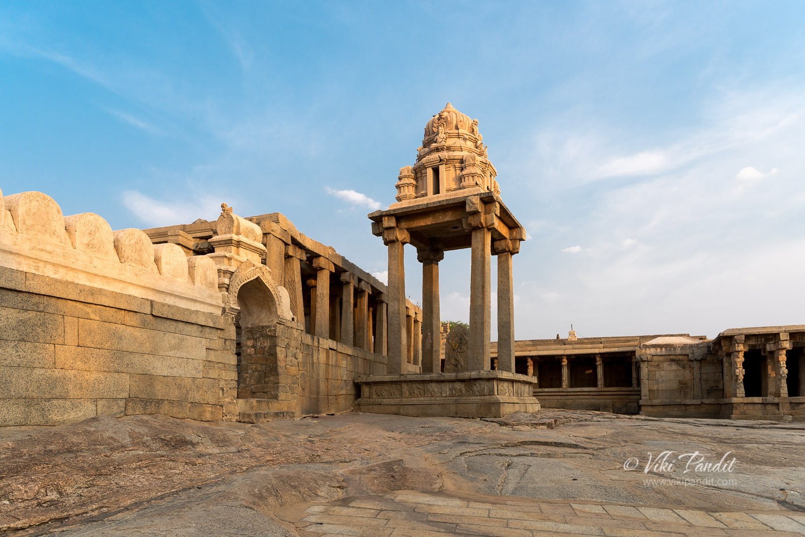
The main temple stands inside two concentric irregular enclosures. The outer enclosure wall is lined with shielded porches and corridors surrounding the temple grounds.

The main temple is laid out in three parts:

  • The assembly hall or the central pavilion called Mukha Mandap, with a pavilion for dance performances (Rang/Natya Mandap)
  • An intermediate hall called the Ardha Mandap (worship chamber)
  • Garbhagriha, the innermost sanctum sanctorum

Mukha mandap, Veerabhadra Temple, Lepakshi

As I entered the inner sanctum, I was awed by the profusion of sculptures and paintings over every inch of space on the columns as well as the ceilings. Karnataka and several parts of Andhra are blessed with an abundance of granite hills and our ancestors have used it smartly so what they created hundreds of years back can still be enjoyed by us and I hope numerous generations.

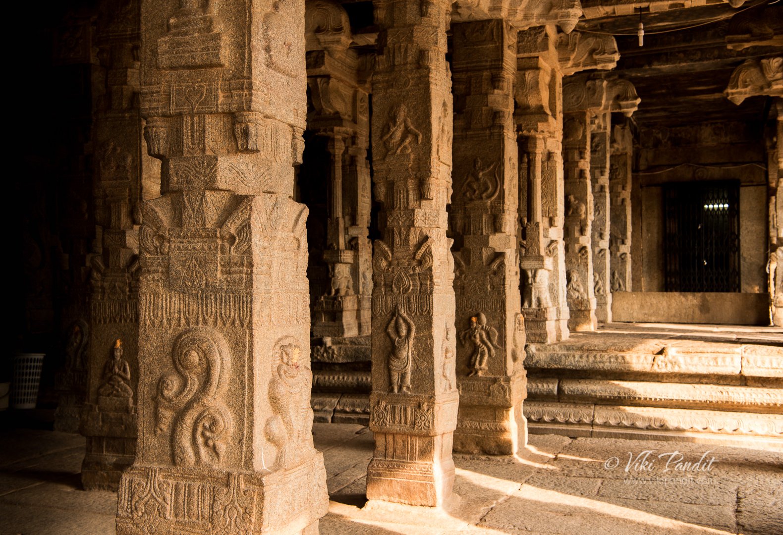
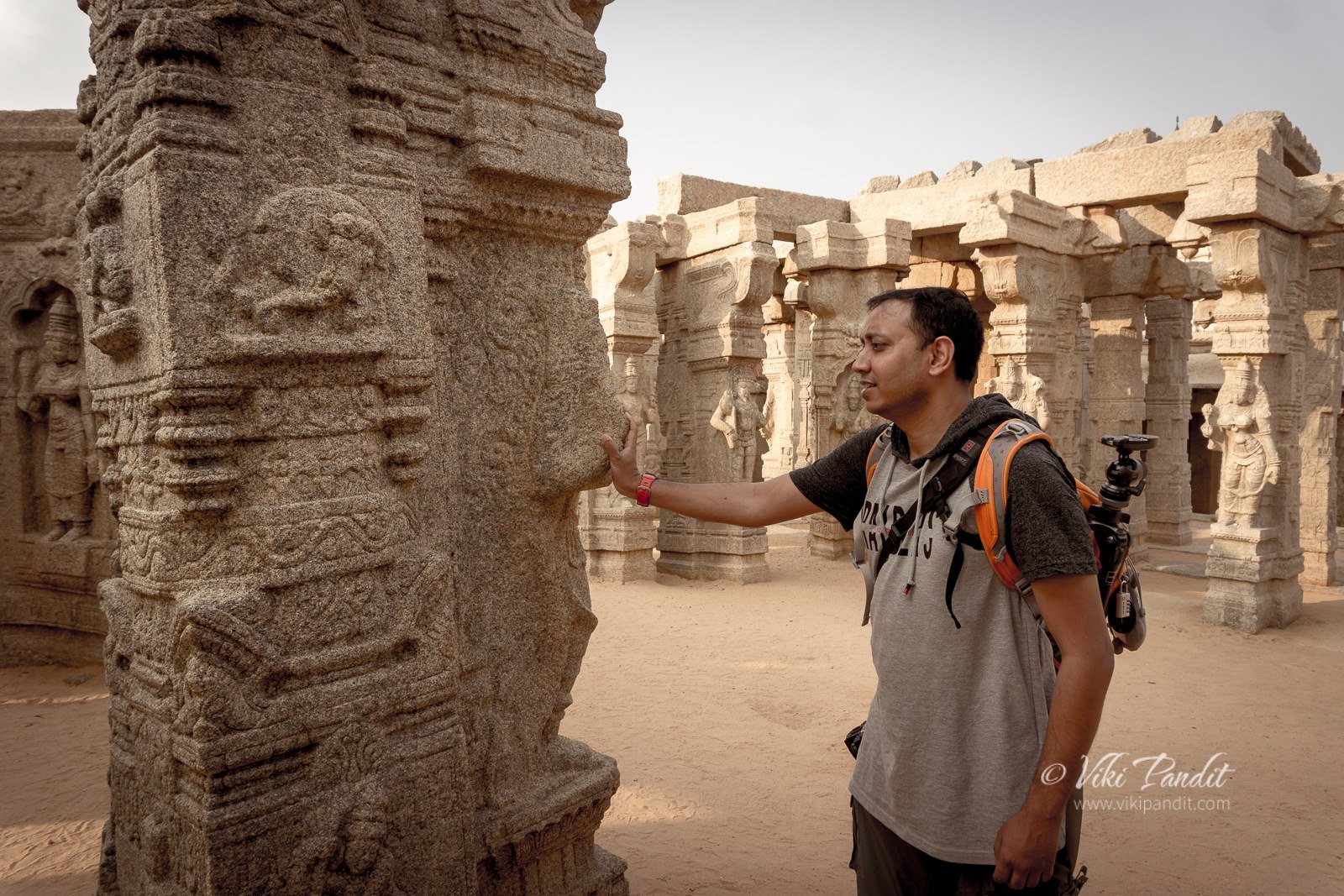
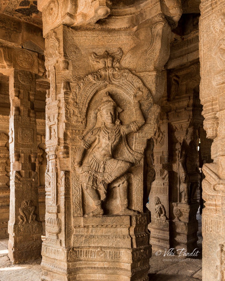
Inside the Mukha mandap, there are about 70 pillars at this fabulous 16th-century temple of stone in Vijayanagar style. The carvings on these 15-foot pillars constitute of divine beings and the avatars of Shiva. I felt the cold stone through my naked feet as I walked along with the figurines of the goddesses Ganga and Yamuna at the entrance to the sanctum.

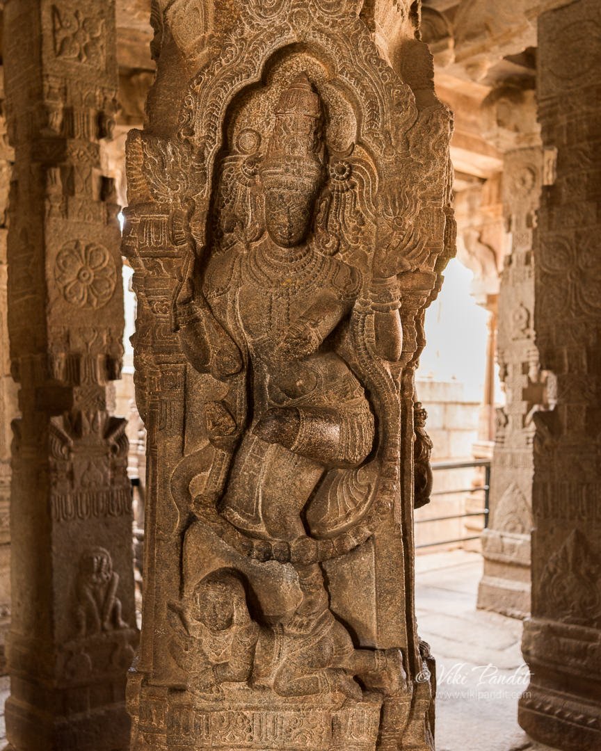
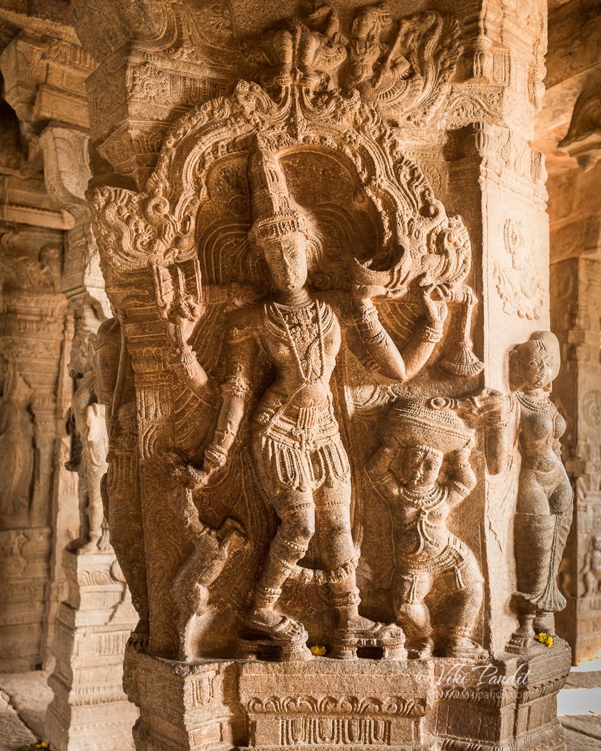
The central space is surrounded by many pillars with sculptures of divine beings. The first to catch my attention was that of the Nataraja, standing over the demon named Apasmara. Nataraja sculpture is almost the same pose as Natesha, the difference being Shiva has his left leg raised, unlike Natesha who has his right leg raised in the same pose.

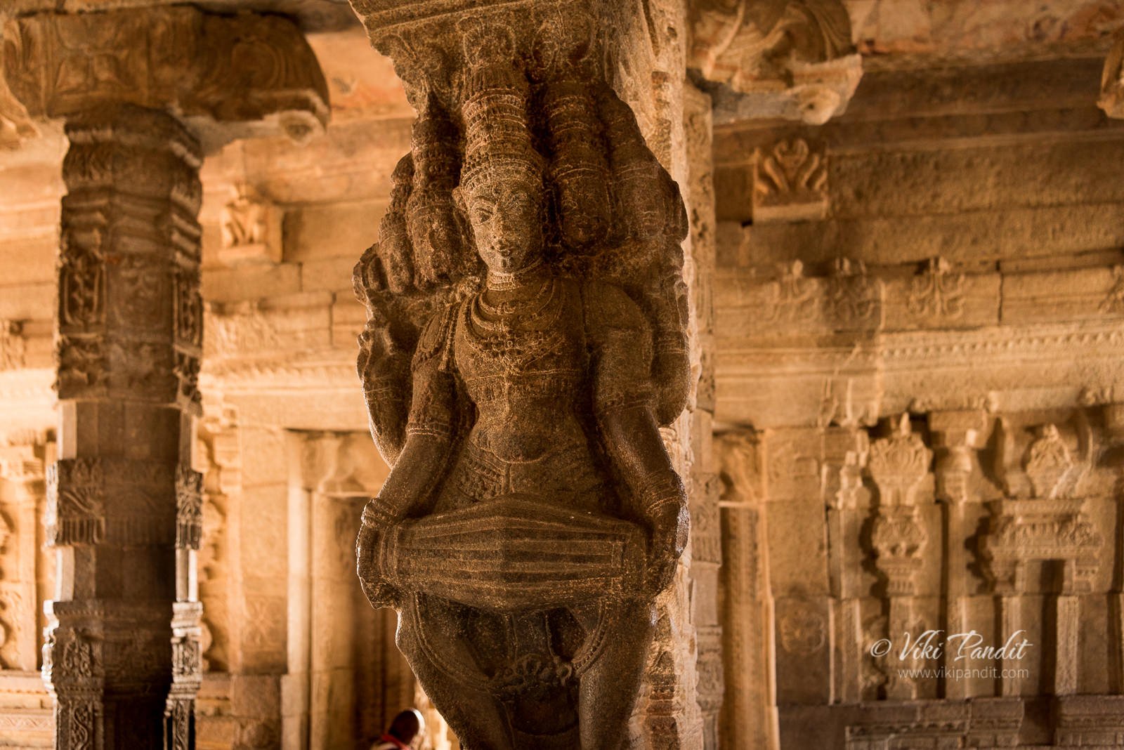
Beside him lies a sculpture of Brahma playing the Mridanga. The Mridanga is a percussion instrument from India of ancient origin also known as ‘Deva Vaadyam‘ or the instrument of the Gods.

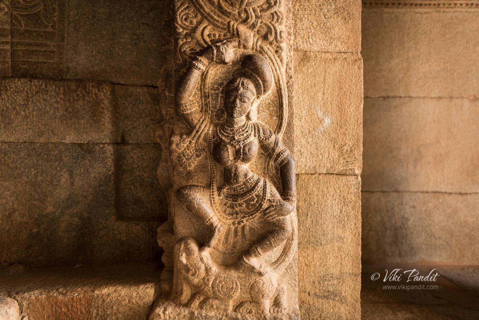
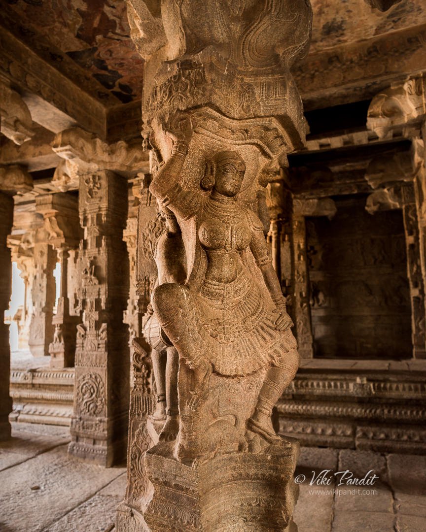
In an adjoining column, one can see the lovely Rambha, a celestial nymph, in a dancing posture created with the minutest of details. In Hindu mythology, she is the Queen of the Apsaras (nymphs), the magical and beautiful women of Devaloka, the city of the divine gods.

The column at the southwest part of the hall has an image of Parvati, Shiva’s consort, feeding her husband, who was disguised as a beggar. There are many such interesting tales in Indian mythology.

Beside her statue on another pillar one can see the three-legged Bhringi. If you notice carefully, he has 3 legs. Wondering why? read on..

Bhringi was an ancient sage who would not worship Parvati and took forms such as a snake or a bee to be with only Shiva and trying to drive a wedge between them. Annoyed by this, Parvati cursed Bhringi and he became so weak that he could not dance anymore. Shiva seeing his pain, granted him an additional, third leg and since then Brungeshwara is always seen dancing with 3 legs .

Musicians and ascetics adorn the intermediate pillars. 

The Natya (dancing) and the Ardha (worship) Mandaps are the most interesting parts of the temple in terms of architecture.

The mystery of the hanging pillars of Lepakshi

The peripheral columns called the Aakaasa Sthambha, are slightly elevated on an ornate basement, with blocks carved of horses and warriors, a tribute to the engineering genius of ancient and medieval India’s temple builders.

How such a heavy pillar stays hanging just about a centimeter above the basement is truly a mystery. it is said that during the British colonization, a British engineer had tried to uncover the secret of its support in an unsuccessful attempt. 

Ceiling paintings of Lepakshi

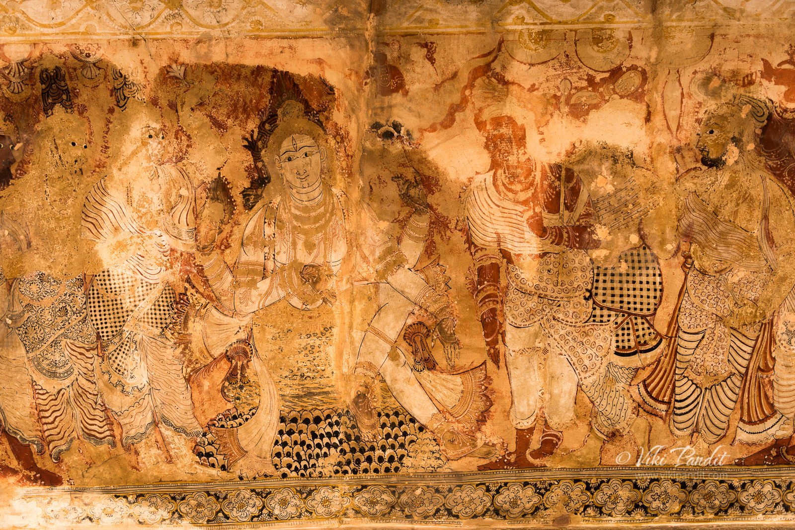
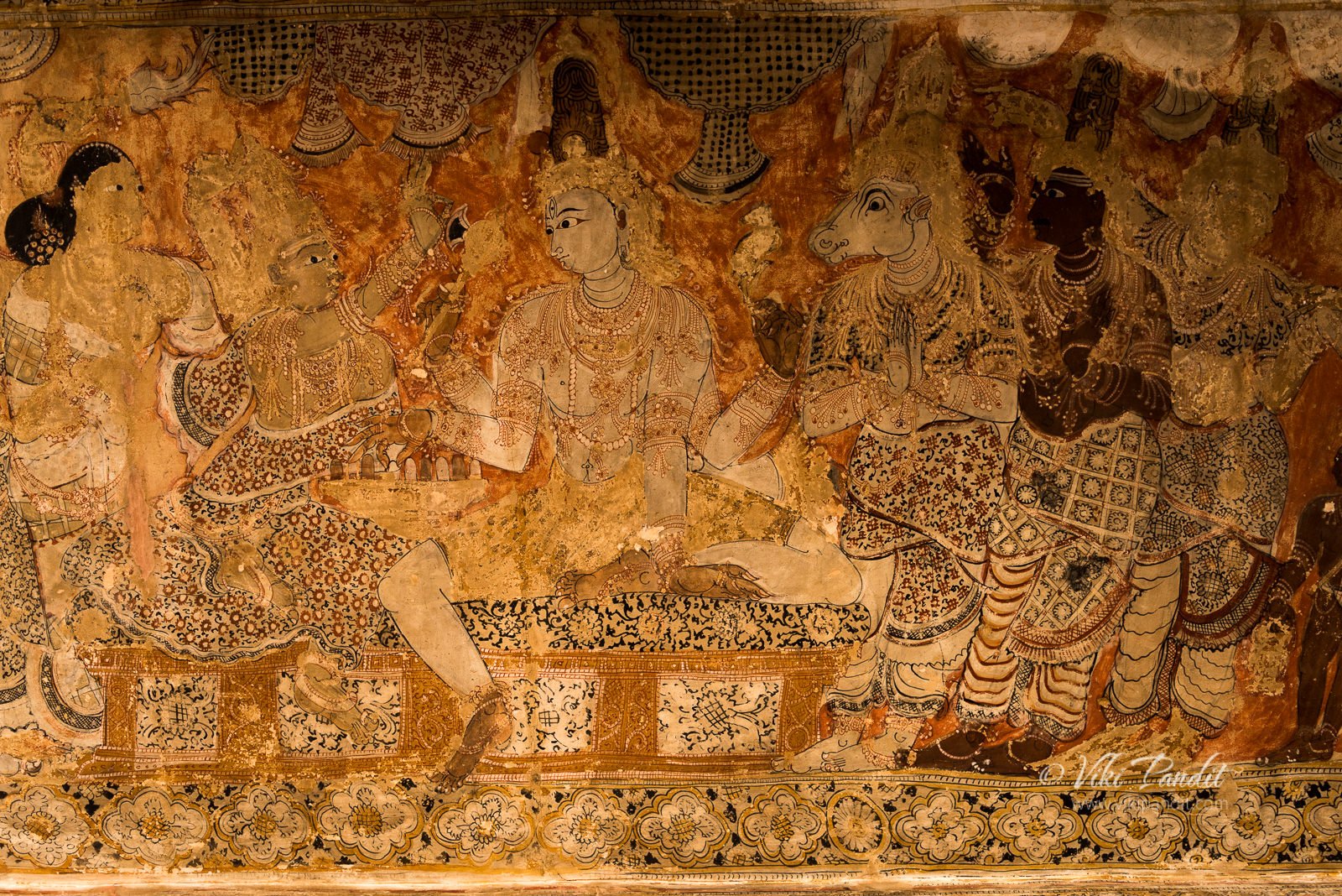
As I searched for answers to the secret of the hanging pillars, my eyes were drawn towards the ceiling. The fresco in the ceiling of ardha mandapa is said to be Asia’s largest, measuring 23 by 13 feet with the depiction of all the 14 avatars of Lord Shiva as Ardhanarishwara, Andhakasurasmahara, Bhikshatana, Chandes Anugraha Murthy, Harihara,  Kalyanasundara, Tripurantaka, Nataraja, Gouriprasadaka, Lingodhbava, and Yogadakshinamurthy. The frescoes are also beautiful and show an impressive attention to detail with colors strikingly contrasted – black limework against an orange-red background with some green, white, black, and shades of ochre-gold and brown mostly applied to a stucco surface blended with lime water. 

This is a panel of Dakshinamurti. is the name of the Hindu god, Shiva, as the supreme guru who imparts higher knowledge. The name comes from the Sanskrit, dakshina, meaning “southern” or “right”; and murti, meaning “incarnation,” “personification” or “image.” It is usually translated as “the one who faces south.”

Dakshinamurti is a form of Shiva, which is found invariability in almost all the Shaiva temples of Tamilnadu. Shiva, in this form, is depicted as the “Guru who guides his devotes in the right path (dakṣiṇāmārga)” and hence called by this name. In this form, Shiva is represented as seated on a rock in lalitāsana. His right hand is in vyākhyānamudra. Other hands hold sarpa, agni and akṣamāla. The four sages (Sanaka, Sanandana, Sanatkumara and Sanatsujata) are represented as seated on the foreground.

Apart from paintings of gods and goddesses, in the presence of the devotees arranged in rows, the frescoes also depict the various incarnations of Vishnu. The paintings are in striking compositions where particular emphasis is given on the period costumes and facial expressions depicting the grandeur of Vijayanagar pictorial art. The fresco paintings are particularly detailed in very bright dresses and colors with scenes of Rama and Krishna from the epic stories of the Ramayana, the Mahabharata, and the Puranas. However, these frescoes are peeling off in many places and in need of better maintenance and expert restoration.

The ceiling in the sanctum above the deity has paintings of the builders of the temple, Virupanna and Viranna, regally dressed and crowned with headgear. They are depicted, with their entourage, in a state of reverential prayer, being offered sacred ashes of their family deity.

Garbhagriha, Lepakshi

The temple’s main deity is Veerabhadra, the fiery god created by Shiva in his rage after the Daksha Yagna and the immolation of Parvati. The presiding deity in the sanctum sanctorum is a near life-size image of Veerabhadra, fully armed and decorated with skulls. There is a cave chamber in the sanctum where sage Agastya is said to have lived when he installed the image of the linga here. I would recommend the caretakers to install softer yellow lights to preserve the ancient feel of the place when it used to be lit up only with diyas, rather than the intrusive bright white bulbs.

There are several forms of Shiva here — a majestic Kankala Murthi, Dakshinamurthi (Guru of Gurus), Tripuranthaka or Tripurasurasamhara (vanquisher of demon Tripura); Ardhanareeshwara (the half-female, half-male form, where Shiva and Parvati are equally represented in one body), etc. Another shrine has the fiery goddess Bhadrakali, though bearing an uncharacteristically serene expression. Photography is not allowed inside the garbhagriha.

Kalyana Mandap, Lepakshi

After paying our respects we came back out into the Mukha mandap and headed left towards the marriage hall. We slowly walked out of the shadows of the temple porch into the now blazing sun.

But as I got up the stairs, I was saddened to see the structure in an unfinished state. There are 38 pillars in this Mandap. The peripheral columns looked completed, but the columns towards the center of the altar were standing bent with no ceiling. Parts of the ceiling joints lay at the base of the column. 

The theme of these carvings is the marriage of Parvati and Shiva. Inside the mandap the pillars are arranged in the form of a circle, with the Gods and Goddess who attended the wedding also carved on the pillars.

Parts of this temple complex and some structures within never got completed. Why? That is another story in itself…

The beautifully crafted pillars of the unfinished wedding hall still lie out in the open air with no ceiling. Virupanna, it is said, had grand plans for the temple. In his blinded pursuit, he emptied the treasury for funding the monumental project. For this financial embezzlement, the architect met with a gory fate, with his eyes were gouged out, as was the customary punishment for cheating in those days. With his conviction, the construction was stopped indefinitely and the structures have been standing in a semi-broken state as we see it today.

Even though many of the pillars of the Kalyan Mandap are unfinished, it will still amaze you with the fine craftsmanship of the sculptors. In fact in the radiant sun, this section of the temple impressed me even more than the main mandap. I rested for a minute on one of the fallen pillars for the day was warm.

Ganesha, Lepakshi

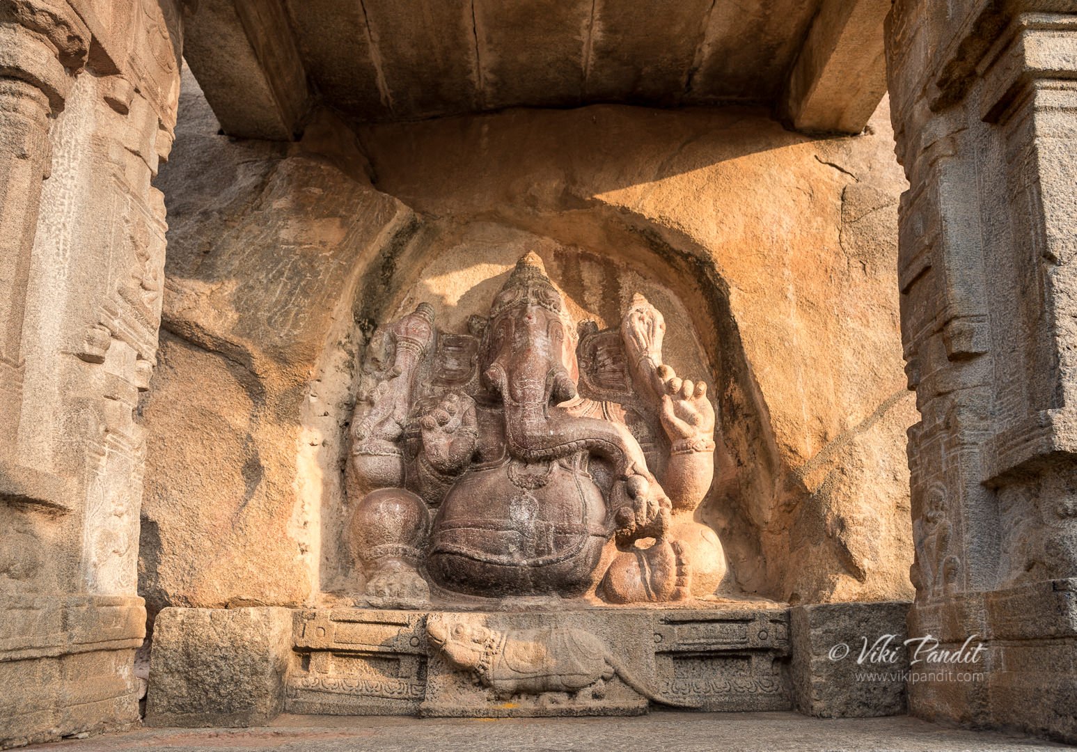
From the marriage hall, we took a left towards a mammoth Ganesha – hewn in stone and leaning against a rock. This giant monolithic Ganesha carved in to the side of the boulder is also one of the attractions of Veerabhadra temple. Veerabhadraswamy inside the Garbhagriha is ugraroopi meaning he is in an angry state. It is considered that the teekshna drishti (angry eyes) of Veerabhadraswamy is too powerful for mere mortals and one should pray to Ganesha before entering the sanctum.

On the back side of the Ganesha idol, one can find stains of blood which leads us to the story of Bhaktha Kannappa Nayanar and how he sacrificed his eyes to Lord Shiva.

Kannappa Nayanar was born in a vyadha (hunter) family. Being a hunter, he did not know how to properly worship Lord Shiva. It is said that he poured water from his mouth on the Shiva lingam which he brought from the nearby river Swarnamukhi. He also offered Lord Shiva whatever animal he hunted. But Lord Shiva accepted his offerings since Thinna was pure at heart and his devotion was true.

Thinna noticed that one of the eyes of the Shiva linga was oozing blood and tears. Sensing that Lord Shiva’s eye had been injured, Thinna proceeded to pluck his one eye out with one of his arrows and placed it in the spot of the bleeding eye of the Shiva linga. This stopped the bleeding in that eye of the linga. But to complicate matters further, he noticed that the other eye of the linga has also started oozing blood. So Thinna thought that if he were to pluck his other eye too, he would become blind to exactly know the spot where he has to place his own second eye over the bleeding second eye of the lingam. So he placed his great toe on the linga to mark the spot of the bleeding second eye and proceeded to pluck out his other and only eye. Moved by his extreme devotion, Lord Shiva appeared before Thinna, stopped him from plucking his only eye and restored both his eyes.

Nagalinga, Lepakshi

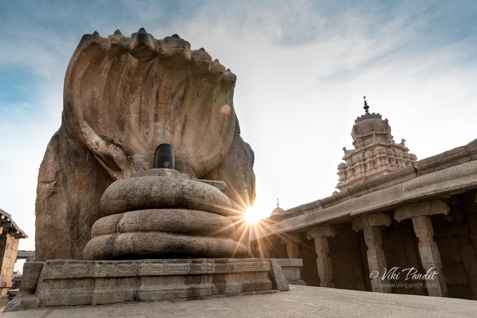
Beside the Ganesha, is a massive Naga (serpent) with three coils and seven hoods. The monolithic Nagalinga, approximately 12 feet in height, forms a sheltering canopy over a black Shivalingam. It’s reckoned by many as the largest Nagalinga in India.

The nagalinga has a small crack and there is a story behind it too. in one hour, while their mother cooked lunch and she said it will take time, by that time before their mother finishes breakfast preparation they will be completing the Shiva Linga with seven heads snake. When their mother finished cooking she saw this amazing sculpture, praised her sons/sculptors, and soon a crack appeared at the base caused by her “evil eye”. With that a small crack happened.

You never find Lord Shiva Linga without Nandi. If you recall the Nandi we saw before entering the temple. That nandi used to sit directly staring at this linga. Unfortunately they have been separated by the boundary walls of the temple.

Legends and Myths of Lepakshi

One of the legends gives the town a significant place in the Ramayana. It is said that this was where the mythological bird Jatayu fell, wounded after a futile battle against Ravana who was carrying away Sita. When Rama reached the spot, he saw the bird and said compassionately, “Le Pakshi” which in Telegu translates to – “rise, bird”.

The Sthala Mahatyam and local legends mention that sage Agastya stayed here, in a cave on the Kurmasailam hill, during his visit to scared places in the south of the Vindhya mountain.

Hanuman temple at Lepakshi

Giant Footprint at Lepakshi

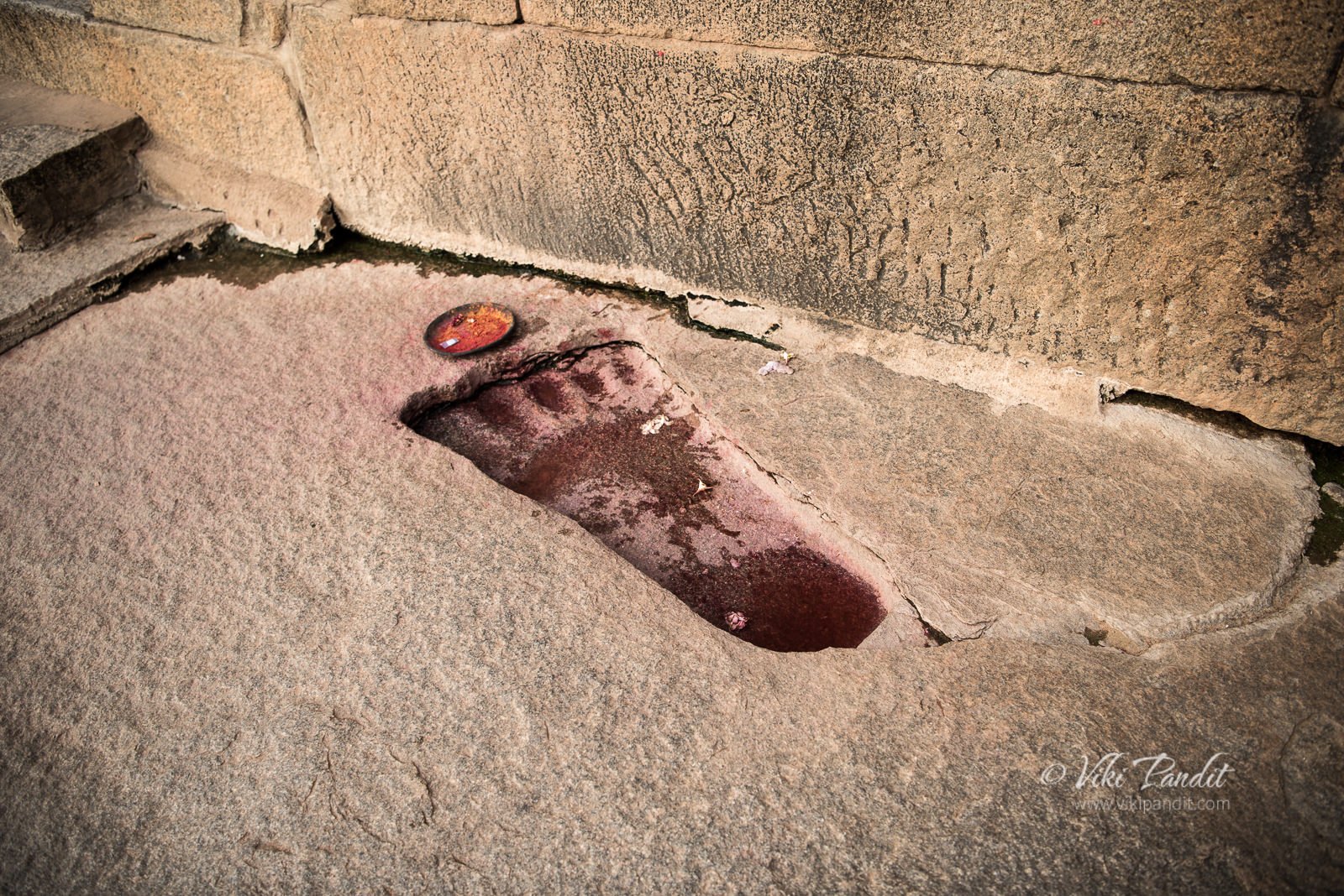
In front of the Hanuman Temple lies a large footprint craved in the rock, whose big toes are always filled with water. I was told that this is Sita’s footprint and the devotees around cupped some water with their hands, drinking it, and then sprinkling a little over their heads. Others believe that it is of Hanuman whence he landed here on his right foot. The force was so great that his footprint was left pressed into the solid stone. The next left footprint can be found at Penukonda fort, some 35 km away.

On the way back, we stopped for a few minutes at the Nandi sculpture, which is the 2nd largest monolith in India after the statue of Gomateshwara Bahubali in Shravanbelagola. The crowd had grown in numbers, in the lovely evening weather. The grandeur of Nandi certainly makes it a popular photo-op with visitors. I had to wait for about 20 minutes as a stream of selfie-takers kept photo-bombing my composition. In India, I have learned to be patient 🙂

Even though some structures within the temple complex lie incomplete, Lepakshi will surely amaze you. As you enter inside the Veerabhadra Swamy temple, you will be mesmerized by the intricately carved pillars in the main “mukha mandap“. The Lepakshi temple also has the finest specimens of mural paintings of the Vijayanagar Era. Being just a couple of hours ride away from Bangalore, I would highly recommend you to go and witness this amazing creation from the yesteryear.

Thanks for reading. Please leave me a comment if you liked the post or follow my story as I visit the intriguing tombs of Chattardi.

When was the Veerabhadra Temple in Lepakshi built?

The Veerabhadra Temple in Lepakshi was built towards the middle of the 16th century.

What is the architectural style of the Lepakshi Temple?

Dravidian architecture.

Is there a dress code to visit the Veerabhadra Temple in Lepakshi?

There is no dress code as yet for men or women for entering the temple, but it is always appreceiable to go dressed decently to respect the feelings of the local surroundings.

Is parking available near the Veerabhadra Temple in Lepakshi?

Yes, parking is available for a nominal charge of Rs. 40 for the entire day. The fees are subject to change.

Terracotta Temples of Bishnupur

Winter has been quite foggy this year. We had been planning a trip to the Terracotta temples of Bishnupur for some time but the dense haze had been putting us off. This weekend it finally relented somewhat and we grabbed the opportunity.

We started at a bit late at 9 am. The early morning fog had dissipated by then. From Kolkata, we drove up the Grand Trunk Road up to Burdwan. All along the Grand Trunk Road one can see endless potato fields. There are two toll booths on the way, each charging Rs. 75 for a car. At Purta Bhawan crossing in Burdwan, we turned left, taking the Ahilyabai Holkar Road road, straight to Bishnupur. We had made quick headway along the Durgapur Expressway where the roads are great. But as you turn into the road to Bishnupur, the roads are not that good. On this stretch of road towards Bishnupur, the potato fields gave way to fields of yellow flowers of mustard. It is also surprising to see the contrast, in terms of development along these small towns/villages. It is disheartening to see the stark disparity in development between the urban concrete jungle of Kolkata and these mud-house villages just outside of the city.

From the expressway, It took us about another hour of driving alongside beautiful mustard fields till we finally reached Bishnupur at around 1 pm.

Bishnupur is a small town not more than 400 sq km. For almost a thousand years it was the capital of the Malla kings of Mallabhum, till their power waned with the advent of British rule in India.

The Malla Dynasty

The history of Bishnupur can be traced back to 694 AD, when Adi Malla founded the Malla dynasty. However, it was much later in 994 AD that the place was named Bishnupur, derived from the name of the name of the Hindu God ‘Vishnu’.

There is an interesting story behind how Adi Malla ascended the throne. His father was a Rajput prince who was on a pilgrimage to the shrine of Jagannath in Puri. In his pursuit, he took along with him his pregnant wife. While they were crossing the great forest at Laugram, near Bishnupur, the princess went into labor. She died during childbirth. The remorseful king surrendered his infant child to the local villagers and left. The newborn was raised by a woman of the Bagdi caste who used to reside near the forest.

The boy grew up among the low-caste tribals, working as a shepherd. Many stories can be heard floating around the town, how once, this boy fished out a golden insignia from the river or when a huge cobra was seen standing over him shielding him from the sun when he fell asleep in the forest herding cows. A Brahman priest noted that the royal child was different from the rest of the Bagdi boys and took him under his care. The child grew up in the Brahmin’s house. In his care, the boy was imparted with good education along with physical and warfare training. By the time he was 15 years old, he not only excelled in education but also turned out to be an outstanding wrestler. People started calling him Adi Malla (Malla meaning wrestling), because of his wrestling prowess. 

When the then Raja of Bishnupur died, he left no heir to the throne. The Brahman was invited to the funeral feast (Sraddha). and he took the boy with him. During the Sraddha, to everyone’s amazement, the dead king’s elephant lifted the boy from the rows of spectators and placed him gently on the throne.

Soon on the request of the local elders he ascended the throne of the local kingdom, which was renamed as the Malla Kingdom.

The Malla Kingdom flourished and after about 300 years the 10th Malla King, Jagat Malla decided to shift his kingdom to Bishnupur. Over the next 800 years Jagat Malla and his descendants built several temples and structures turning Bishnupur into a temple town.

Of all the Malla kings, the credit primarily goes to the patronage of Raja Veer Hambir and his successors Raja Raghunath Singha Dev and Bir Singha Dev who made Bishnupur one of the principal centers of culture in Bengal. Most of the exquisite terracotta temples for which town is justly famous were built during this period in the 17th century.

Temples of Bishnupur

Bishnupur contains an interesting mix of terracotta and stone temples. The temples of Bishnupur are located in a small compact area and it is best to explore them by a combination of walking and self-driven cars. Toto rides are also available and they can guide you through all the temples.

Madanmohan Temple, Bishnupur

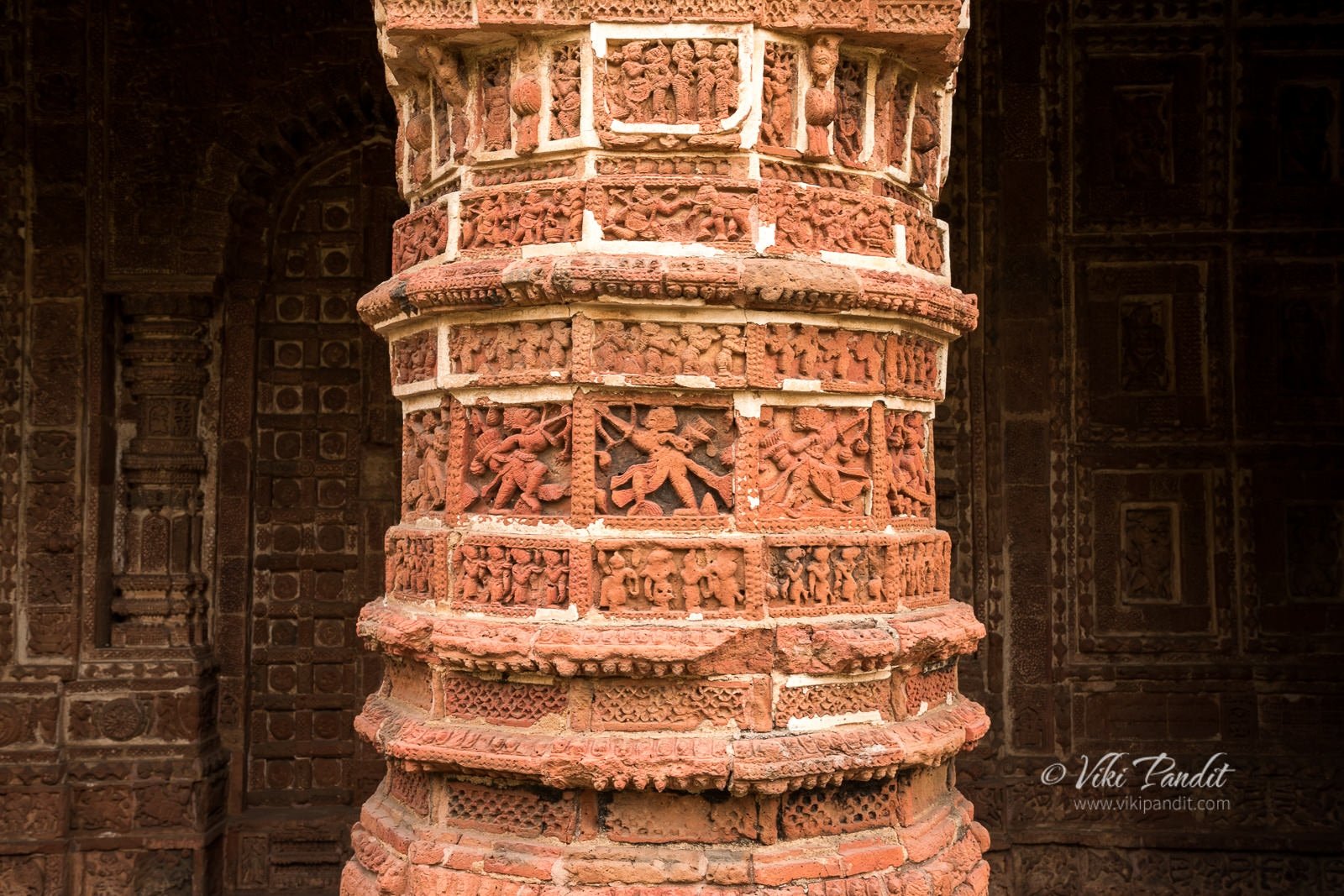
The Madanmohan temple was the first architecture we encountered. This single pinnacled temple has some of the finest terracotta in the whole of Bishnupur.  Built in 1694 CE by Malla King, Durjana Singh Dev. The star attraction of Madanmohan is its intricate terracotta artwork along all the four walls of the temple, that are still intact.

The temple stands on slabs of rusty-red colored laterite stones, found in abundance in this region.  It is dedicated to Lord Madanmohan (an incarnation of Vishnu) and is still an active temple. Entrance is free to this temple. Scenes from the Mahabharata, Ramayana, and the Puranas are depicted on the temple walls on terracotta panels.
We paid our respects to the deity at the temple and headed towards the Ras Mancha.

Ras Mancha, Bishnupur

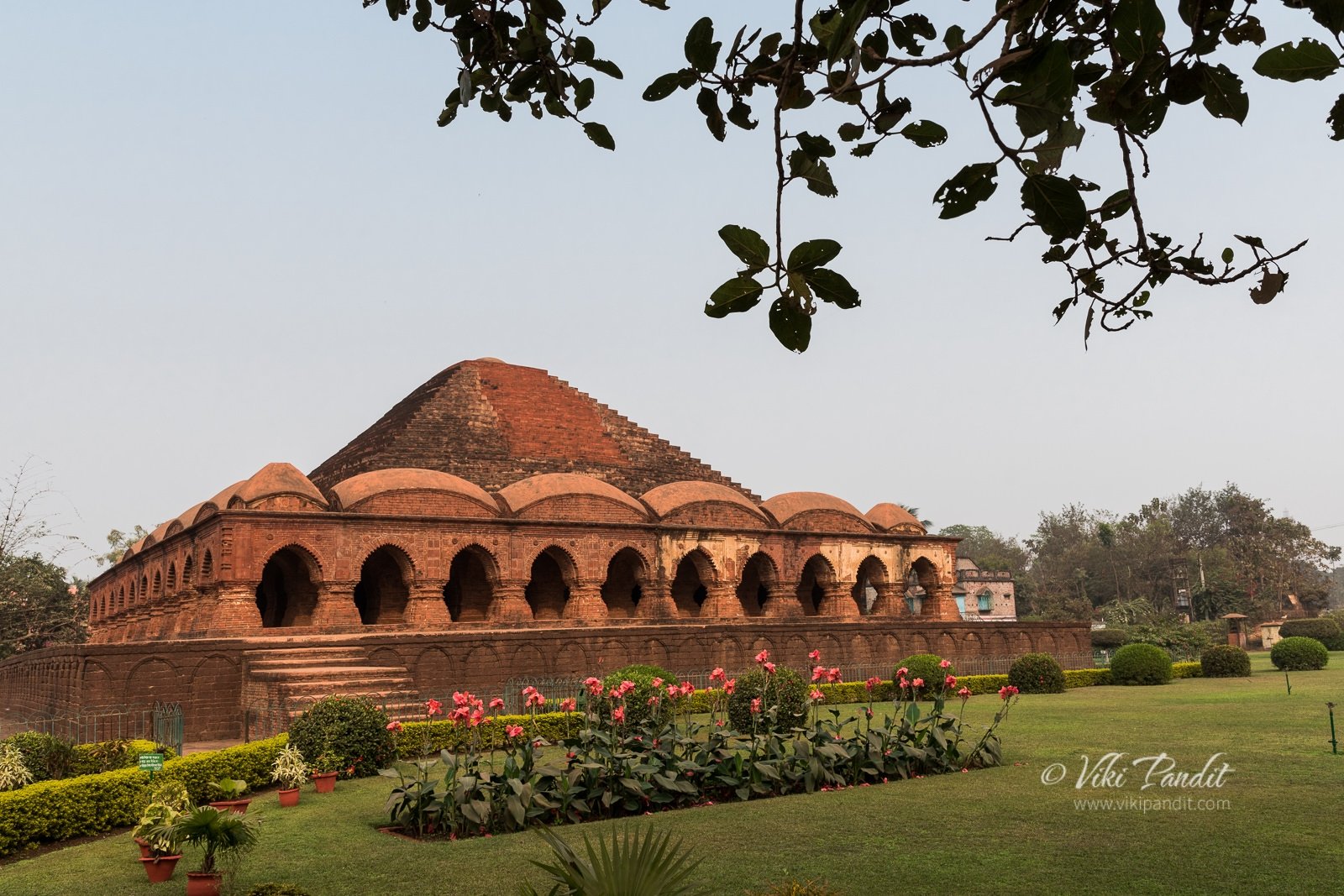
The Ras Mancha is about 5 minute drive away. Built in 1600 CE by the Malla King Hambir, the Ras Mancha is the oldest standing brick structure of Bishnupur. Consisting of arched entrances separated by pillars the Ras Mancha stands on a raised, red colored, laterite stone platform and is crowned with a stepped pyramidal structure. The structure is absolutely unique in style and architecture, not only in Bengal, but in India. The pyramidal summit is constructed of baked bricks while the podium is created out of  laterite rocks, cut into brick-like shapes. The square base is about a meter high and the structure itself rises to about a height of 10 meters. The platform composed of laterite rocks show little weathering. However, the walls  and the supporting columns are gradually decomposing because of the chemical change due to surrounding pollution.

The Archaeological Survey of India (ASI) maintains most of the sites of Bishnupur and it levies a minimum entry fee for the sites. The amount is Rs 10 for Indian citizens and Rs 100 for foreigners. With this ticket, one can visit all the sites of Bishnupur maintained by ASI. The counter is located near the entrance of Rash Mancha.

The Ras Mancha was designed to be a gallery used to display art during the Malla regime. The main motive behind the making of this enormous construction was the festivity of the ‘Ras Festival’, when portraits of deities from the neighboring shrines or temple were created and then arranged for display here in the open doorways for common public. This ceremony was put into exercise during the Malla Rule and now the hallowed corridors stand without a purpose. In my travels, I am yet to see a structure that can be suggested to be of a similar nature in architecture or purpose as to the Ras Mancha. I can safely say, it is architecturally unique and one of its kind in the whole of India. Apart from a few floral lotus motif the Ras Mancha does not contain any terracotta art work. Walking the empty corridors are sure to give you a unique experience of walking in the past.

From Ras Mancha, we headed towards the Shyamrahi Temple.

Shyamrai Temple (Pachchura Temple), Bishnupur

We stopped at a narrow dusty path that lead up to the Shyamrai Temple. As we got down, on the right we could see a placid square tower like structure called Ghumghar of maybe two storeys, with no windows, located atop a small mound. Nothing much is known about the construction date and the purpose for which it was built. It is hard to ascertain the usage of such a building. It is likely it was used for storage or maybe solitary confinement of a small number of prisoners.

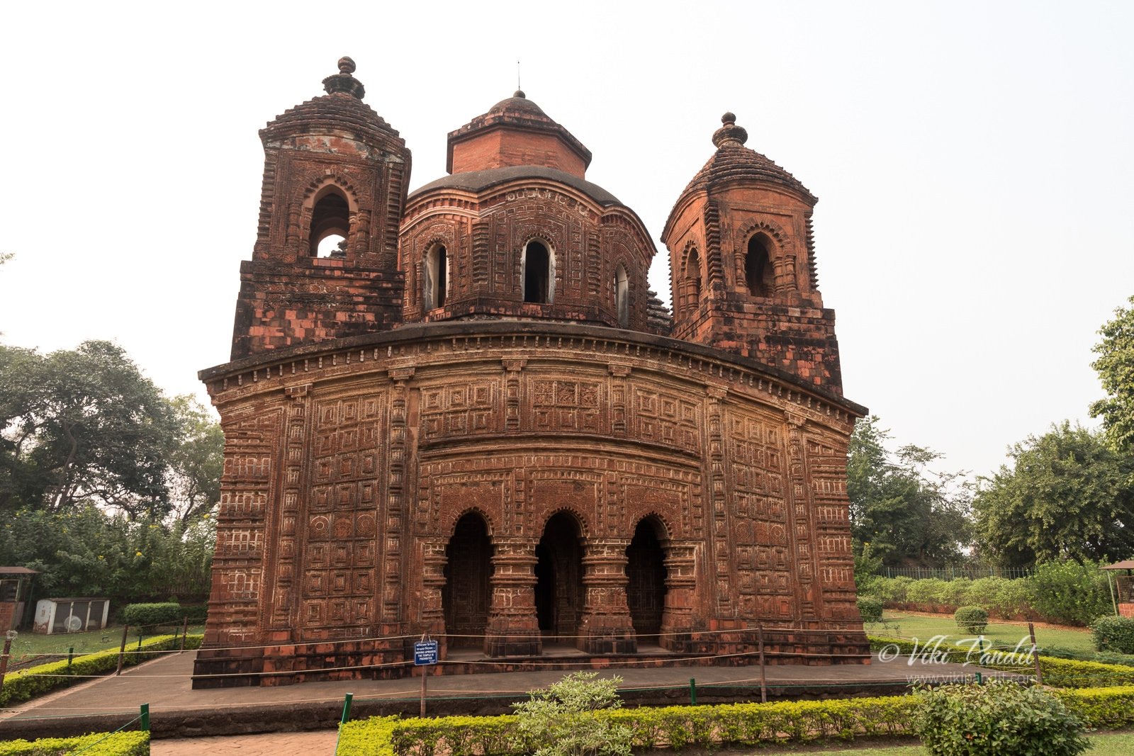
We left the car there and walked left towards the Shyamrai Temple, popularly known as the Pachchura temple, because of its five pinnacles. King Raghunath Singh, commenced building the five towered Temple of Shyam Rai in 1643 with its superior figurines and floral patterns. Under his reign, terracotta gained further momentum.

The Shyamrai Temple contains terracotta on all its four sides including the inner walls and the pinnacles. Each of the four sides contains triple-arched entrance adorned with the Ras Chakra and love-making scenes of Radha-Krishna. Entering the complex is forbidden.

From Shyamrai Temple we got back into the car and headed for Jore Bangla. The area is very dusty and if you have dust allergies do come prepared. We kept our car windows up for most of the time in the terracotta town.

Kestorai Temple (Jore Bangla) , Bishnupur

A short distance away from the Shyamrai Temple is the Kestorai temple. The most powerful king of the dynasty was King Raghunath Singh Dev II, who ruled from 1626 AD. At that time the administration of Bengal was in the hands of Shah Jahan’s son Suja. He developed a close friendship with the Mughal king and there followed a period of peace when art and music flourished. It was during this period that the Kestorai Temple was erected.

It follows the jora bangla style of architecture and hence is popularly known as the Jore Bangla Temple. Jora Bangla type of temple consisted of two Bengal styled thatched roof like structure joined together. Unfortunately some repairs were going on and we couldn’t enter the complex.

The Jore Bangla temple built in 1655 CE is considered as one of the finest example of Bengal terracotta art. There are numerous panels covering a wide range of topics. Panels of ships and boats are quiet in the temple. There are also several panels from the two great epics but a panel depicting Bhishma in Sarasajya (bed of arrows) during the fight of Kurukshetra.

Just beside the Jore Bangla, a few minutes walk away is the Radhashyam Temple.

Radheshyam Temple

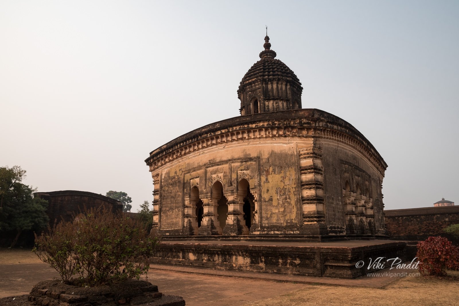
This Ek ratna (Single Pinnacled) temple is built over laterite stone. Radheshyam temple dating back to 1758 CE was constructed by the Malla King Chaitanya Singha. This temple is one of the “youngest” among the temples that were constructed during the heyday of Malla kingdom. 

The temple is enclosed with high walls and is entrance consists of a triple domed Islamic style gateway. The spire is cylindrical, with semi-spherical dome inspired from the then prevailing Muslim architecture. Because of the closeness of the Mughals with the Malla Kings we can see the convergence of two different styles of architecture in this temple. The crumbling stucco is most elaborate and aesthetically pleasing among the laterite temples in Bishnupur. 

Beside the Radheshyam Temple, one can find the Radha Laljiu Temple complex, somewhat in ruins.

Radha Madhab Temple

Built 100 years earlier than the Radheshyam Temple, the Radha Laljiu or the Radha Madhab temple follows a similar single pinnacled structure. Built by the Malla King Bir Singha in 1658 it is considered as the finest laterite stone temple in Bishnupur. Unfortunately it is badly maintained and the limestone coat has suffered erosion over the years. 

Form the Radha Laljiu Temple, one can see the stone gateway known as the Pathar Darwaja in a distance.

Patthar Darwaja

At a short distance from the Radha Laljiu Temple lie two gateways – the Bara Patthar Darwaja or Main Gateway of Bishnupur and the Garh Darwaja. The larger of the two gateways, built of laterite stone is known as the Patthar Darwaja (Stone Door). This gate once served as the northern entrance of the Royal residence and was built in the second half of the 17th century by Maharaja Bir Singha.

The double storied gate could accommodate troops and the narrow slits allowed the archers and the gunmen to fire their shots. 

Garh Darwaja

A few yards away from the Patthar Darwaja is a small stone gateway, which was also built in the same period. Although much smaller in magnitude, the Garh Darwaja is an arched terracotta structure with a plain exterior. Both the gateways are not protected by the ASI and is thus not well maintained. Cars, bikes use this historic monuments on a daily basis enveloping them in smoke and dust.

There are many more similar temples around the town but it was already 4 pm and we decided to head back. This time we took the shorter route crossing Arambagh. The traffic along this route is a lot slower and even though it’s a lot less kilometers, it took us the same amount of time to reach the city.

The most famous art form of Bishnupur is terracotta work. But the town has much more to offer. One can collect exquisite terracotta pottery, artifacts and even jewelery from local souvenir shops. The town is also famous for its Baluchari Saris. The silk strands are dyed separately and then put into a loom. One sari may have an entire episode from the Mahabharata woven into its border and Pallu.

It was really a treat making our way across this sea of terracotta architectures. It is a mystery why the terracotta architecture stayed bound to this area of Bishnupur only. These architectures deserve UNESCO status. The Archaeological Survey of India is doing a great job but it needs to do better at conserving our history many of which have already been turned to dust by the Mughals.

Photowalk to Ukimido Pavilion

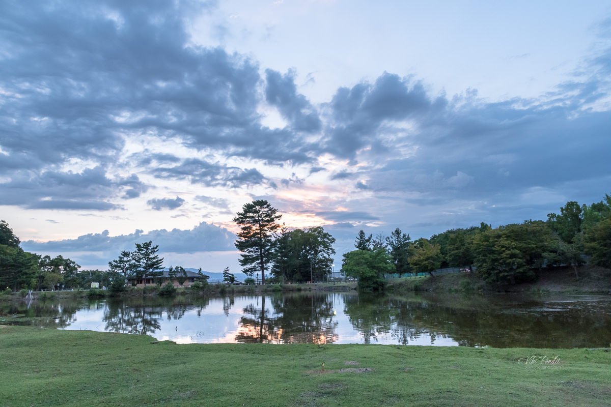
Ukimido is a hexagonal gazebo over the Sagiike Pond in Nara Park. The park is generally crowded with tourists all through the day, but they usually stay away from this area. The airy structure in the middle of the pond, surrounded by herds of deer, is one place where I can find peace at any time of the day.

I have been to Ukimido in Nara several times before but never during the evenings. A few days before I came across a flier at the Nara Tourist Information Center that had a cover photo of the pavilion at night. It looked so immersive that I couldn’t miss photographing this lovely gazebo.

So, at around 5 pm I walked down to the park. I had with me some acorns that I had gathered at Nagoya Castle grounds. The deer love munching on these acorns.

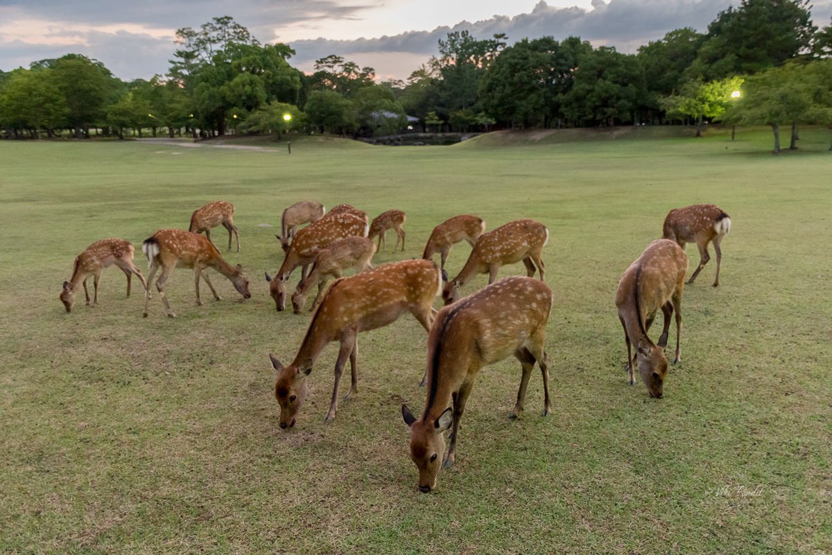
On my way, I went past the meadows beside Todai-ji temple where the deer were busy munching on the green grass. I was a bit surprised to see so many gathered at a single place. A couple came running towards me hoping to get some tidbits. I fed them the acorns I had stuffed in my cargo pockets. The sun was on its way down, so I hurried towards the floating pavilion.

Ukimido, Nara Park

It was almost sun down by the time I reached the pavilion. Some elderly ladies were sitting inside the dimly lit structure. The sunset was playing its magic creating a blend of purple and orange sky.

I stayed around till the ladies moved away after having their fill of the enchanting surroundings. During the summer evenings the floating pavilion is illuminated and it feels very relaxing sitting in the center of the pond amid dimly lit lanterns. I took a few shots of Ukimido Pavilion until the sun had fully set.

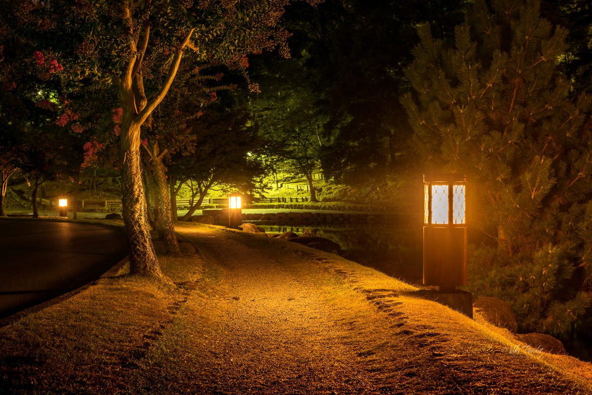
Once I was done taking pictures, I went back the along same path towards home. With the fall due in a month, some of the trees had started to turn red already. The lanterns along the Sagiike pond lit up the trees casting a reddish glow over them.

Nara Park is lovely in the day, but its mesmerizing at night. If you are in Nara, try to visit the place at night. Kofukuji and Todai-ji grounds remain open all night. The five-story pagoda at Kofukuji looks like a painting with the moon rising behind. The Todai-ji temple closes at around 5-5:30 pm depending on the season but you can still enjoy the beautifully lit park surrounding the temple. On certain days Todai-ji does remain open during nights. I was lucky to visit Todai-ji on New Years Eve, one of the rare times when the temple is opened to the public at night.

Thanks for reading! In a couple of days, I go back to India but in these few months, I have been so captivated by the rich culture and traditions of Nara, that I am certain that I will be back soon to complete my understanding of this western island of Japan. I would love to know about your experiences. Please post your thoughts using the form below or connect with me on Instagram.

The thrilling Tojinbo Cliffs

This day is special to me, today I can safely proclaim to be the second Indian to visit all 47 prefectures of Japan. The first Indian to explore all 47 prefectures is obviously my wife Mani san. I had been wanting to visit the cliffs since the day I witnessed the thrilling cliffs of Sandanbeki in Wakayama. My JR Pass was going to expire soon, so I made up my mind to drop in at Tojinbo today.

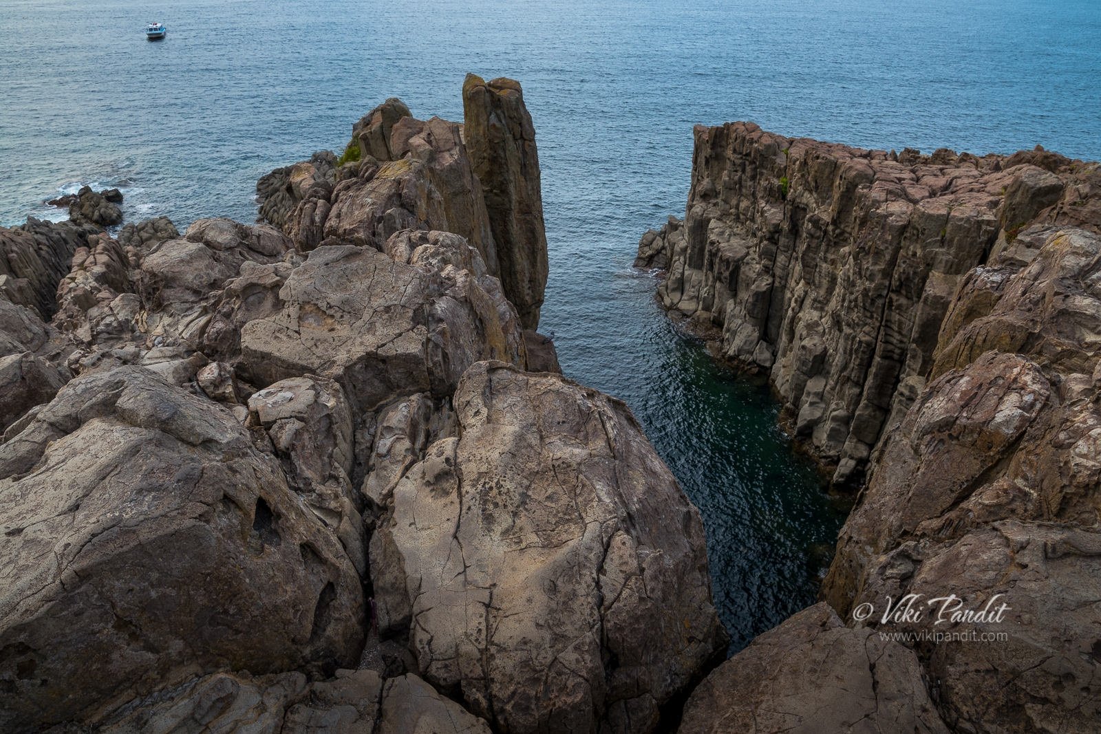
Tojinbo is a series of basaltic cliffs located within the Echizen-Kaga Quasi-National Park in Sakai, northern Fukui, bordering Ishikawa. Pronounced Toujinbou, the rugged, precipitous cliffs stretch for over a kilometer, and is designated as a precious natural monument.

I was a bit tired traveling more than 2000 km in the last couple of days. From Nara, it was a leisurely 40 minute ride to Kyoto. The trees on the hills along the route had started turning red with the advent of fall.

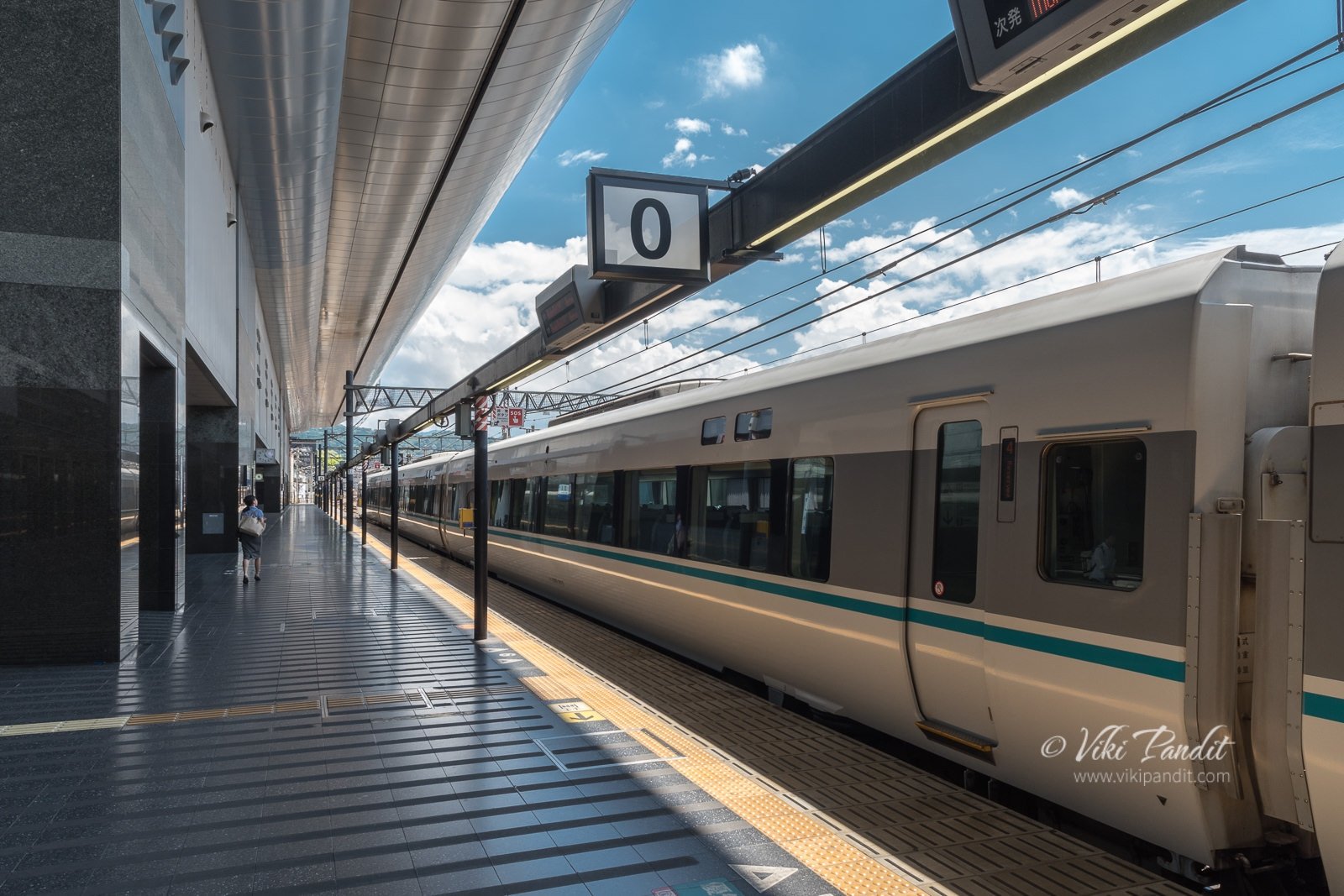
At Kyoto, I took the Thunderbird Limited Express to Fukui. Even though the Thunderbird is not a Shinkansen, the interiors are nothing less than one.

The train ride to Fukui goes along a hilly region and for most part of the journey we were traveling inside tunnels. It had started to rain strongly and I was keeping my fingers crossed hoping for a better weather at Fukui.

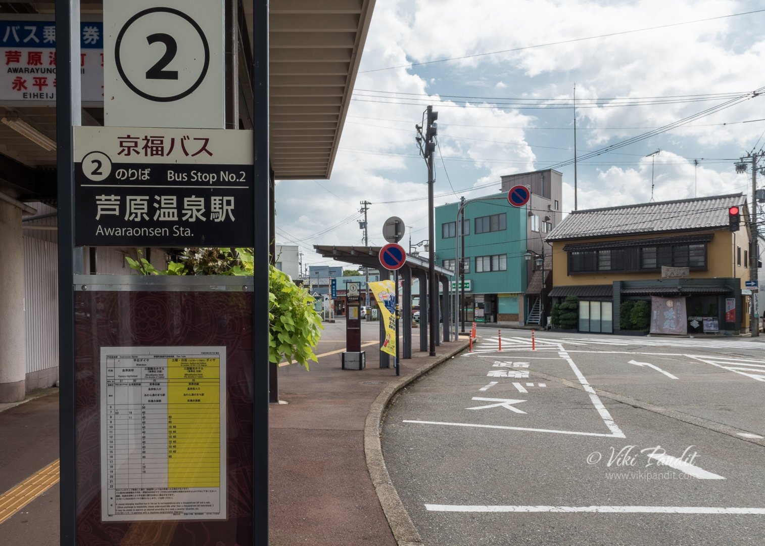
I reached Fukui at 1 pm. The weather here was much better. The tourist information booth had been shifted to a new place because of renovations. It took me a bit of time searching for the relocated office. Once I was there, the lady at the counter told me to catch the train to Awaraonsen Station and take a bus from there. There is another way using the Echizentetsudo-Mikuni-Awara Line to Mikuniminato Station, but it’s not a JR line. Both routes cost similar and take up almost similar time but I chose to go to Awaraonsen as it was a more preferred route.

At Awaraonsen, just outside the station is a bus ticket counter where one can purchase a round trip ticket to Tojinbo. One can save a few Yen by buying the round trip ticket that costs ‎¥1000. One way ticket to Tōjinbō costs ‎¥750 each way.

The bus for Tojinbo leaves every hour so I had to kill some time at the station. I wandered around the place but its a small town with nothing interesting around the station. There is a Seven-Eleven store inside the station premises, and that’s it.

The bus arrived at 2.40 pm. The cliffs are popular with foreigners and the bus stops are announced in English as well as Japanese.

It was about 3.30 pm by the time I reached the Tojinbo bus stop. The cliffs are at a 5 minute walk from the bus stop.

It was a breezy evening as I walked along the cobblestone path towards the cliffs. The path is lined on both sides by many omiyage (souvenir) shops and restaurants. The restaurants serve some delicious baked seafood in the restaurants. One can also enjoy the Squid Ink Ice cream, a specialty found only in the Tojinbo area.

At the end of the path, the view opens up to the wide Japan Sea. Some wooden benches are set up here so the less adventurous guests can enjoy the breathtaking scenery right from here.

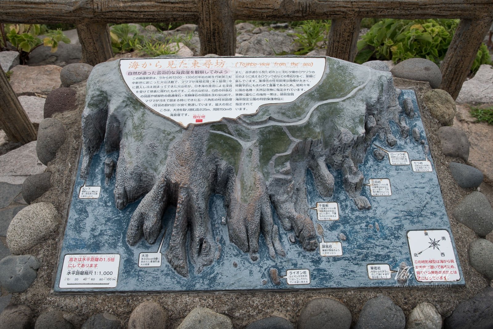
My first thoughts were that it was somewhat smaller than the Sandanbeki Cliffs but more widespread. I climbed down towards one of the protruding cliffs. The rocks in Tojinbo are named from their shapes such as Sandan Rocks (three-layer rocks), Rosoku Rocks (candle rocks), Byobu Rocks (wind wall rocks), and Oike (big lake).

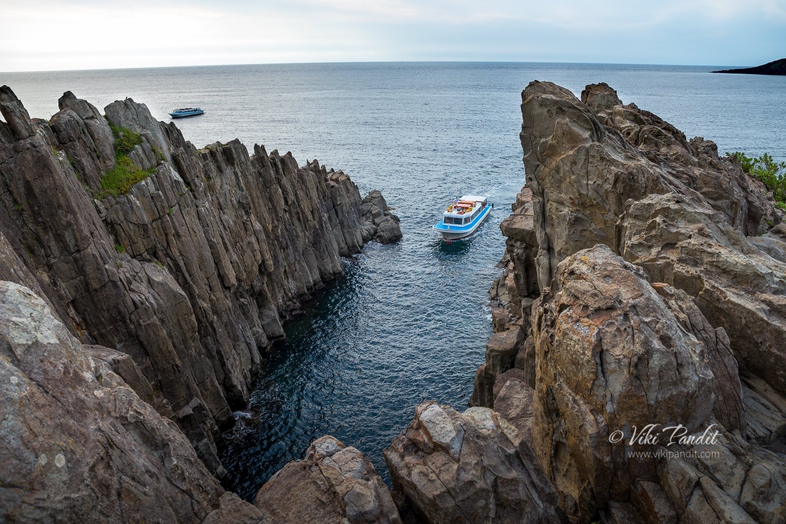
The rocks are easy to maneuver through. I found myself a comfortable spot at the edge of the 25-meter-tall cliff near the Oike. These magnificent andesite rocks appear like hexagonal pillars growing out of the sea.

In between a boat would come inside the lagoon called Tojinbo Oike, carrying tourists wishing to explore the magnificent rocks from the sea. Far away, I noticed the Oshima Island and the red bridge leading to the island. There is a cruise service available, which takes about 30 min to commute between Tojinbo and Oshima. Oshima is one of the biggest islands in the Echizen coast.

I spent around an hour lost in the beautiful moment from the edge of the cliff looking into the vast vividly blue-green sea. In winter one can observe a phenomenon called “Nami-no-hana,” or flowers of waves. They occur when the waves are caught in the reefs and churn into bubbles that the violent winds then fan up in to the air. I had seen those at Sendanbaki, but today the waves were at peace. Eroded by the raging waves, the sea had made inroads along the coast creating small caves.

There were so many tourists walking up and down the steep rugged cliffs, enjoying the spectacular scenery. Some were extremely adventurous, venturing to the edges. I captured this photo of a girl looking down the cliffs.

For some reason I felt something was wrong about her. She went further down towards a lonely side of the cliff and sat down at the very edge. I could tell she was crying. She sat there listening to something on her phone.

Tojinbo cliffs also have a dark side – many Japanese come here each year to end their lives by jumping off the high cliffs, throwing themselves onto the jagged rocks.

Local legend has it that Tojinbo, a Buddhist monk was pushed out off the cliff to death by his fellow monks because of misbehavior. His angry spirit didn’t leave the sea and it had always been incredibly stormy on the day of his death that falls on 5th April. Every year his spirit is soothed by the prayers of a master monk so the waves subside. It is said his ghostly spirit has been drawing many depressed souls to commit suicide from these cliffs.

I hung around beside her for about 30 min after which she, to my relief, got up and went back towards the shops area.

The sun was gradually descending by 5.30 pm. Far away a fishing boat was sailing in the glittering waters.

I went down towards the east side where a series of steps led right down to the base of the cliffs.

I felt the cold water of the Japan Sea in my hands. In monsoon the waves at Tojinbo are more dramatic. From down there, I was awed by the surreal and eerie look of the cliffs with its gigantic columnar joint of basalt.

From the base of the cliffs I took some shots of the sea with the sun gradually descending behind thick clouds.

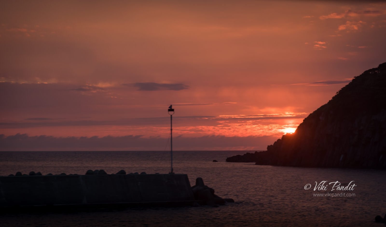
I wanted to catch the sunset, but unfortunately my last bus back was scheduled for 6.21 pm so I had to leave before the sun actually set. The bus stop was desolate. The bus arrived on time. It was carrying a couple of passengers. On the ride back, luckily, I was able to catch a glimpse of the sunset from the bus.

I reached Awaraonsen only to find the next Thunderbird express to Kyoto was an hour away. So I caught another train and went to Fukui. I grabbed some snacks at the station and waited for the train there. In a couple of hours I was back in Nara.

Tojinbo is a beautiful place with spectacular cliffs. It’s a great place to relax and witness the sunset. I had a wonderful time hiking up the cliff. It is sad to hear about suicides though.

An evening at Kobe Harbour

Mani & I dropped in at Kobe in Hyōgo Prefecture today, to spend the evening at the stunning Harbor but we were pleasantly surprised by the Bon Odori festival happening on the same day!

We used the “Kansai Thru Pass” to travel to Kobe. The Kansai Pass, also called Surutto Pass, allows unlimited travel on most train lines in the Kansai area, barring the JR trains. You can also avail the JR Kansai Area Pass for the same. However, if you are touring mostly the Kansai area, the Surrutto Pass offers better value as it covers a denser network in the region’s most visited areas.

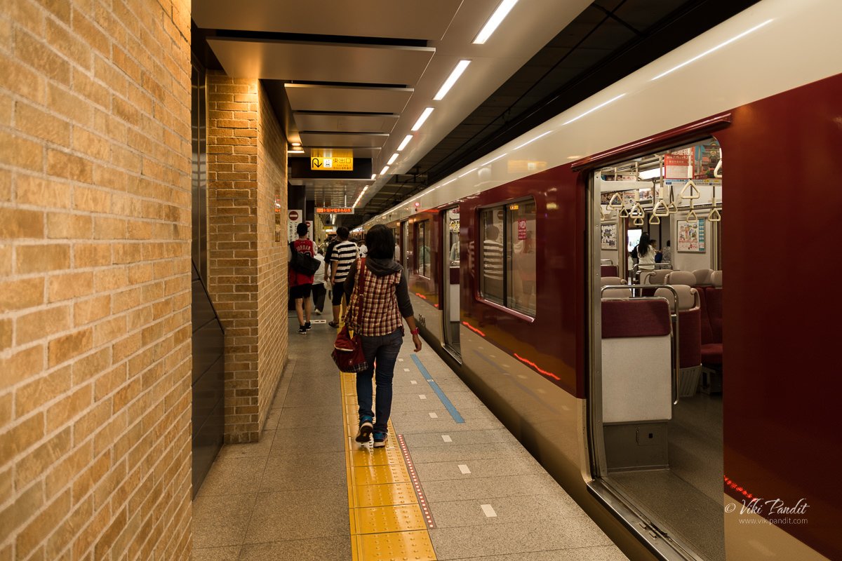
For visiting Kobe from Nara, it is preferable to travel via the Kintetsu line, since a direct train is available. On the JR line, one has to change a couple of trains in-between. The red and beige train with its big square windows was a great experience as we chugged along the beautiful Osaka countryside. We reached Kobe Sannomiya at about 3.30 pm.

The nearest train station to reach Kobe harbor is Kobe Sannomiya

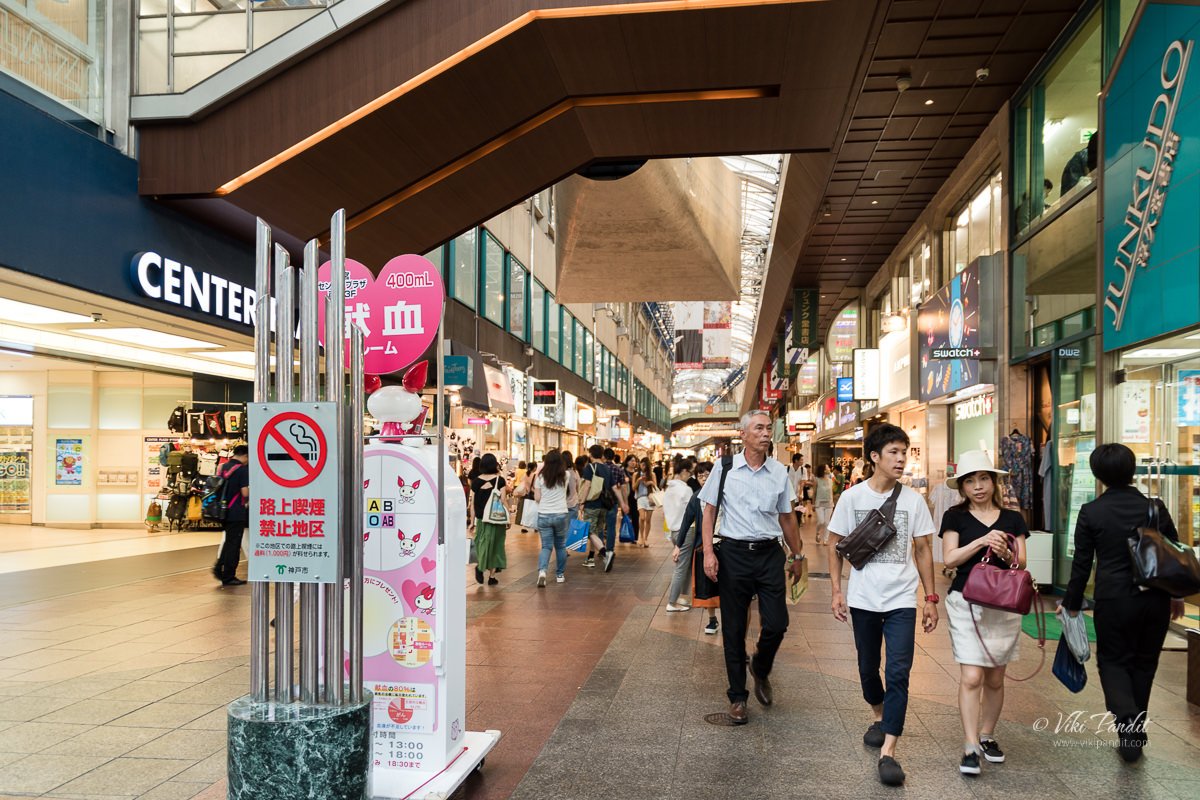
It was still too early so we wandered around the shopping area for a bit before heading out towards the Kobe Waterfront.

The Kobe Waterfront is about a 20-minute walk from the station. On the way, we passed the well-known Kobe Chinatown.

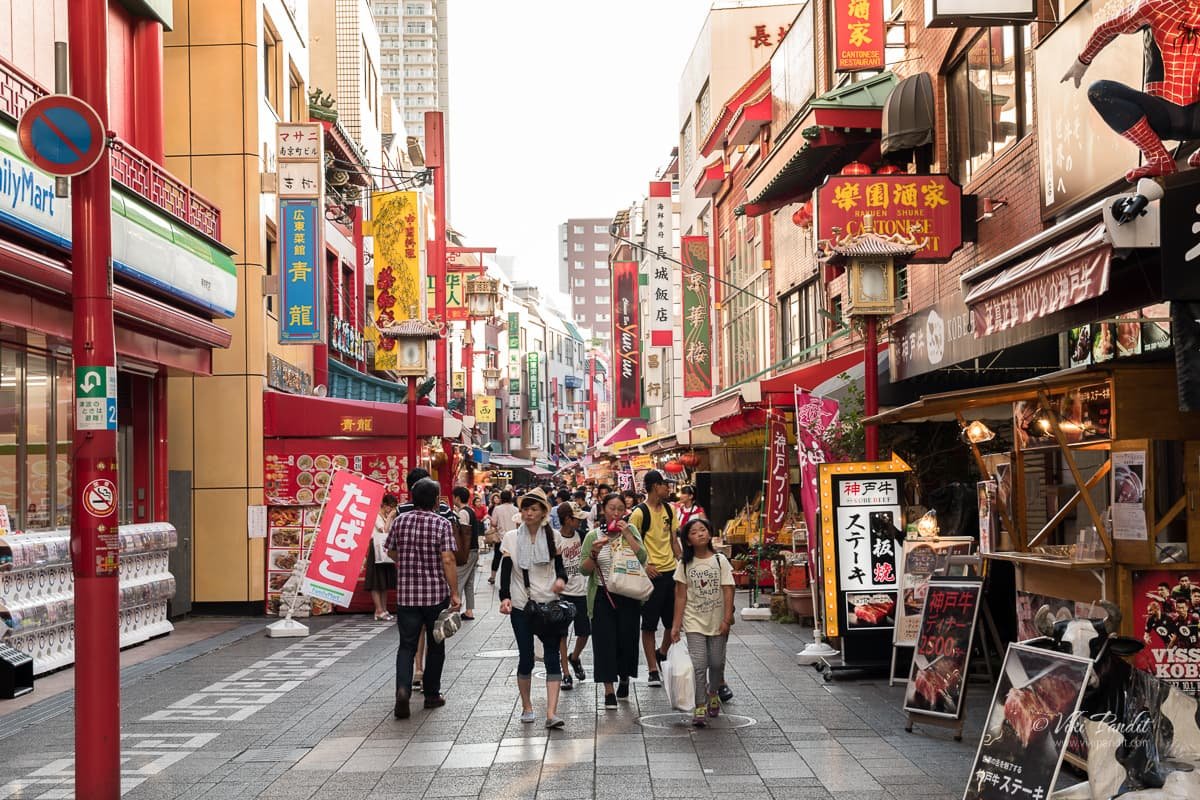
Nankinmachi

Nankinmachi is Kobe’s Chinatown and the center of the Kansai region’s Chinese community. It was originally developed in the 19th Century by Chinese merchants who settled near Kobe Port. Nankinmachi is now a popular shopping and dining district. There are shops, restaurants, and food stands selling popular Chinese foods like steamed buns and ramen. However, they are not genuinely Chinese dishes as they have been adapted to the taste of the Japanese to a big extent.

The port area is just a block away from Nankinmachi. As we neared the port area, we passed under the huge Hamate Bypass on the Kobe waterfront which was extensively damaged during the quake of 1995. It is another marvel of Japanese technology.

As we entered Merikane park, we were surprised by the presence of large crowds of Japanese in their lovely kimonos. It was only then that we realized that we had landed there right on the day of the Bon Odori festival in Kobe. The Bon Odori Festival in Kobe is one of the largest in the Kansai area. It features live performances of Japanese traditional folk songs with Kobe’s famous night view in the background.

Up ahead a high wooden scaffold had been constructed with red paper lanterns hanging from all sides. On the scaffold called Yagura, a group of girls were performing to the “Kawachi Ondo“. Many vendors had set up food stalls where you can enjoy delicious Kobe food.

Bon Odori ( 盆踊り) or simply known as the Bon dance, is a style of dancing performed during Obon, a festival lasting over a period of five days, welcoming the spirits of the dead. The style of the Bon dance varies from region to region.

In the Kansai region, the song goes like “Kawachi Ondo“. Around the platform, young couples in their colorful kimonos were dancing along with the performers in a circular ring around the yagura. The dance is also performed in a different way at times with people facing the yagura and moving towards and away from it in concentric circles.

I was fortunate to experience the dance in another variation while I was in Tokushima in Shikoku, very famous for its “Awa Odori” which simply proceeds in a straight line through the streets of the town.

The Bon dance tradition is said to have started in the later years of the Muromachi period (1333 – 1573) as public entertainment. Over the course of time, the original religious meaning has faded, and the dance has become associated more with summer festivities.

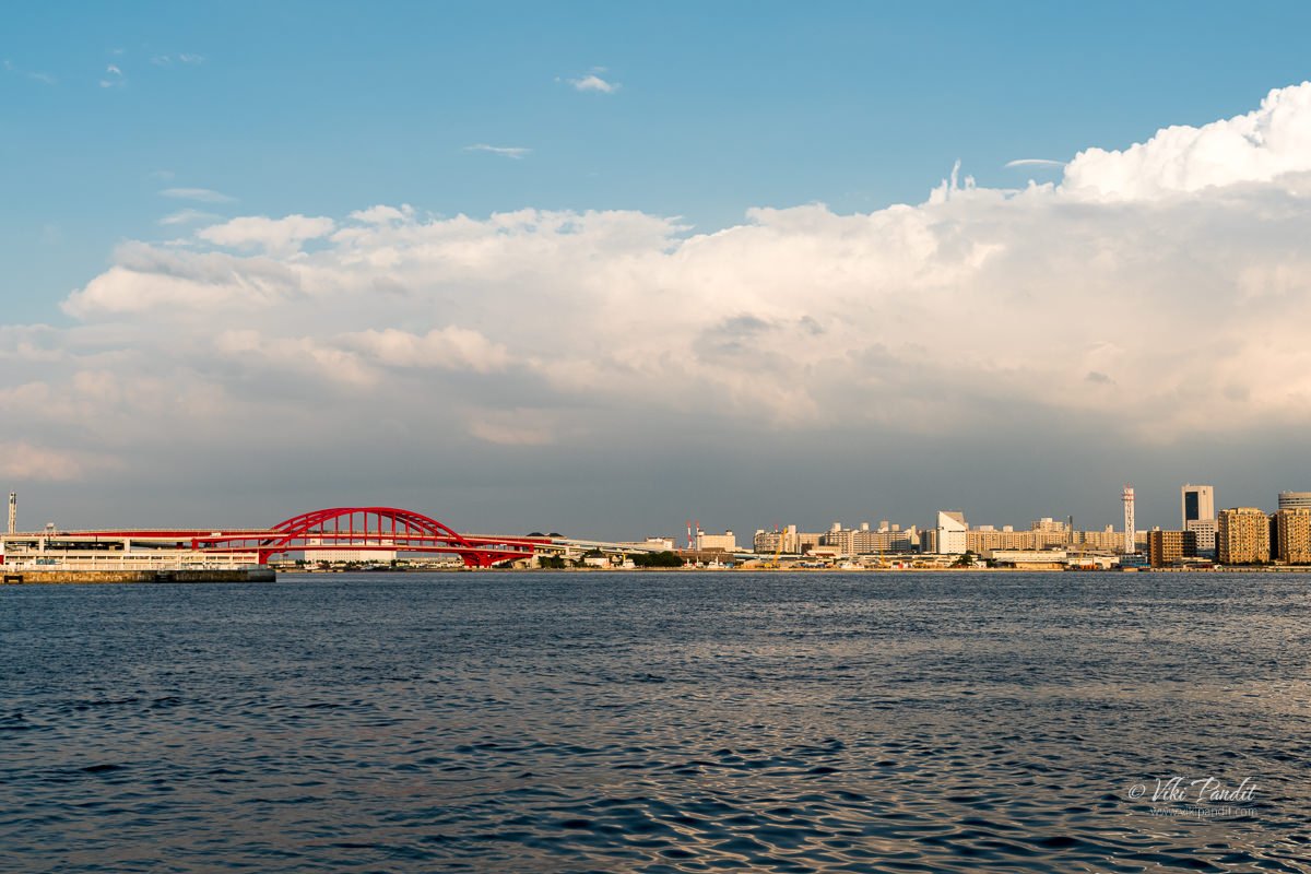
We enjoyed a couple of dances before moving towards the Kobe Tower. On the way, I caught a view of the Kobe Ohashi, Japan’s first double-deck arched steel bridge.

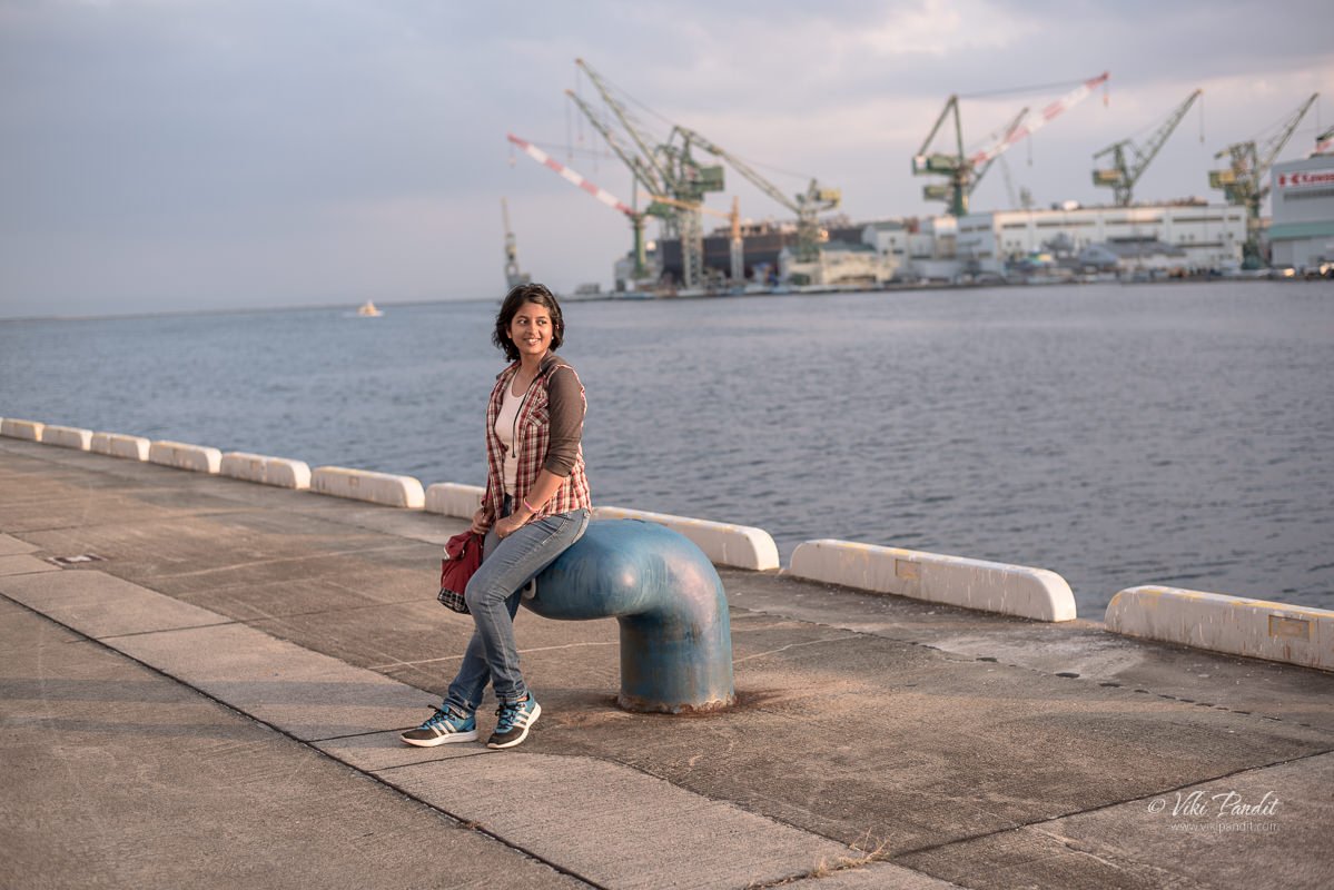
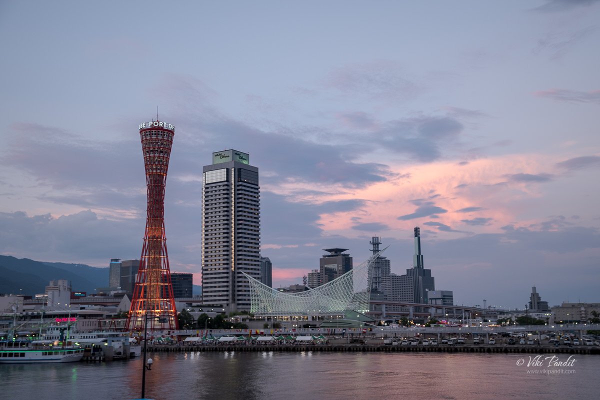
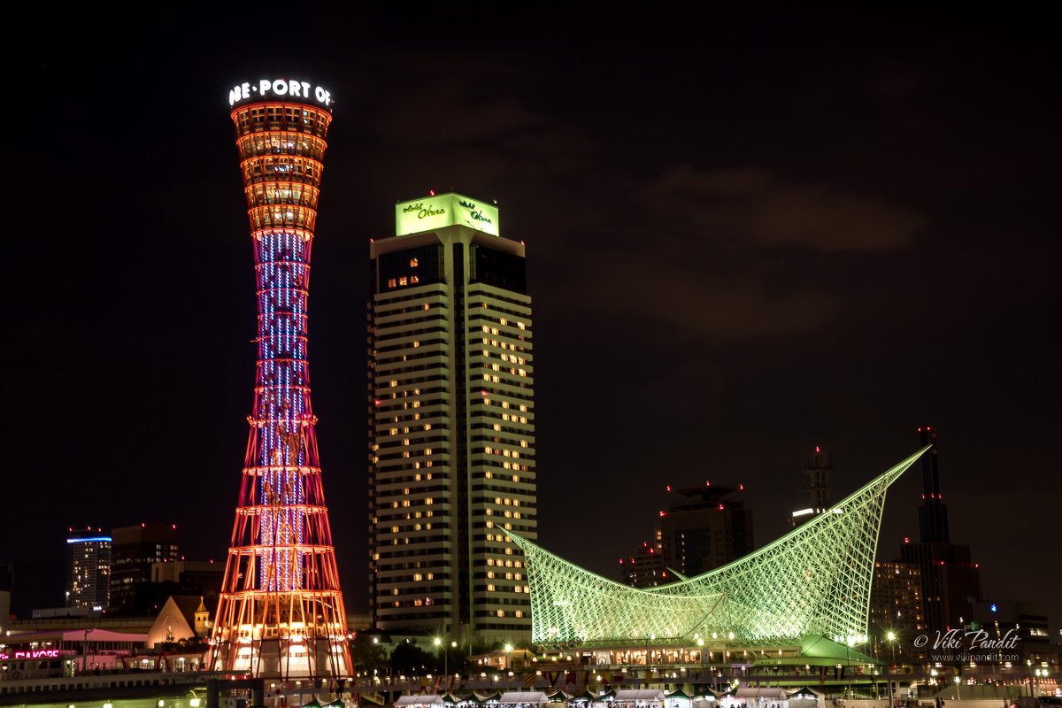
As we walked towards the Kobe Tower, the sun was starting to set behind the tall buildings. The lights on the tower were slowly being turned on. Far away on the other side of the pier, we could see Kawasaki Shipyard.

Kobe Marine Harbour Park

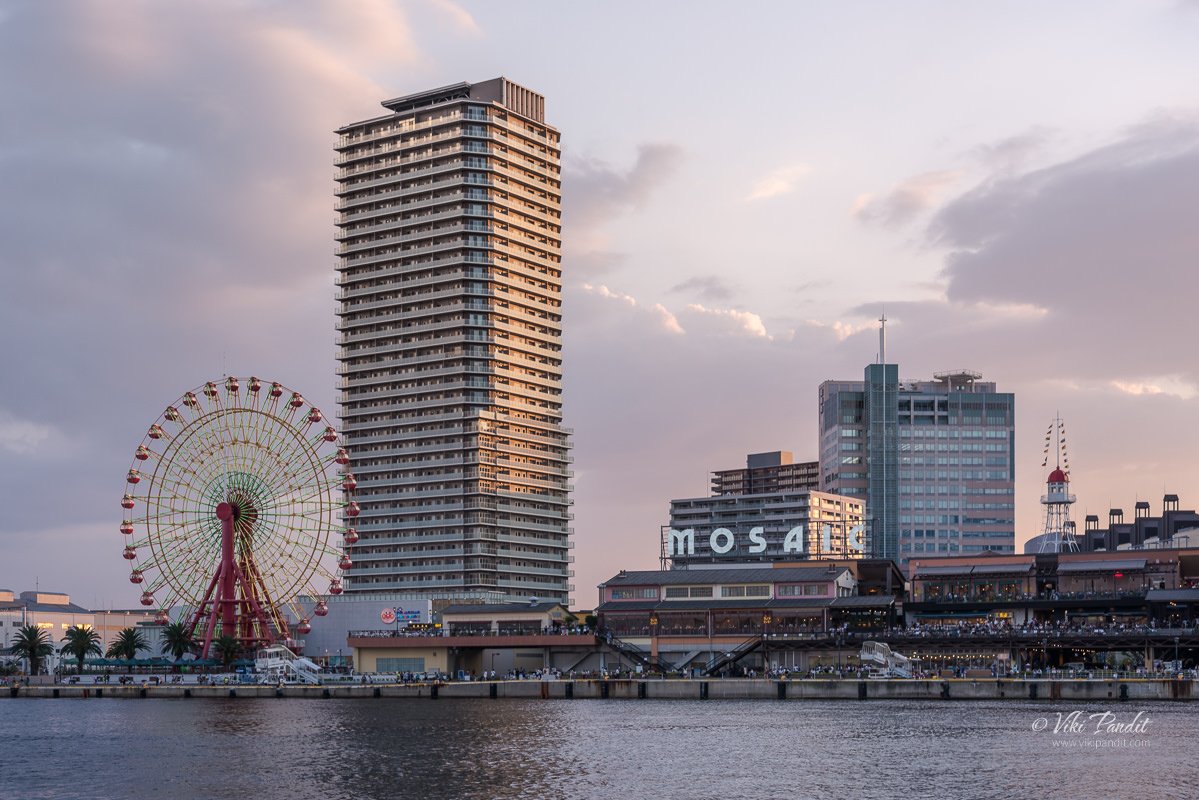
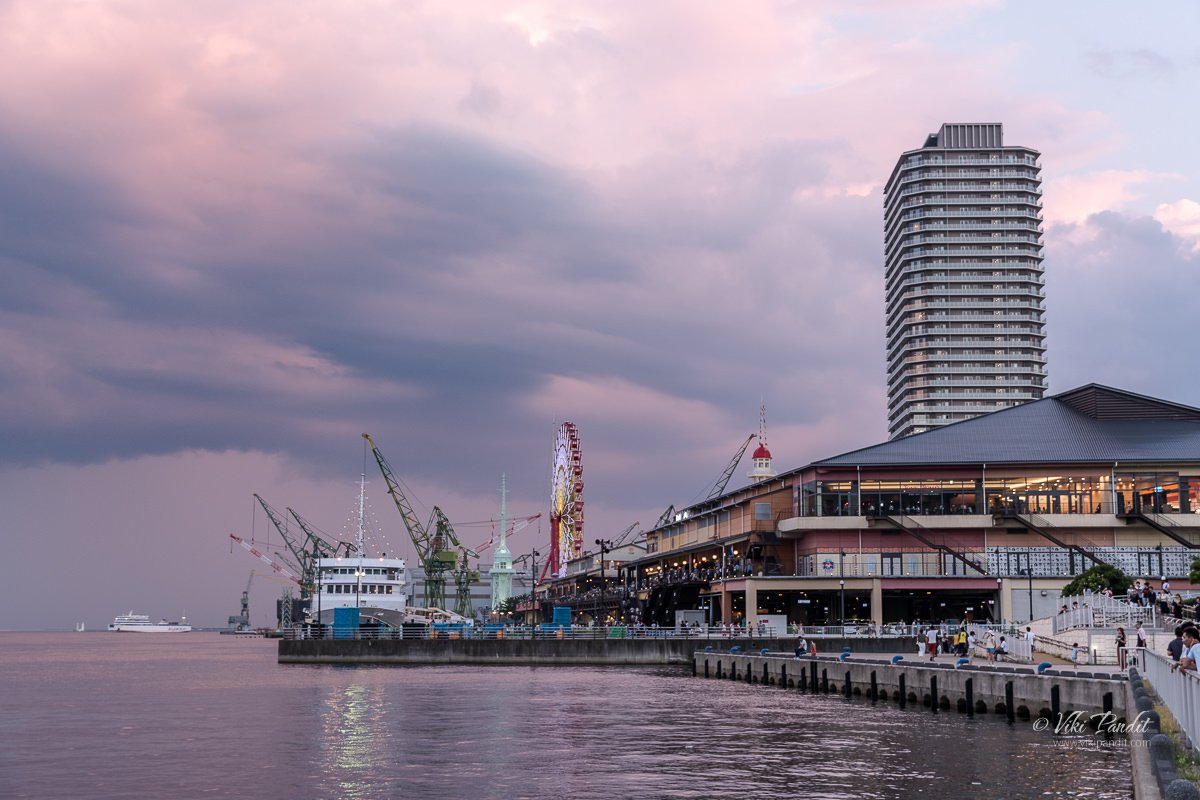
Across the peaceful waters of the bay, Kobe Harborland looked amazing with the big Ferris wheel. Kobe Harborland is a shopping and entertainment area along with the Kobe port that offers a selection of shops, restaurants, cafes, and other amusements, which, together with the romantic evening atmosphere, have made it a popular spot for couples and tourists alike.

As we went around the bay towards Harborland, we were stopped midway at the base of the Kobe Tower where a group of girls was ready to perform the Samba. Now, this was right out of the blue. Samba is not really what Japan is known for, and that’s what made this even more surprising for me. Performers, of all ages, in their colorful feathery attires, adorned with glittering beads were ready to daze the eager crowd.

They swayed to the sensual beat of Samba, heating up the evening at Meriken Park, and coloring it with many brilliant hues. Some from the gazing crowd joined in, stumbling awkwardly among the seasoned dancers.

The dancers were amazing. They put a lot of energy into it, and the costumes were truly astonishing. It was really something I never would have expected.

Once the dance got over, we moved on towards the pier across a pedestrian bridge and onto Kobe Harborland. The crowd was huge filling every inch of the array of department stores. This shopping area was built on the site of the former freight yard, Minatogawa Kamotsu Station of the Japanese National Railways. The yard was removed in 1982 and the shopping district opened in October 1992 as a cultural hub.

The cafe area was even more crowded. The evening was set up for the many events planned for the evening. People had taken up seats along a promenade for further events in the evening. A cruise ship was parked nearby. Across the bay, I could see the Kobe Tower and Maritime Museum along with the tall buildings. This cityscape from this side of the harbor is very popular among photographers and the reason why I was here too.

We hurriedly crossed by the shopping area and reached the giant Ferris wheel. Honestly, I was glad to come out of the heavy crowd into some kind of peaceful sanity. Some guys were fishing along the pier. The Kobe harbor looked amazing from here. I set up my tripod and took some shots of the Kobe skyline. Kobe also has one of the most beautiful skylines at night

Kobe skyline at Evening

Kobe was one of the world’s busiest ports prior to the earthquake, In the 1970s the port boasted of handling the most containers in the world. It is said that it was one of the world’s busiest container ports from 1973 to 1978. The 1995 Hanshin earthquake diminished much of the port city’s prominence when it destroyed most of the facilities here, causing immense damage. Over 6,000 people died in the quake, which also left a $100 million trial of damage. Despite the repair and rebuilding, it has never regained its former status as Japan’s principal shipping port.

As dusk set in the cruise ship stationed nearby started on its run. This luxury pleasure boat offers a 40-minute cruise where one can savor the scenic attractions of the Kobe seaside along with the Akashi Kaikyo Bridge.

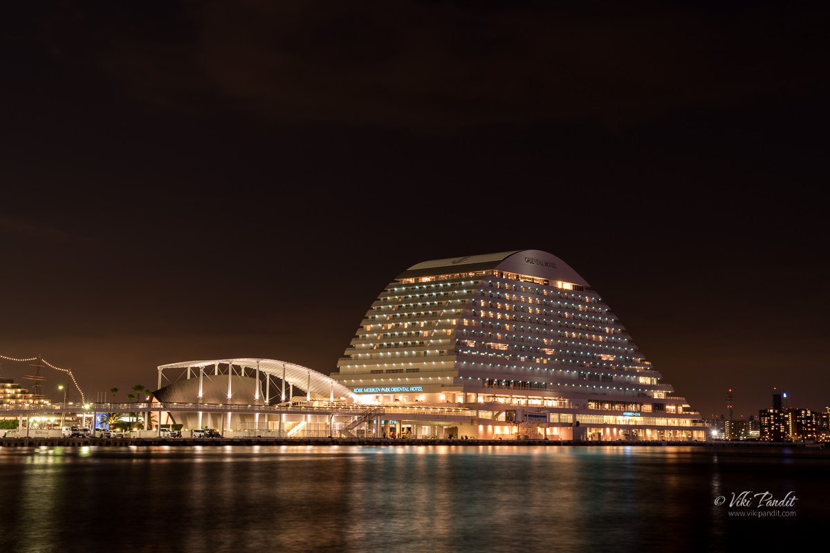
Kobe Meriken Park Oriental Hotel at night

The Oriental is an upscale hotel resembling a luxury liner and one of the iconic structures in the Kobe skyline. It was opened in June 1995. From the looks of it, one can make out it’s a plush hotel.


We stayed around till the sunset and the sky turned pitch black. Far away on the hills behind the city, numerous lights were illuminated. The dancing and feasting went on late into the evening.

By 8 pm I had got the shots I came for. I packed my gear and we started our walk back towards the Sannomiya station.

On the way back, we went past the dazzling Kobe Tower. The sightseeing tower was completed in 1963. The first floor is leased out to souvenir shops and restaurants. The ticket office to the sightseeing level is locating on the second floor. The third floor is a 360 rotate cafe with 20 minutes for a single round. I don’t think we even tried getting inside looking at the surrounding crowds.

Near the Maritime museum, the Bon Odori festival was still going on. We stayed around for a dance. The crowd was dancing in concentric circles around the Yagura.

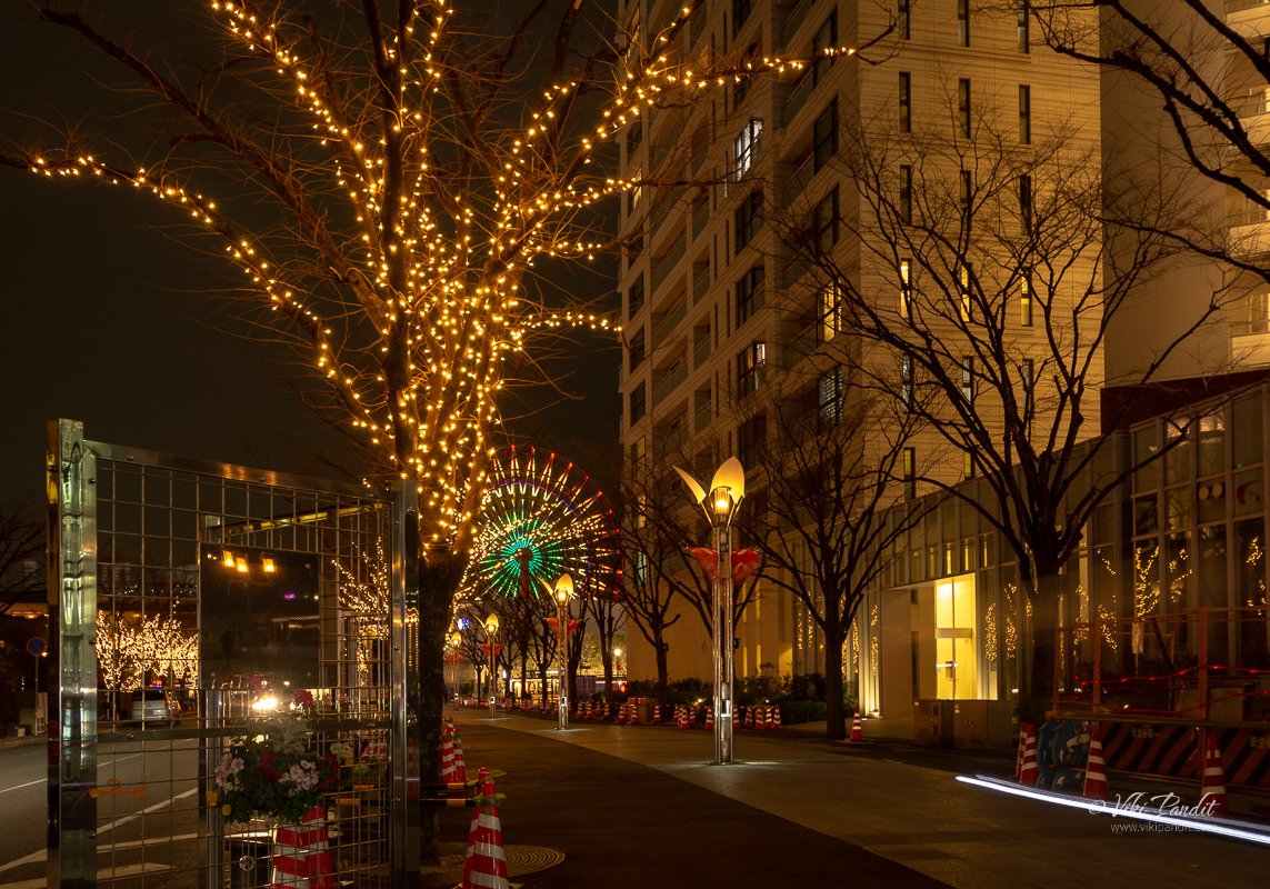
At around 9 pm we bid adieu to the beautiful harbor and walked back to Sannomiya station. The streets were much quieter as we made our way out of the Harbor. The route took us along Gaslight street, a beautiful sight when on an evening outing. It’s called gaslight street because the street is decorated with old-fashioned gas street lights and electric lamps.

The trees and lights enhance the avenue and surrounding buildings, which makes Gaslight Street a little-known but memorable spot for taking pictures.

Kobe harbor is a happening place to spend quality time. It is surprising how people here are able to get over the tragedies brought on by earthquakes. Maybe it’s just inbuilt. After the devastating quake of 1995, it is commendable to see them getting back to living their lives and having fun. I came to Kobe just to catch the stunning Kobe harbor but I am going back with some special memories of the Bon Odori festivities.

Thanks for reading. Please leave me a comment if you liked the post or follow my story as I visit the thrilling cliffs of Tojinbo.

Photowalk to Suizen-ji Park

Today I traveled to Kumamoto almost 750 km away, to visit the lovely Suizen-ji Garden.

Suizenji Garden (水前寺成趣園) is a Japanese style landscape garden in Kumamoto. The garden is named after a Buddhist temple Suizen-ji that no longer exists on the grounds. The origins of the garden go way back to 1632, when Tadatoshi Hosokawa, the administrator of Kumamoto, built the Buddhist temple Suizenji. It was completed by 1670 and named Suizenji Jojuen which means “Garden of Elegance”.

Nara to Kumamoto

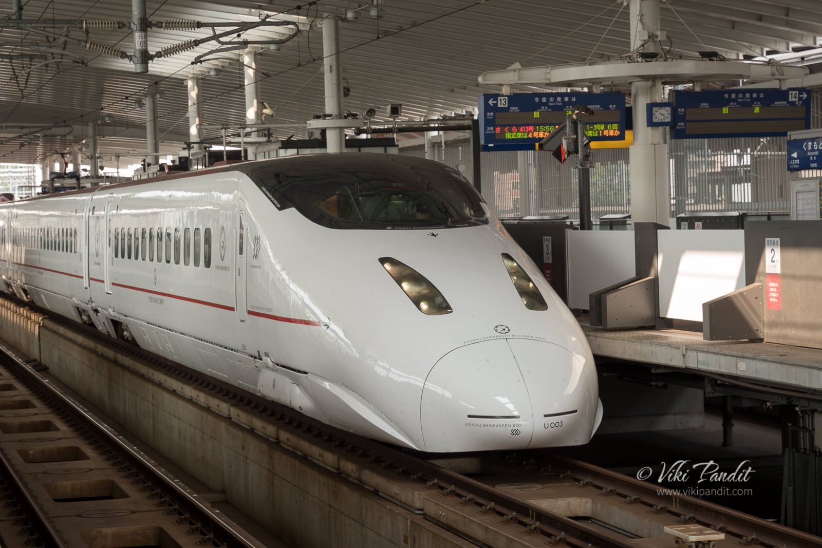
From Nara I took the local train up to Osaka. From Osaka I had to take another change-up to Shin Osaka, since bullet trains don’t have a stop at Osaka Station. From Osaka, I took the Hikari Shinkansen to Kumamoto. it’s a 5 hour ride even on the bullet train. A long ride like this can cost a fortune, but I was carrying my JR Pass. With the JR Pass I can travel unlimited number of times, anywhere in Japan on the JR line trains. It has been a great asset on my travels throughout the land of the rising sun.

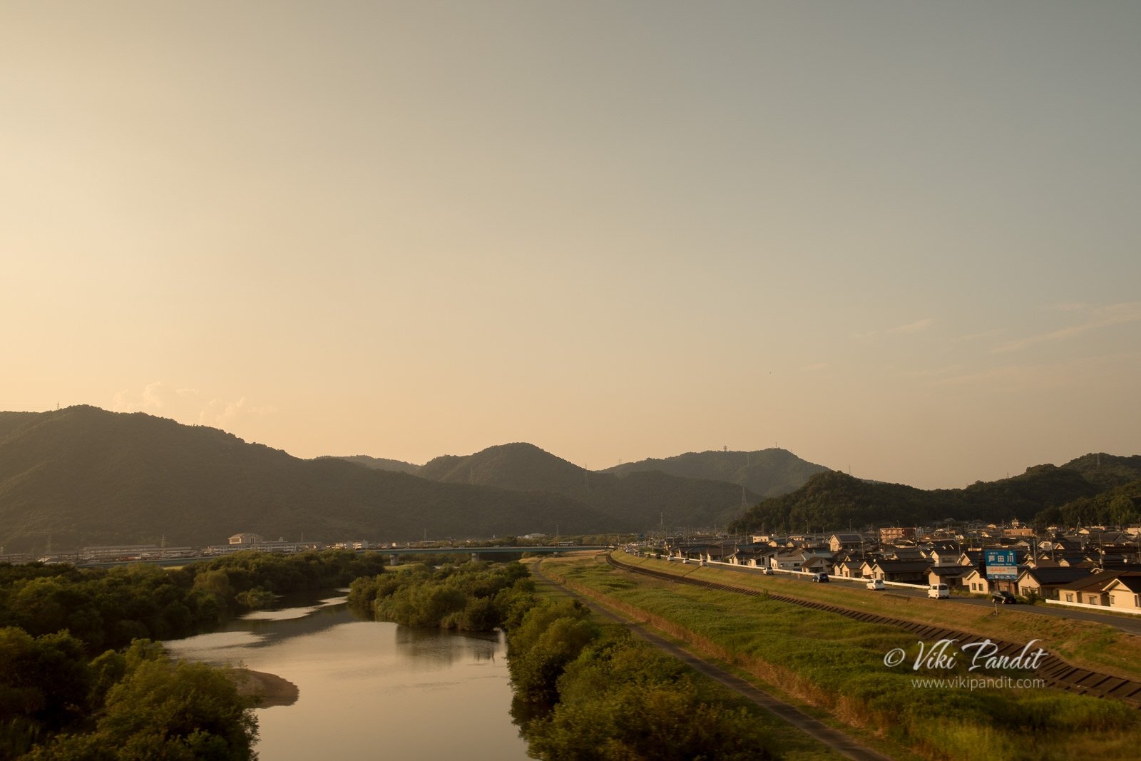
The weather kept changing from a bright sunny to rainy and then misty as I passed prefecture after prefecture.

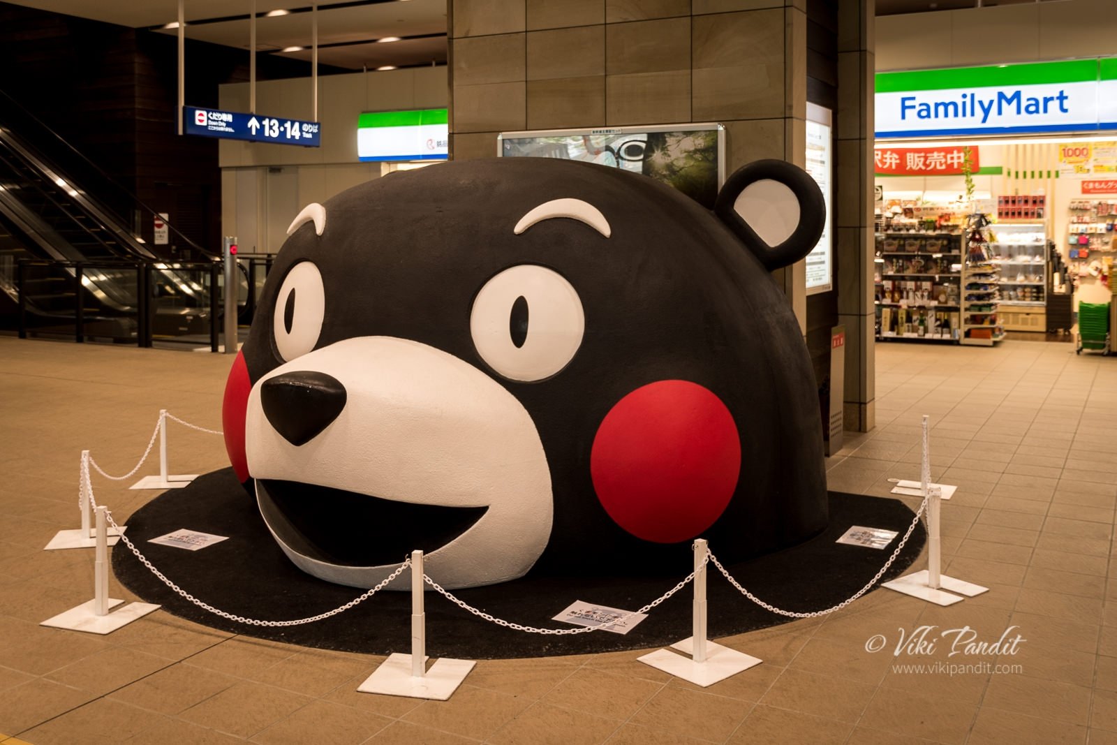
Inside the Shinkansen area of the Kumamoto Station, a huge face of Kumamon, the official mascot of Kumamoto welcomes you to the city. The Kumamon was unveiled in 2010 with the opening of Kyushu Shinkansen in order to promote tourism within the region. The mascot’s character is inspired by Kumamoto – the prefecture’s name literally translates into “bear origin”.

From the bustling station of Kumamoto, I changed to the local Hohi line, that dropped me off at the Shin-Suizenji Station. The train bound for Suizenji, leaves at regular intervals of 20 minutes and costs ¥‎210. Those with JR Pass can avail this ride for free. From the station however, it is still a 15 minute walk to the park.

Suizen-ji Garden

Google maps was playing up and it led me on a round-about way to the park. After a bit of searching I was finally able to find the entrance. A sweet lady dressed in Kimono provided me the admission tickets that cost ¥400.

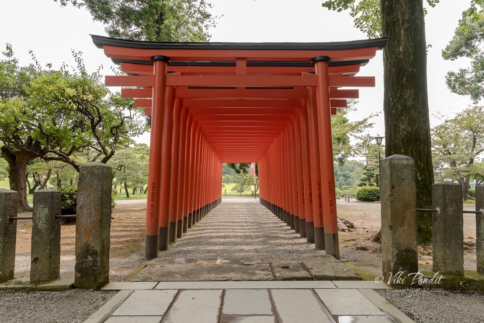
Just beside the entrance one can find an Inari Shrine. A series of red Torii gates lead up to the shrine. Some of the Hosokawa family members are enshrined here.

In Japanese mythology, Inari is a god primarily known as the protector of rice cultivation. The fox, symbolizing both benevolence and malevolence, is sometimes identified with the messenger of Inari, and statues of foxes are found in great numbers both inside and outside shrines dedicated to the rice god.

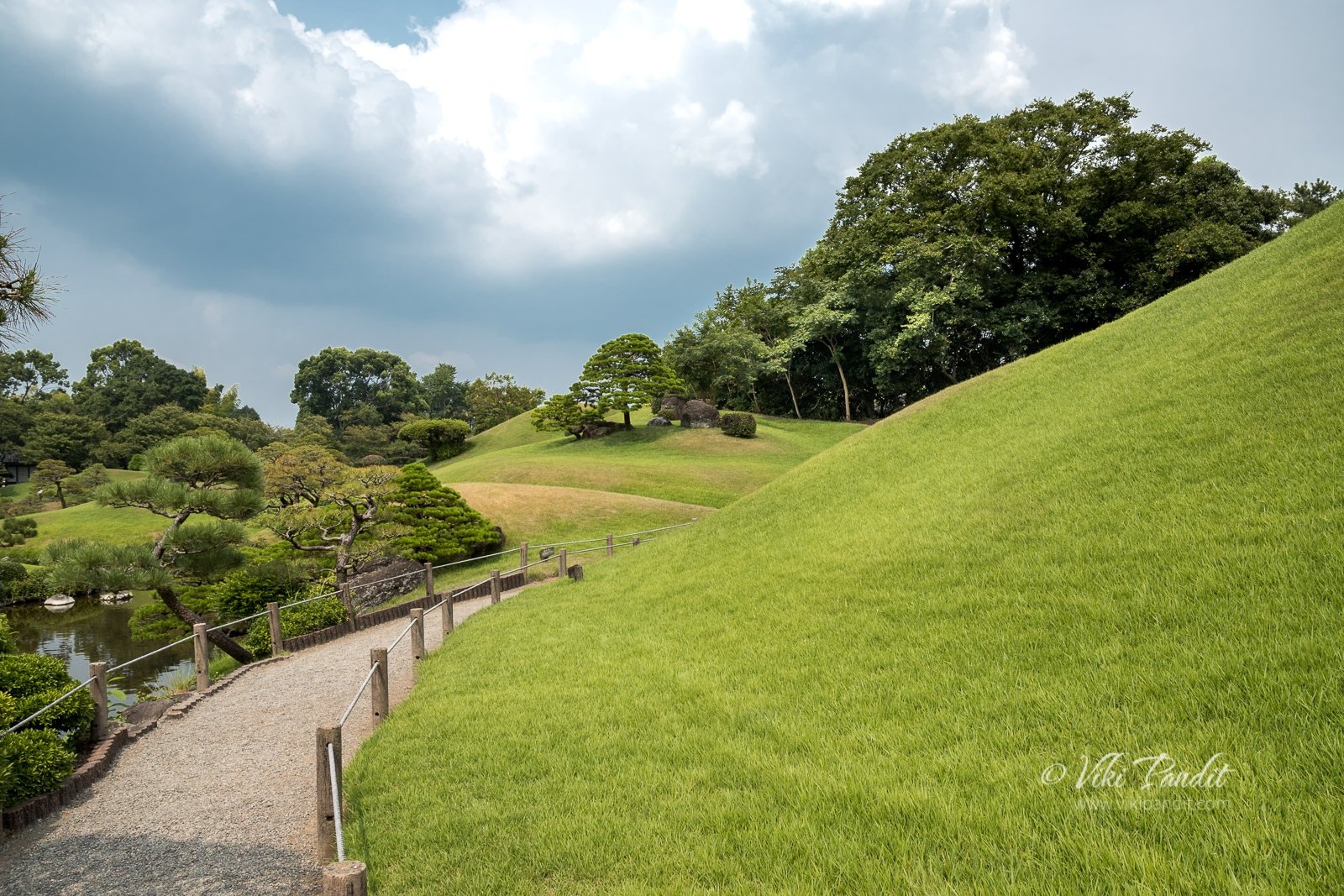
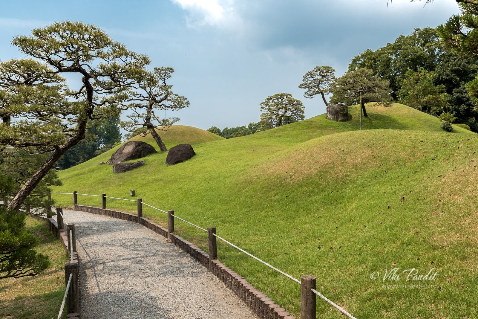
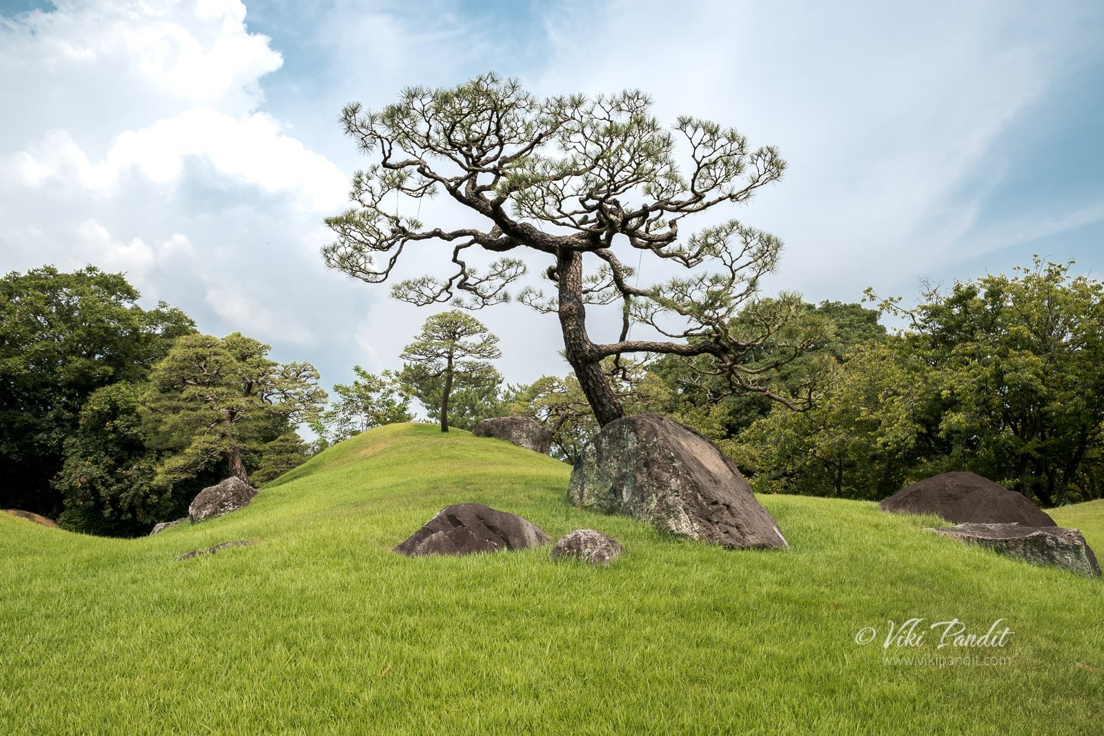
After paying my respects at the shrine, I walked up the beautiful garden path lined with an array of miniature man-made hills. Just opposite to the shrine there is a miniature hill, made to look like Mt. Fuji.

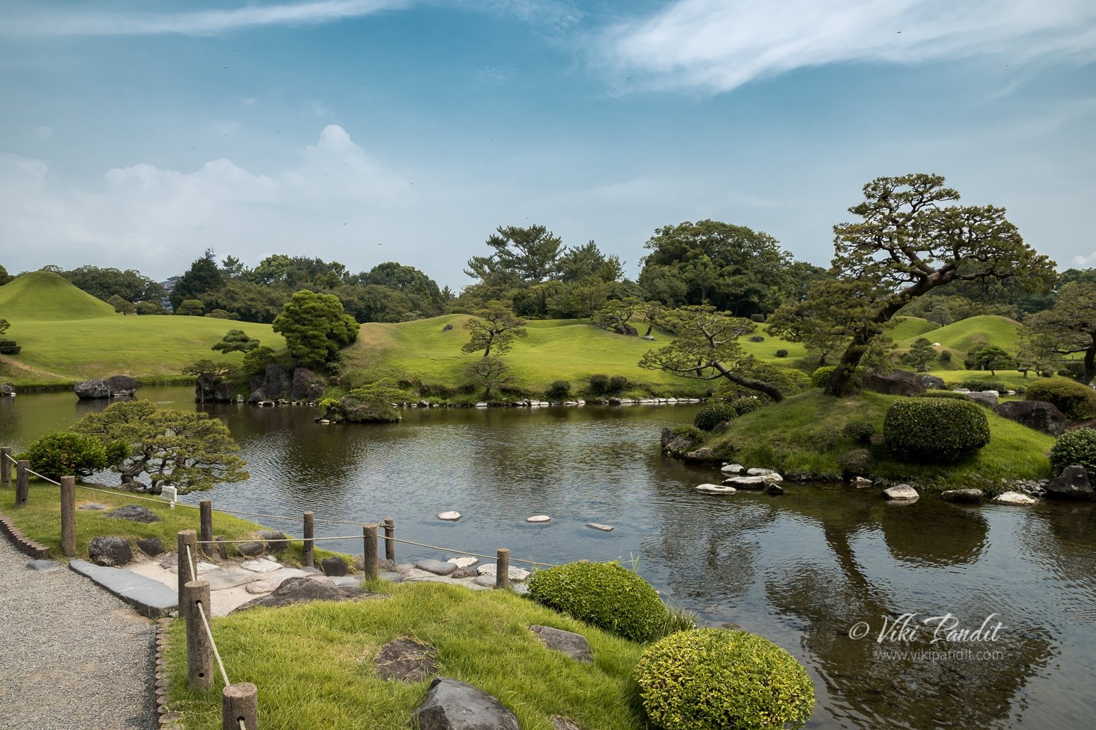
Along the path, I crossed a small arched bridge to reach a pond filled with Koi fish. Three tiny islands float in the middle of the pond. The pond is fed by spring water from Mt. Aso, an active volcano in central Kyushu. As I went near the edge of the pond to feel the crystal clear cold water, a school of colorful Koi swam towards me searching for an afternoon snack. Unfortunately for them, I didn’t have any.
A few paces ahead I came across the thatched Kokin-Denju-no-Ma tea-house which was moved from Kyoto’s Imperial Palace to Kumamoto in 1912. A couple of Japanese were sitting inside. The tea house opens towards the pond. For people sitting inside the tea-house, the lovely pond looks like a picture frame. Pigeons were walking around just outside the tea house. A crane stood on rocks in the middle of the pond, making the scene even more exquisite. It’s a perfect place to relax and let the mind wander.

With the relentless Japanese summer sun beating down against my skin, I moved on, beyond the tea house, towards the beautifully trimmed pine trees on the other side of the pond.

It is said, the garden was landscaped to give the impression of views seen when traveling along the Tokaido, the 12th century highway between Kyoto and Edo (present-day Tokyo) .

The path up ahead, lined with an array of small green mounds are sure to please any nature lover. At Adachi Garden, I had made up my mind that it was the most beautiful garden. However Adachi Gardens can only be viewed from behind glass windows, so the feel of walking in such a beautiful garden just tilts my judgement towards Suizen-ji. The historical aligned, beautiful landscapes of this garden have led to it being acknowledged by the Japanese government as a site of historic and natural beauty.

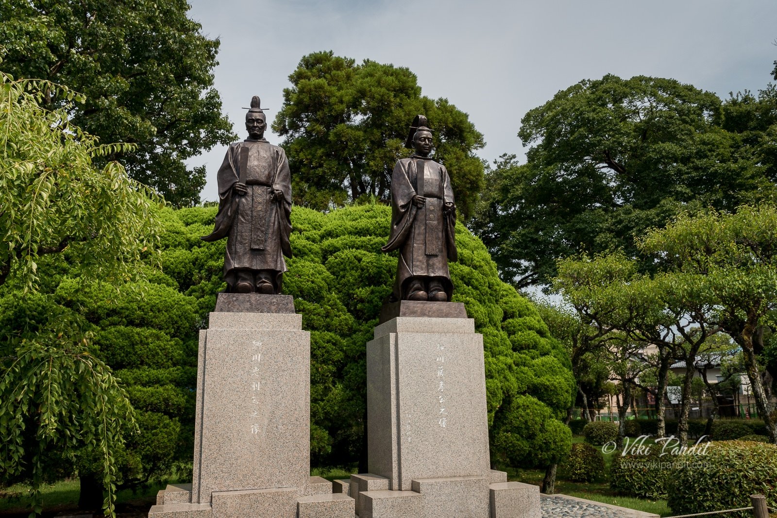
Walking through, I came back a full circle back to the Shinto Shrine. On the right there are two statues of Fujitaka Hosokawa with Tadatoshi Hosokawa.

The garden covers an area of about 15 acres, reproducing the 53 post stations of the Tokaido, including the miniature Mt. Fuji, I saw earlier. Before I end the article, I want to share this most beautiful section of the entire park.

The garden is also home to a Noh theater, where Noh is performed in spring and fall ceremonies. It also contains the Izumi Shrine, built in 1878 and dedicated to the Hosakawa family.

It was evening, and I had about 6 hours ride in front of me to reach home. So, I went back to the Kumamoto station and caught the Shinkansen from there back to Shin Osaka.

As I made my may back to Nara, the lovely garden with its picture-postcard beauty kept lingering in my mind. The beautiful dusk only made my experience of the day richer.

The Garden is a slice of history and beauty put together in a tasteful combination. The Suizen-ji Garden is a must visit for anyone who loves nature and appreciates the cultural and historical aspects of Japan.

Don’t Miss

Ikinaridango: a mochi (rice) and bean paste cake which is popular in the Suizenji area

Admission Fees

¥ 400

Timings

8 am – 5 pm

Built by

Hosokawa family

Built in

1636 CE

The stunning Osaka Castle

I dropped in at Osaka today to capture the stunning Osaka Castle in the evening light.

Osaka, Chūō-ku is the second largest metropolis of Japan. It’s a bustling city with over 19 million inhabitants. The city is well-connected by the subway. During my first few days in Osaka, I used to feel very lost making my way through the confusing subway. But I have made progress in the last few months and now am able to understand the routes better.

We started from Nara after lunch.

Nara to Osaka Castle

We reached the Tembabashi Station at about 4 pm. In my opinion its the easiest route to the Castle while coming from Nara. From the station its just a 10 minute walk to the castle.

A wide moat surrounds the grounds encircling the castle. In the center of the park, surrounded by the moat, the castle is built atop a tall stone foundation to protect its occupants from attackers.

Osaka Castle

Osaka Castle was built by the hegemon Toyotomi Hideyoshi, who ruled Japan in the latter half of the 16th century, on the site of a temple called Ishiyama Hongan-ji. The construction work began in 1583 and most buildings including the castle tower were completed by 1585. Tens of thousands of people were contracted for the construction which lasted nearly two years.

The stone foundation itself is said to consist of  about 40,000 stones. There is an interesting story that powerful daimyo from all parts of Japan competed in sending the large rocks for the castle, to display their loyalty to the Toyotomi Hideyoshi.

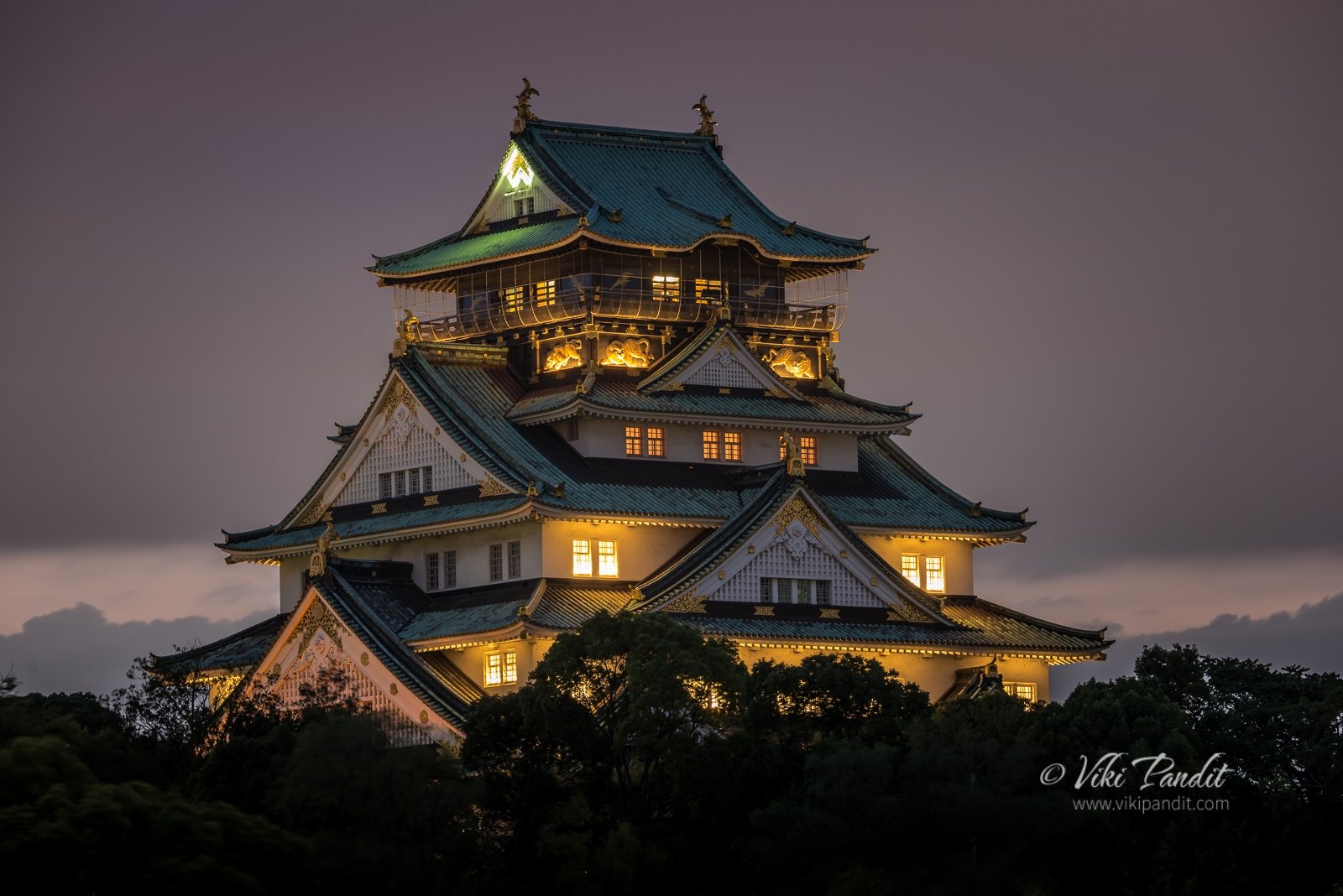
The castle was destroyed in the forthcoming years and then rebuilt in 1931. The current structure is a concrete reproduction of the original and the interior functions as a museum. The central castle building is five stories on the outside, sitting on a high stone foundation. The castle’s interior consists of eight floors devoted mainly to exhibits. The castle tower has large golden dragon fish ornamental shining on the rooftop. Just below the rooftop viewpoint, the exterior walls are decorated with golden tigers.

Small packets of clouds went floating by the castle as we walked around the garden. After a bit of wandering about the castle grounds we came across some weeping Sakura trees on the north side of the garden.

The evening at Osaka Castle

A small bridge on the north side connects the castle with the grounds, over the moat. Evening was gradually setting in and the sky had begun to change into a multicolored canvas.

Beside the bridge, over the moat, a couple of pleasure boats were tied up. Business hours had closed by then and the boats floated nonchalantly over the moat as the sun was just about to hide behind the tall trees.

After a few minutes the sun went to sleep and we started our walk towards the viewpoint I had decided upon to take the evening shot of Osaka Castle.

Osaka Castle at Night

Finally, the moment for which I came here. The light was perfect. I set up my gear on the high stone wall and took this stunning view of the Osaka Castle. For the next 10 minutes the Osaka Castle looked like a fantasy structure from the mythical age of dragons.

Once the lights came on, the castle was illuminated in a burst of bright white light. I packed up my gear and we head back towards the Tembabashi Station.

It was a lovely evening at the castle. The exteriors of the Castle are stunning. There is always a good breeze blowing on the grounds. Many locals use the grounds for jogging in the evenings. Overall its a good place to spend an evening.

Thanks for sticking around to read my journal. If you have any questions, please use the comments section below. If you are in Osaka, you must visit the Kaiyukan Aquarium, the best aquarium I have seen in Japan or if you are looking for a quite evening, just wander around the Osaka Bay.

Built

1583 CE

Built by

Toyotomi Hideyoshi

Castle Tower Timings

9:00 to 17:00 (entrance until 16:30)
Closed: December 28 to January 1

Admission Fees

Adults: ¥600

The lovely Matsumoto Castle

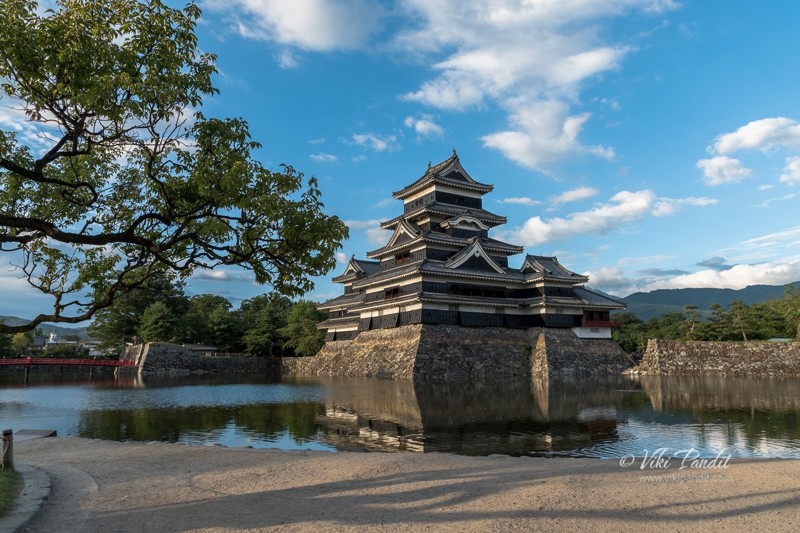
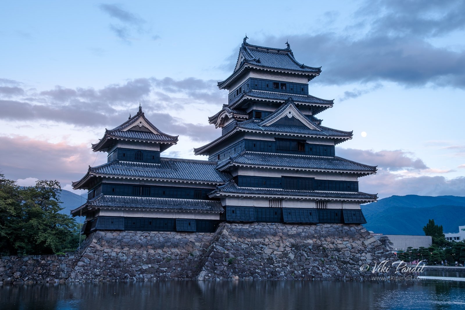
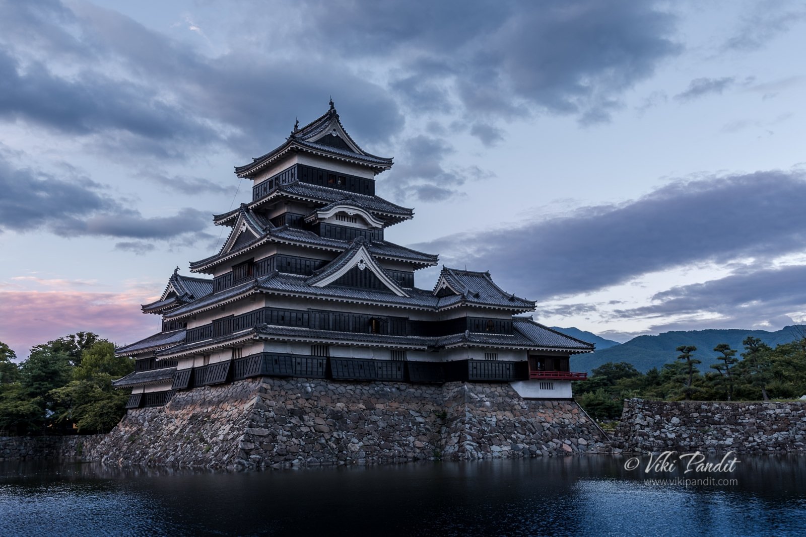
After a whirlwind tour of Kanto region, we were finally headed home. Along the way we decided to stop at the beautiful Matsumoto Castle (松本城 Matsumoto-jō) in Nagano Prefecture.

Constructed in 1592, it is one of four castles designated as ‘National Treasures of Japan’ and the oldest castle donjon (castle keep) remaining in Japan.

Takasaki to Matsumoto

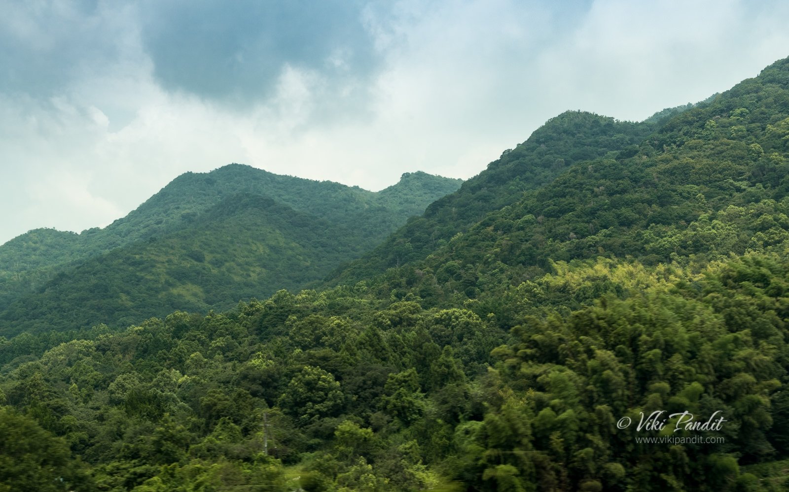
After an early morning tour of Shorinzan Darumaji Temple, we were back in Takasaki. From Takasaki we took the Shinkansen to Nagano. The journey takes about an hour and passing through some breathtaking mountains.

At Nagano Station, after grabbing a quick bite at a Starbucks on the station premises, we hopped back on the train to Matsumoto along the JR Shinonoi Line.

The train chugged along through some high altitude mountains and from the big windows, one can see afar into the valley below. When I was here in March, travelling to Jigokudani, I could barely make out anything in the thick snow.
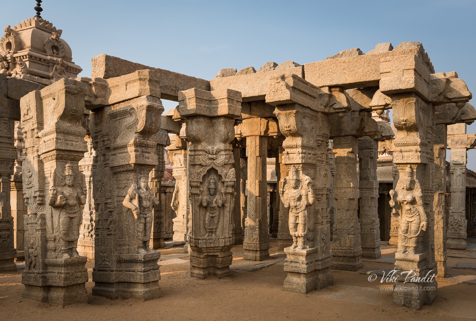
After an hour of passing through some lovely scenery, we reached Matsumoto Station. From the Matsumoto station, it’s a 20 minute walk to the Castle. One can also take a bus, but we love to walk. The city streets were decorated with paper lanterns for the upcoming festivities in summer. Summer is the time for festivities in japan. All across the Tohoku and the Kanto region, everywhere we went, we found people engaged in their local festivities.

It was early evening by the time we reached the castle grounds. Near the entrance, a platform had been constructed for performances during the Taiko Drum Festival . Every summer the 2000 year old Taiko Drum Festival is held at the site in which various groups from across the country gather in Matsumoto to entertain the audience with their performances under night lights with Matsumoto Castle in the background.

The surrounding park is not very widespread and It didn’t take us long to reach the castle. Along a path by the moat, many weeping Sakura trees were swaying in the light breeze.

In April the castle grounds comes alive with cherry blossoms. During these times it is common to see many newly married couples having their wedding photos taken in the grounds of the castle.

It was evening but it was still very bright. Sunsets during summer in Japan happen very late at around 7 pm. I was mighty surprised in Okinawa, when the sun refused go down even after 8 pm.

We walked along the moat watching the koi fish swimming in the clear waters surrounding the castle. The black castle casting its reflection in the water of the moat, looked like a beautiful painting. In old days, because of its black walls, Matsumoto Castle also used to be called ‘Crow Castle.’

Near the red bridge there are some seats overlooking the Castle. We sat there for some time under the growing shadows of the castle.

History of Matsumoto Castle

As we sat by the castle, Mani explained to me how Matsumoto Castle is one of oldest castle in Japan. Its origins go back to the Sengoku period. At that time Shimadachi Sadanaga of the Ogasawara clan built a fort on this site in 1504 AD. This castle used to be called Fukashi Castle. In 1550 AD it came under the rule of the Takeda clan and then Tokugawa Ieyasu..

The most interesting aspect of the castle is the main donjon/keep (tenshukaku) completed in the late 16th century, and which remains in its original wooden interiors and external stonework. This donjon was constructed between 1593 and 1594 by Lord Yasunaga, the second daimyo (vassals of the shogun) of the Ishikawa family.

It was in the Edo period when the Tokugawa shogunate established the Matsumoto domain. For the next 300 years until the abolition of the feudal system in the Meiji Restoration, the castle was ruled by the 23 generations of the Matsumoto daimyos.

Dusk was finally upon us. The flat-land castle (hirajiro), though enchanting in beauty, looked somewhat defenseless in the fading light. The inter-connected rock walls and the surrounding moat are the only defense against any attacks. The narrow wooden windows on the top floors, once used by archers and gunmen as the last defense.

The Castle consists of three stories and a concealed fourth. The second floor of the main keep features a gun museum, Teppo Gura, with a collection of guns, armor and other weapons. A hidden keep on the fourth floor is structurally independent of the main tower and is connected via a roofed passage.
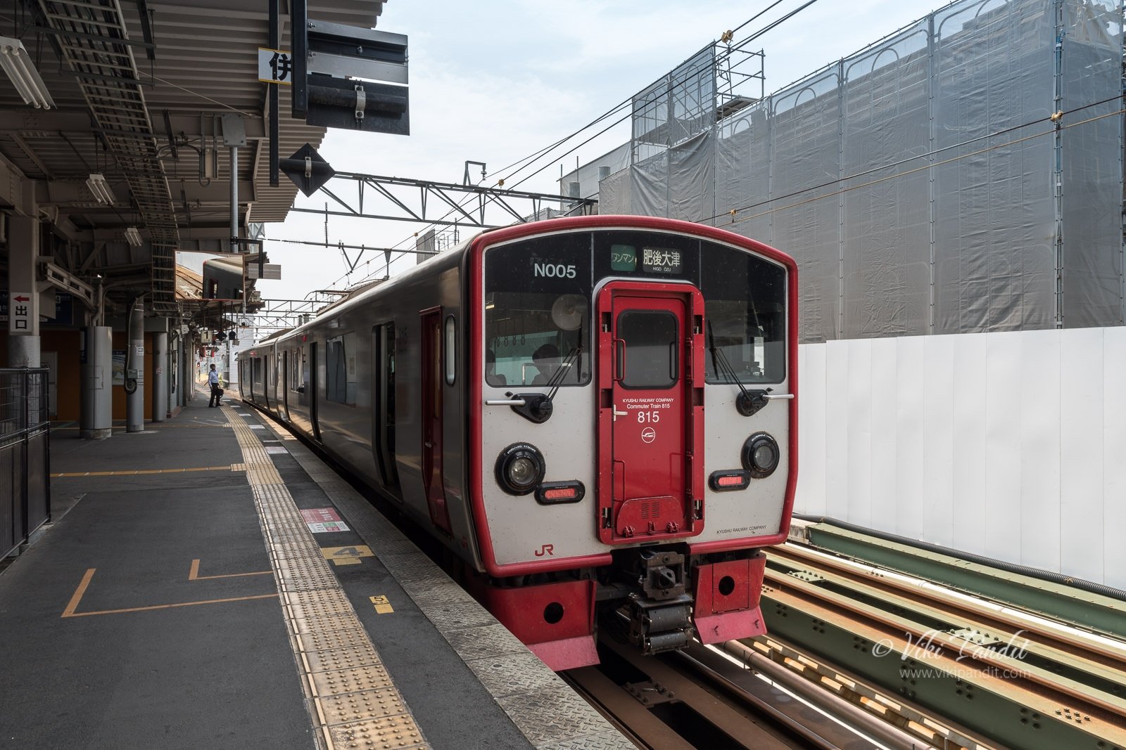
We still had some 4 hours of travel left to reach Nara, so we started on our walk back towards the Station.

The weather had cooled down drastically as we walked towards the Matsumoto station. The limited express arrived in a few minutes and we were off towards home along the JR Shinonoi Line.

With over 400 years of history, Matsumoto Castle is a national treasure that one must see. I have been to many castles and in my opinion this is the most beautiful castle in Japan.

Thanks for reading. Please leave your comments below.